ArcGIS Solutions helps you make the most of your GIS by providing purpose-driven, industry-specific configurations of ArcGIS.
Voting is the defining democratic act, but it is only meaningful if public debate is founded in fact and equitable information. In the United States, the dramatic increase in misleading information, especially during presidential elections, has challenged the ways we vote and increased public skepticism in the results. Therefore, communicating accurate and transparent election results to the public has never been more important.
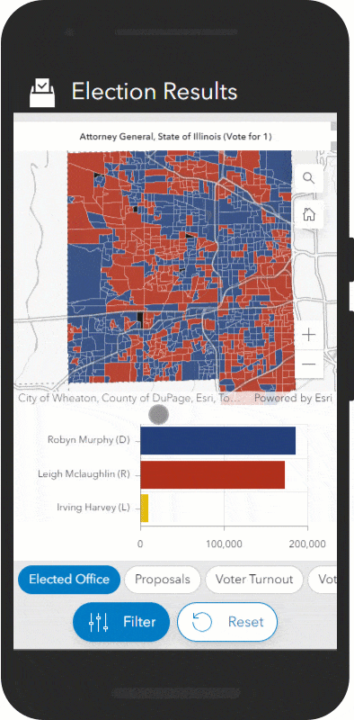
Organizations that conduct elections and tally election results must be able to share authoritative information in a way that is easy for the public to use and understand. Maps are inarguably the best way to meet this need. The latest version of the Election Results solution, released in November, includes key updates that help organizations share clear, mobile-friendly election result maps.
Rising through the ranks
One of the most significant updates is the addition of support for ranked-choice voting contests. Ranked-choice voting is an increasingly popular electoral system that allows voters to rank candidates in order of preference (first, second, third, and so on) rather than casting just a single vote. Votes are then tallied in rounds. In each round, the last-place candidate is eliminated, and their votes are distributed to their voters’ next choices. The rounds continue until one candidate meets the required threshold (for example, more than 50 percent of the vote) and is declared the winner.
Ranked-choice contests often require multiple tallying rounds before a winner is declared, which can make it difficult to visualize and understand all the votes cast and the result. To help you communicate results, the Election Results solution now allows you to upload ranked voting data and use the Election Results dashboard to visualize ranked choice contests. The results are tallied to determine if there’s a winner, and, if not, the solution cycles through additional rounds until a winner is identified.
Results are then easily visualized in the new Election Results Dashboard app. After selecting a ranked-choice contest, click the Round filter and adjust the slider to a round of your choice. The graphs and maps update to show the results for that round.
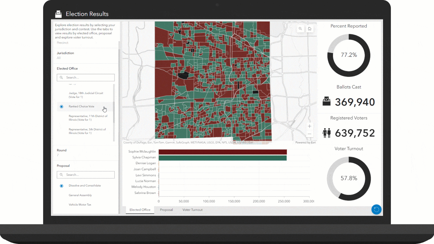
No ranked-choice contests in your area? No problem! Just leave the Round field in your data blank and remove the Round filter from the dashboard.
More winning upgrades
The latest Election Results solution upgrades aren’t limited to ranked-choice voting support. Other notable features integrated into the Election Results Dashboard app include better support for viewing on desktop and mobile devices. The dashboard also has improved visualization; ties are now uniquely symbolized, and the percent reported is easily pictured in a donut chart. Finally, the solution includes the Election Results Pipeline that you can use to regularly update election results data.
Elections may be complex, but sharing election results doesn’t have to be complicated. Why not see what the Election Results solution can do for you?
Learn more
For more information about the Election Results solution, check out the following resources:
- Learn how to deploy, configure, and use the solution.
- View a demo video.
- Discover other election solutions:
- Learn more about Data Pipelines.
- Learn more about ArcGIS Solutions.


Article Discussion: