Note: In November 2024, this solution was updated to align to FEMA’s Individual Assistance 4.0.5 forms version and Public Assistance forms version 4.0.6, along with several other minor enhancements.
The number of natural disasters and the cost of the recovery have been increasing everywhere. Assessing damage in a timely fashion helps local officials understand the severity and magnitude of the incident and its effect on public and private property. Information collected during these assessments is analyzed to determine if the incident-related costs and damages qualify for any state or federal assistance. Any delays could make an organization ineligible for state or federal assistance.
The United States Federal Emergency Management Agency (FEMA) has two programs that provide assistance when a natural disaster or catastrophic event occurs. These programs supplement state, local and tribal government efforts to provide emergency services that lessen the impact of a disaster. Although many incidents don’t result in a state or federal emergency declaration, some degree of assistance is still required.
On June 30, 2021, a new version of the Damage Assessment solution was released. This new and improved solution aligns with FEMA programs and includes a comprehensive set of capabilities that help collect damage reports, assign initial damage assessments, monitor the impact of a disaster on the community, brief internal stakeholders, and share information with the public. The new Damage Assessment solution can be used for declared or non-declared emergencies to quickly understand the impact of a disaster and start the recovery process.
Understand community impact
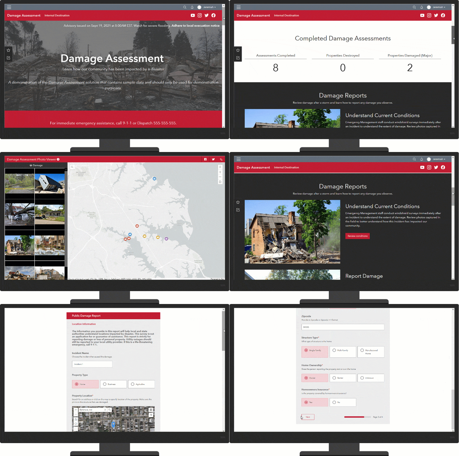
During an emergency, residents need to understand the impact of the incident on their community and how recovery activities may affect them. The Damage Assessment ArcGIS Hub Site can be used by emergency management agencies to share damage assessment information with those that have been impacted. In addition, damage reports can be solicited from the community to better gauge the severity of the damage.

Manage damage reports
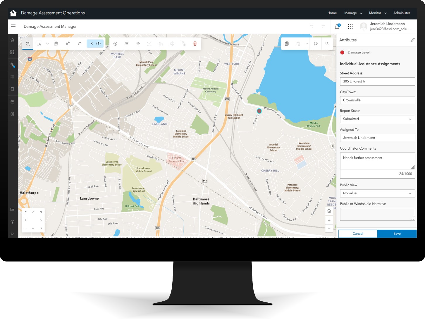
As public damage reports are submitted, the Damage Assessment Operations app can be used by emergency management staff to manage, monitor and administer damage assessments. The information submitted can then act as a starting point for initial damage assessments conducted by government officials.

Conduct damage assessments
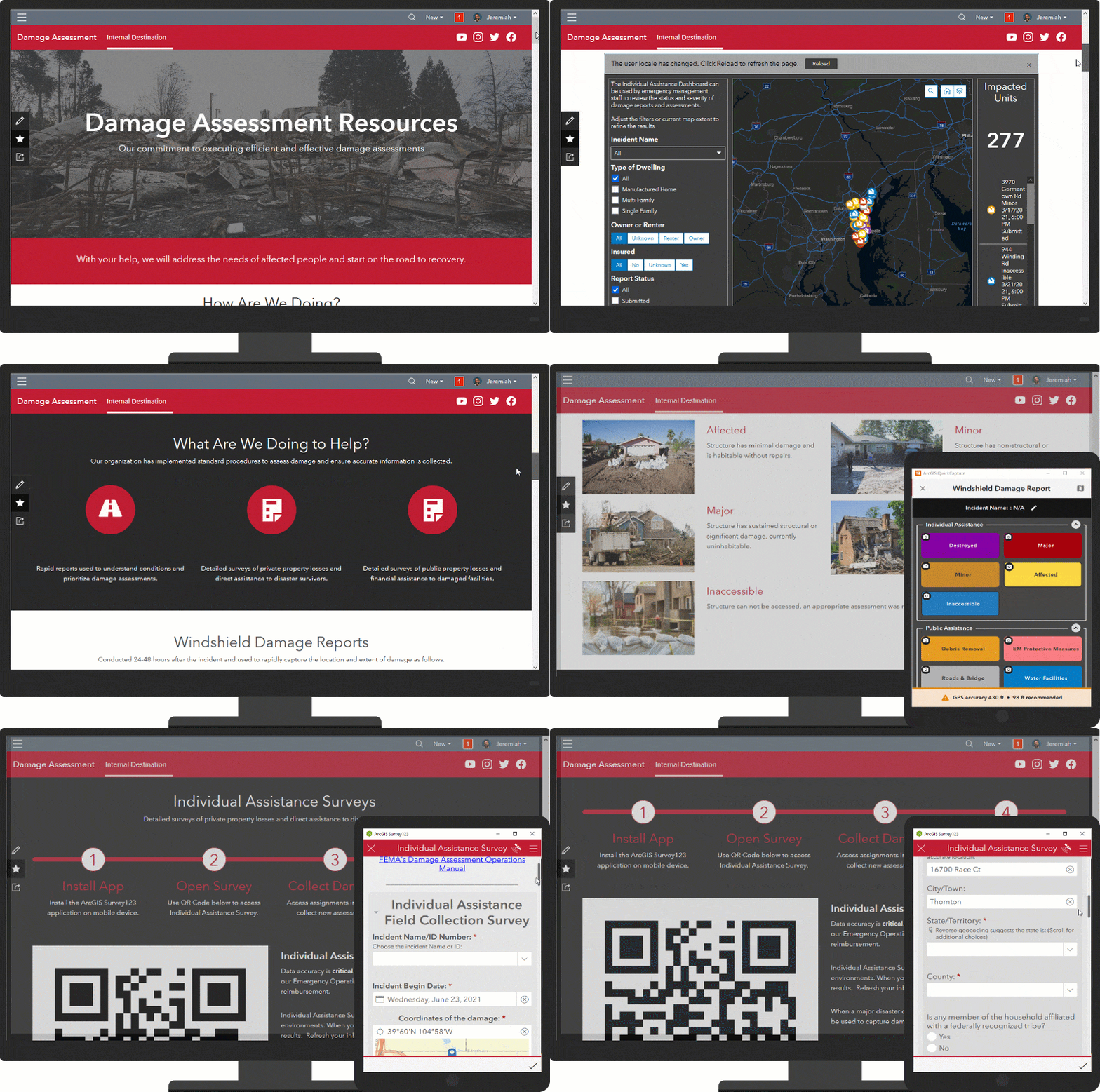
An internal ArcGIS Hub page provides damage assessment resources to public safety staff and volunteers so they can quickly assess damage severity. These assessments determine how much help the community needs. The Windshield Damage Report can be used by public safety staff or trained volunteers to rapidly capture damage reports. After windshield and public reports are reviewed and assigned, more detailed Individual Assistance and Public Assistance surveys can be conducted to collect information required by FEMA.

Monitor damage assessments
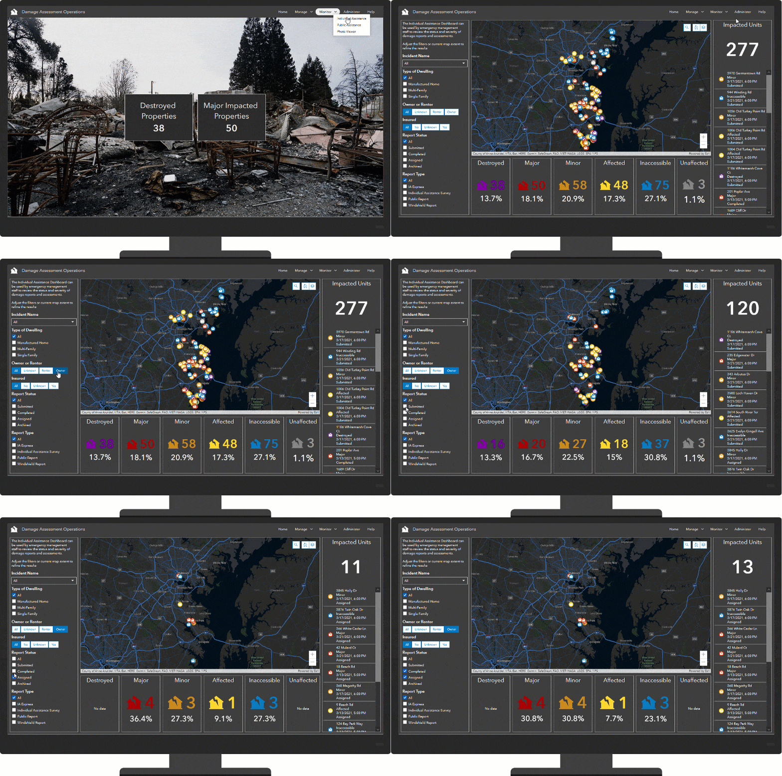
When an incident occurs, local governments must ensure Individual Assistance priorities and Public Assistance needs are effectively captured and communicated to state and federal authorities. The Damage Assessment Operations app can be used to monitor the impact as damage assessments are conducted. This information is used to determine if a state or national emergency declaration threshold has been exceeded.

Administer damage assessments
Damage information is a valuable resource used by many agencies and collaboration with other agencies is critical in making informed decisions. To support collaboration and data sharing, the Damage Assessment solution includes a series of tools that helps manage incident information, provision field users, share information with partner agencies, and export or report incident data. These tools can be accessed from the Damage Assessment Operations app and used throughout an incident.
Additional resources
Learn more about the Damage Assessment solution and how you can quickly deploy this solution on the ArcGIS Solution site. For questions and feedback, chat with us on Esri Community or contact Esri Support Services.
Note that the June 2021 release also includes a new Emergency Debris Management solution. It complements the Damage Assessment solution and helps expedite initial debris clearance, assess volume, and monitor the removal of disaster debris accumulated on roads, right-of-ways, and public facilities.
Finally, if you work in an electric utility or communications organization and need to respond to outages caused by severe weather conditions and emergency incidents, check out the new Outage Damage Assessment solution. It helps you collect damage reports, manage field assignments, and monitor the impact of a severe weather, or emergency incident, on electric utility and communication assets.

Article Discussion: