Special events play an important role in local economies and attract participants from outside the community to events such as fun runs, marathons, outdoor concerts, festivals, and art or food shows. Special Events also improve a community’s quality of life and many times are celebrations of history or heritage that draw people together.
Events pose logistic and public safety challenges for many communities. At a minimum, they must coordinate many permit applications, ensure temporary assets and restrictions do not negatively impact the community, and provide the public safety resources required to assure participant safety.
The coronavirus (COVID-19) pandemic has stopped most large gatherings and cancelled special events across the world. But as communities begin to reopen, they must consider how people congregate in a safe manner. As a result, many event coordinators are incorporating health restrictions in their event planning and operations.
The Special Event Permitting and Operations solution can be used by local governments to manage special event permits, protect event attendees, and promote special events occurring in the community. It includes a series of ArcGIS applications to organize permit applications, develop event site maps and health and safety plans, coordinate the permit review process, share event information with the public, monitor public health and safety operations, and create after-action reports. If you are a public safety agency that does not require permitting capabilities, check out the Special Event Operations solution.
Manage Special Events and Permits
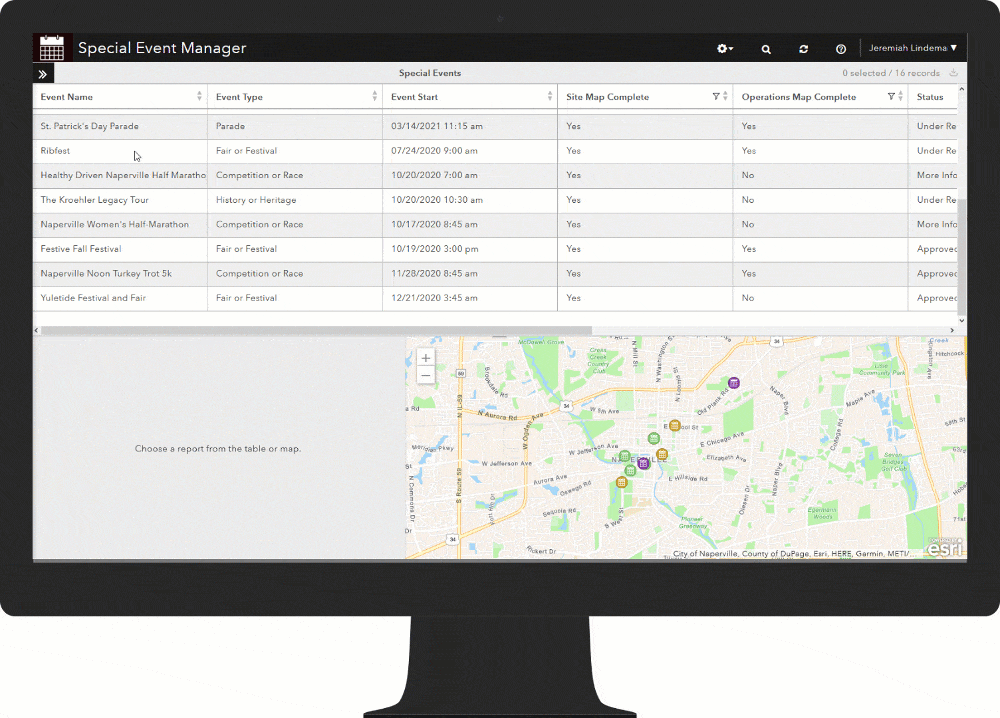
Special events start with private or non-profit organizations that request an event permit from the local authorities. The Special Event Permit can be used by event organizers and sponsors to apply for a community or special event permit. Managing the permit or event review process and backlog of permit applications can be a challenge encumbered by paper or email delays. The Special Event Permit Manager can be used by event coordinators to facilitate the special event permit process and manage the status of a permit application.
Prepare Site Plans
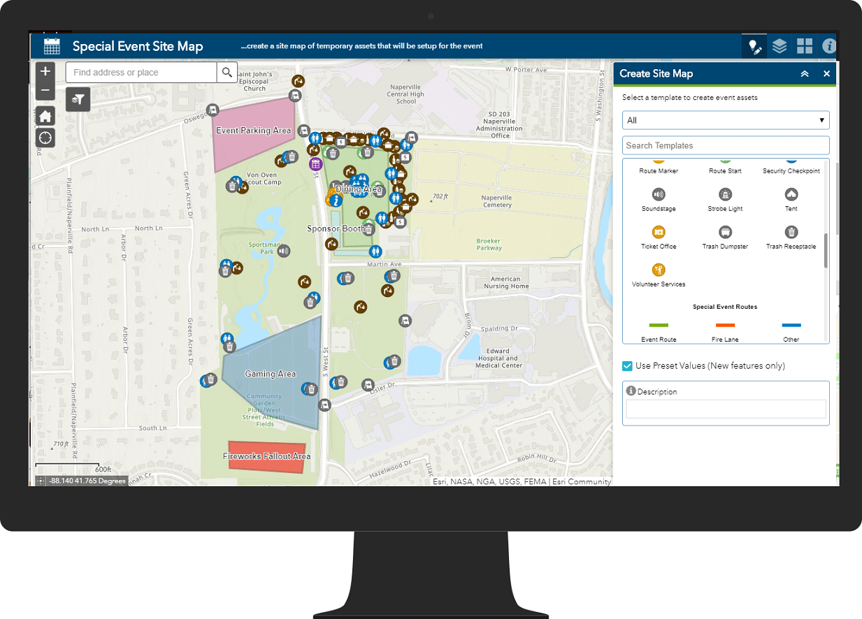
An event site map is a foundation of the event. It provides a common reference for planning, operating and promoting each event. Site maps include the event location, event assets, designated areas, and routes required to conduct the event. The Special Event Site Map can be used by event coordinators to quickly create a map of these assets for the event. These event assets are critical for public safety personnel and other local government agencies that may staff the event.
Inform Stakeholders
Special events play an important role in local economies. As a result, local government executives must understand the events planned for the community and how they might impact public safety and other services. The Special Event Permit Dashboard can be used by executives to monitor the status of special event permits.
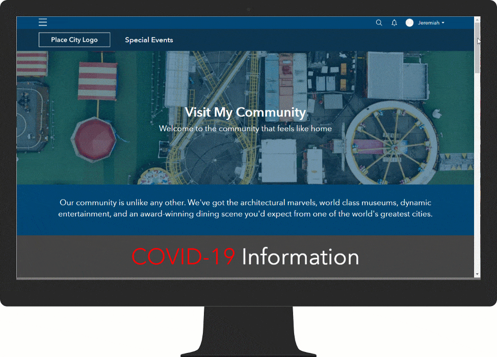
The Special Event Permitting and Operations solution also includes an ArcGIS Hub site to promote special events. The site includes a responsive, and accessible, website that serves as a destination for a community’s special events. From this destination, community members can review key event information and access the Special Event Calendar. The Special Event Calendar can be used to discover festivals, shows, concerts, and other events occurring in a community.
Prepare Operational Plans
Special events pose unique challenges for public safety agencies. Events have large geographic footprints, and involve sizable crowds impacted by a diverse array of threats, like crime, disorder, health, and weather. These large crowds and temporary structures can hinder response time to incidents and cause general confusion to operations.
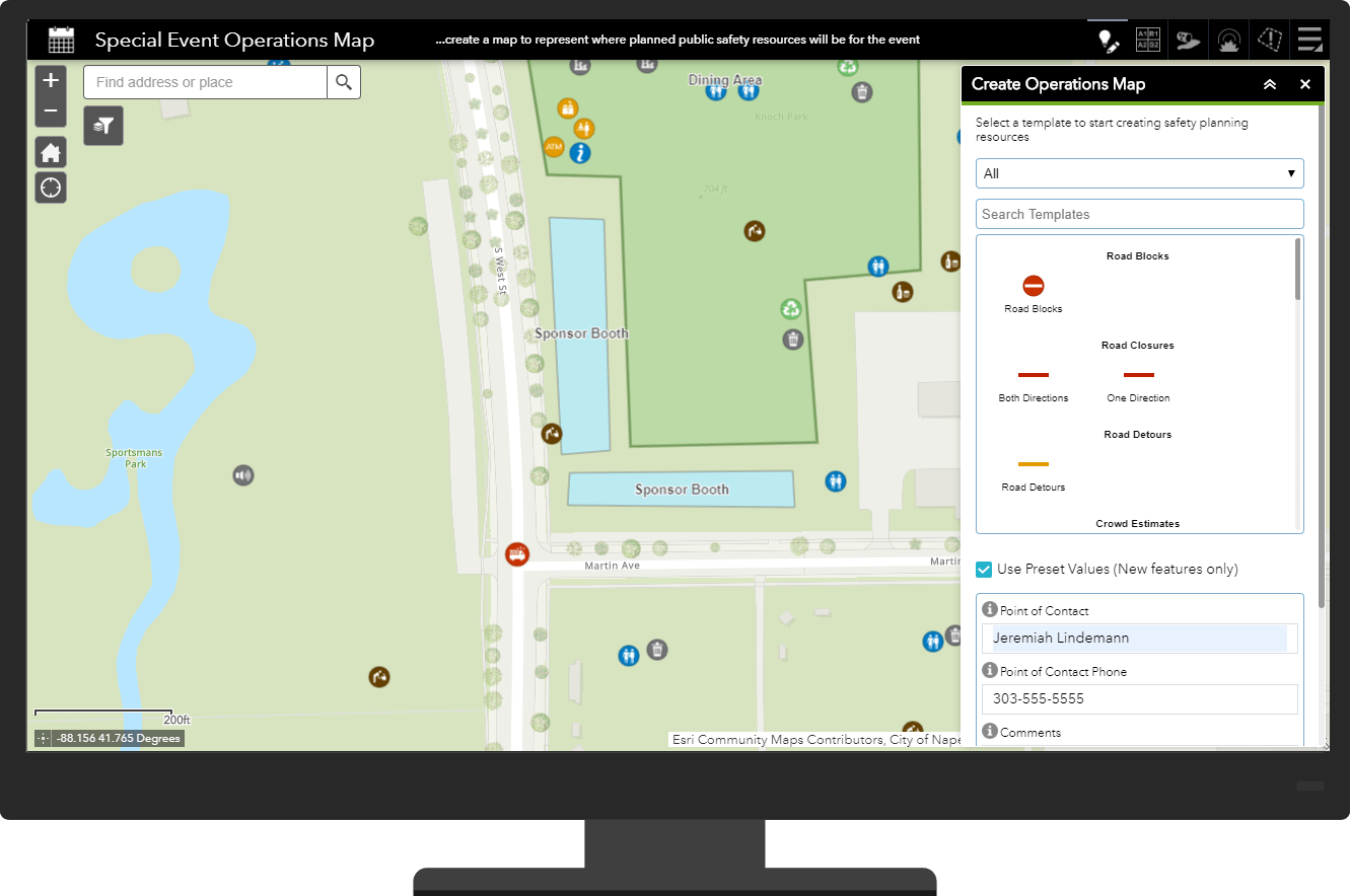
Public safety organizations typically develop an incident action plan to mitigate safety concerns and ensure a safe and secure event. The incident action plan ensures all public safety personnel are assigned to appropriate locations during the event. The Special Event Operations Map can be used by public safety event planners to create operations maps of public safety resources and conduct a high-level threat analysis. The operations map compliments the incident action plan and leverages information provided in the site map.
Conduct Health and Safety Operations
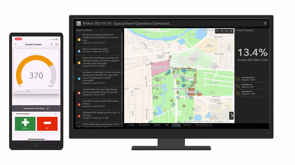
With an operations plan in place, monitoring the event and adjusting the plan in real-time is critical. Special Event Permitting and Operations helps you create a unique set of health and safety operations applications for each event that can be used to collect information from the field and maintain situational awareness. This collection of operations maps and applications help health and safety personnel:
- Report incidents observed during the event.
- Assign reported incidents to the closest field personnel.
- Quickly tally crowds in specific areas.
- Report the status of personal protective equipment (PPE) restocking and disinfection of high-touch areas.
- Monitor incidents, crowds, sanitation, weather, traffic and locations of personnel in real-time.
- Visualize historical event operations and support event after-action reports.
Additional Resources
Learn more about the special event solutions and how you can quickly deploy these solutions on the ArcGIS Solution site. For questions and feedback, chat with us on GeoNet or contact Esri Support Services.
Finally, you may not be hosting traditional special events, but are reopening a facility and hosting gatherings of people. If so, you may be interested in the Coronavirus Site Safety solution. It can be used by businesses, educational institutions, and government agencies to create coronavirus (COVID-19) health safety plans for their facilities, sites, and campuses; and monitor the health safety plans as locations reopen.


Article Discussion: