The Coronavirus Response Solution is now available to deploy with ArcGIS.
The first release of Coronavirus Response deploys a collection of maps and apps turning ArcGIS into a system to help communities respond to the evolving coronavirus (COVID-19) pandemic and be an authoritative source of information for the public.
Coronavirus Response is just one of the resources Esri is providing to help organizations combat the coronavirus. The COVID-19 GIS Hub is the place to access additional resources and to request GIS assistance from Esri.
Upon deployment, organizations will get several ArcGIS apps. You can choose to use all the apps as a comprehensive system or just use apps that meet your current needs.
Inform the Public
The first release of Coronavirus Response includes the following public facing applications:
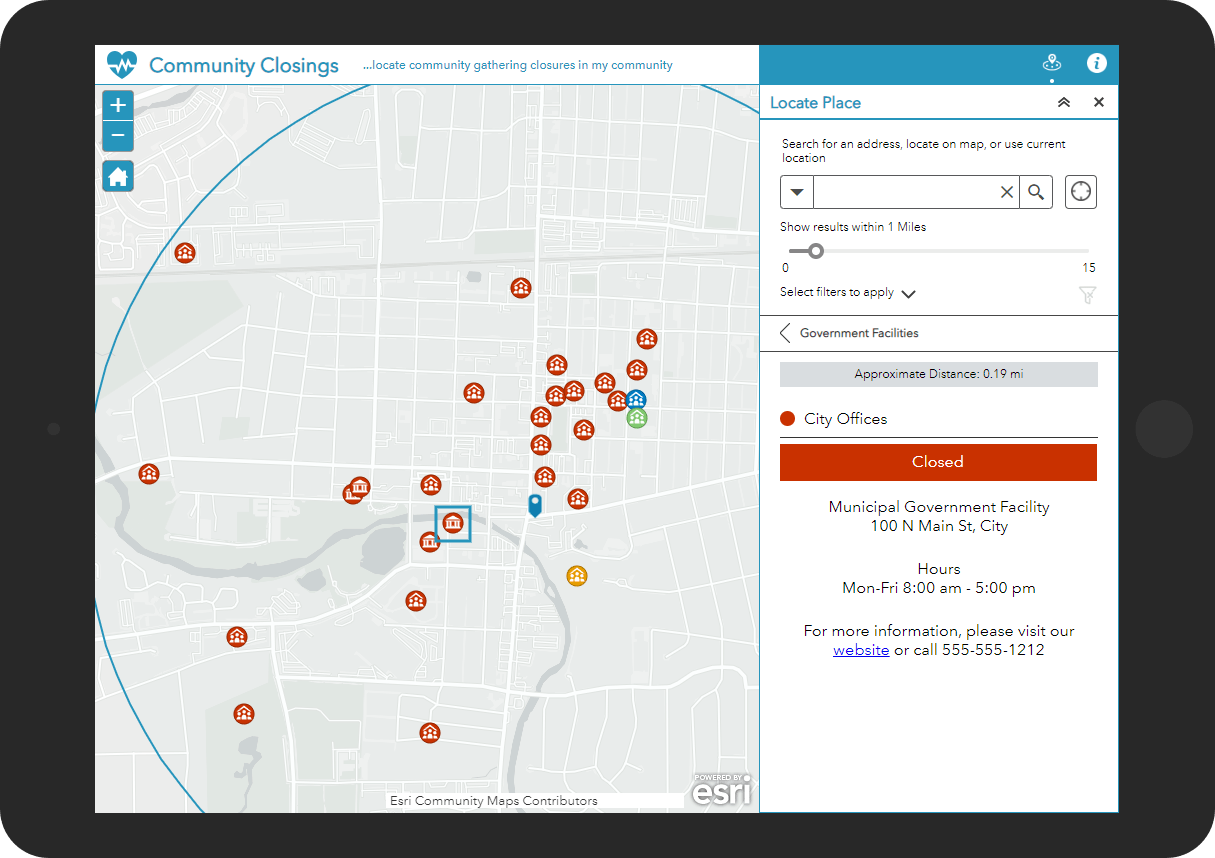
Community Closings – a web application that informs the public about the status of community gathering places such as government buildings, parks, care centers, libraries, food banks, and the like.
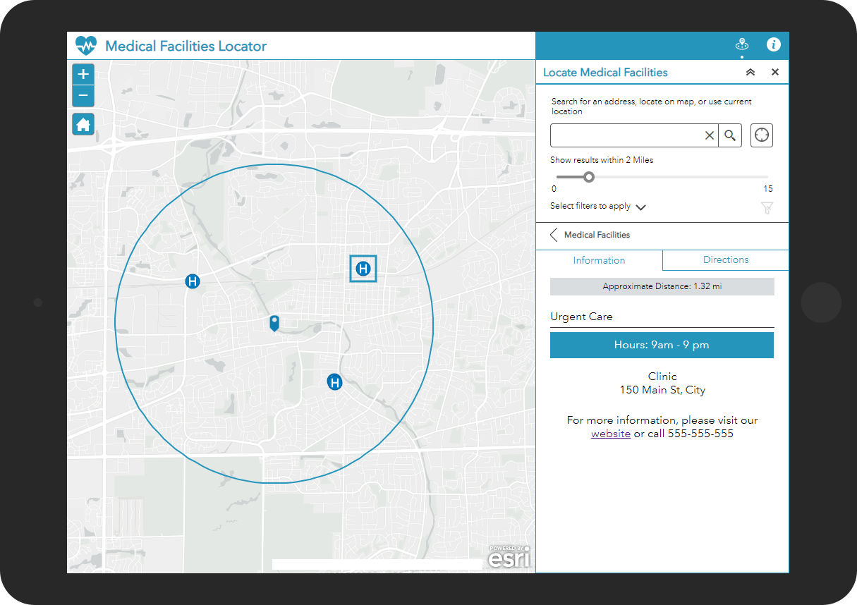
Medical Facilities Locator – a web application that enables the public to locate nearby hospitals and healthcare clinics.
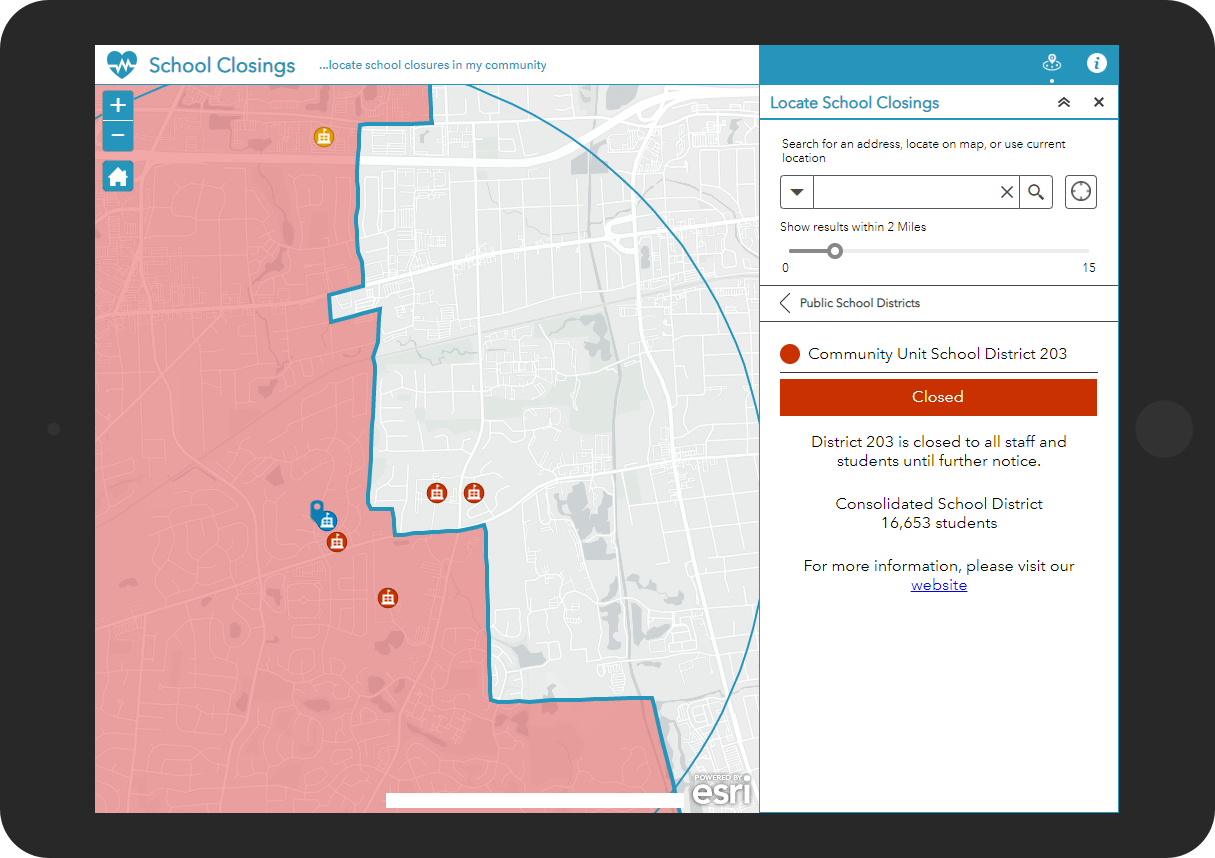
School Closings – a web application that informs the public about the status of school closings.
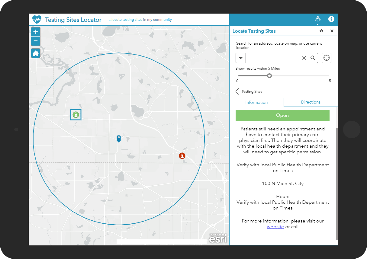
Testing Sites Locator – a web application that helps the public find nearby coronavirus testing site locations.
Each of these applications can be embedded in your Coronavirus Response website. If you do not have a site currently, or wish to enhance an existing site with geographic context, you can use the Coronavirus Response Hub template. This template quickly launches a destination for health and safety information and is available to all organizations using ArcGIS Online.
Manage Authoritative Data
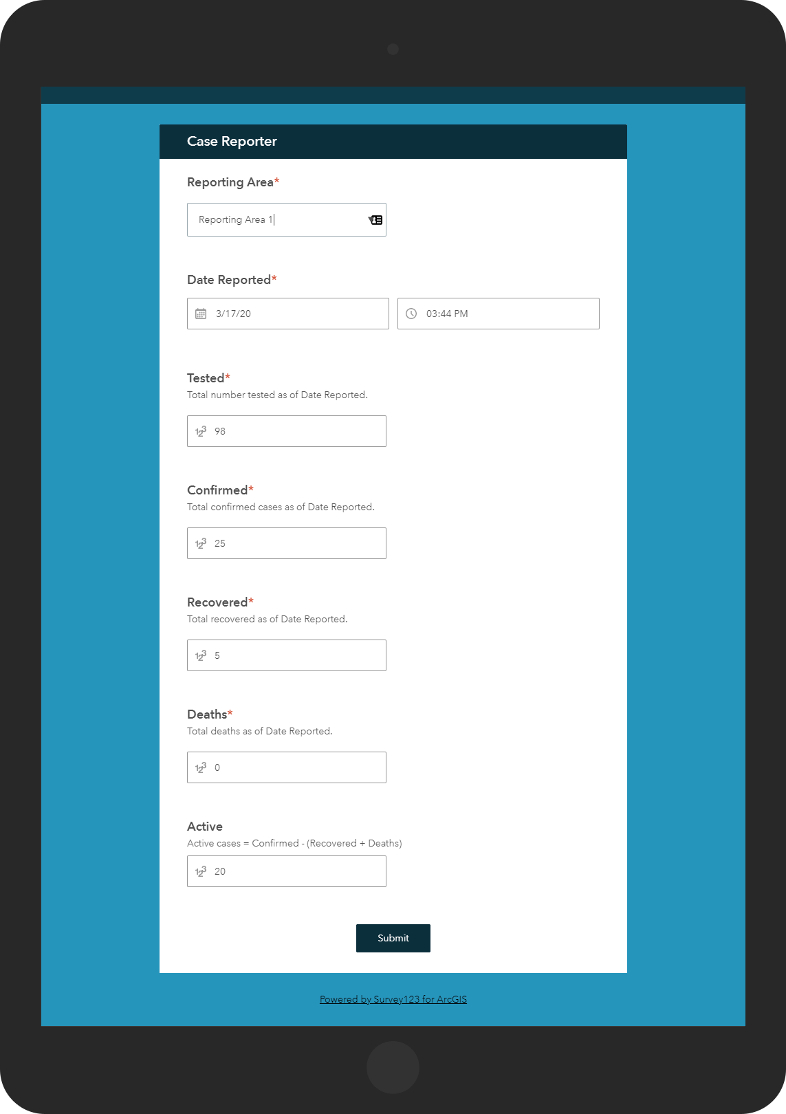
The first release of Coronavirus Response also includes a set of applications that help community staff create and manage the authoritative data being shared with the public.
Additionally, a Case Reporter application is provided for community staff to tabulate coronavirus cases.
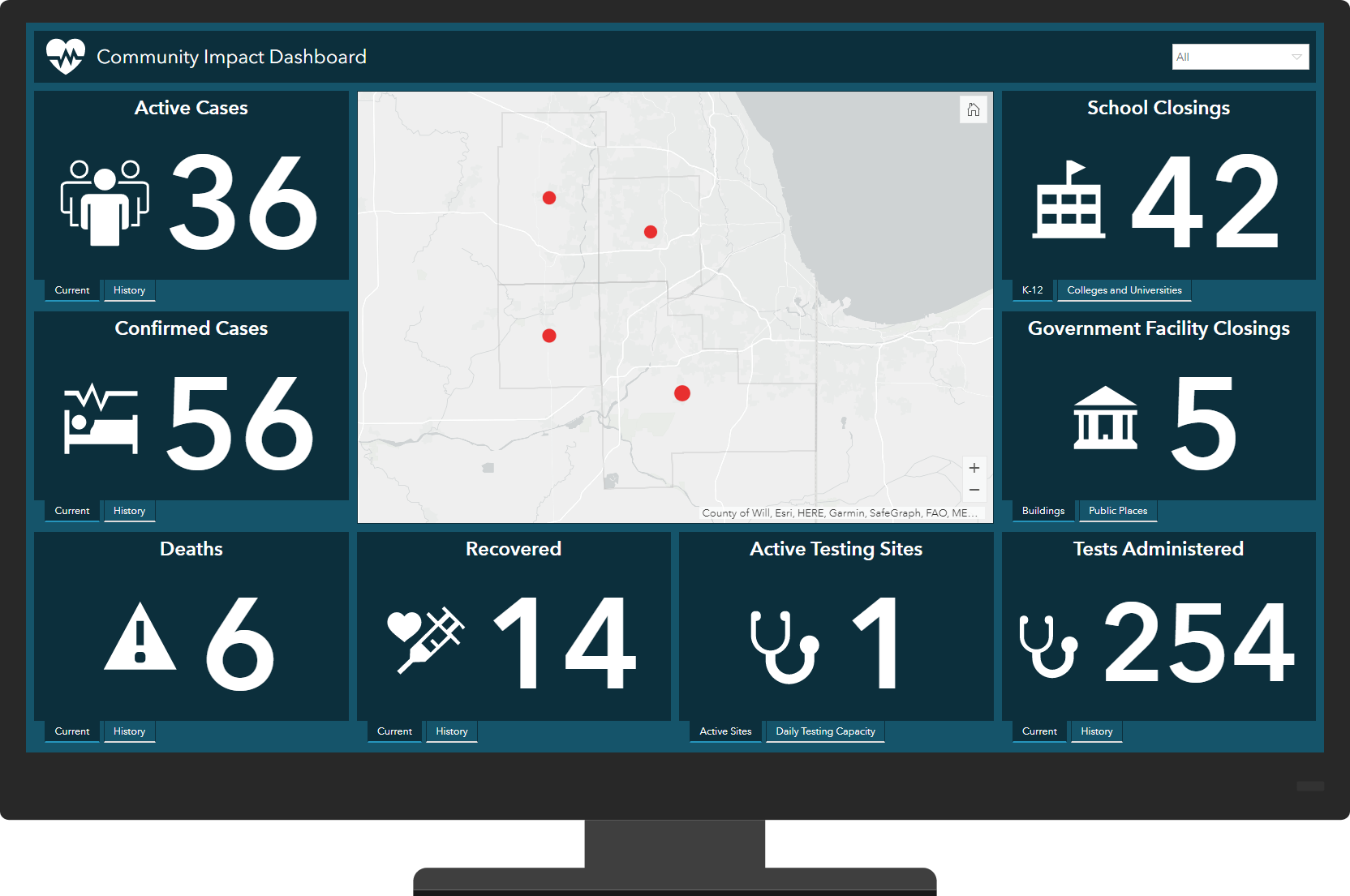
A Community Impact Dashboard is provided for sharing this information as a dashboard.
Additional Resources
Learn more about the Coronavirus Response Solution and how you can quickly deploy this solution for your organization on the ArcGIS Solution site. For questions and feedback, chat with us on GeoNet or contact Esri Support Services.


Howard I have created a Coronavirus Hub along with dashboard apps for the city I work for but I do not see these dashboards or the Hub in the search options when filtering by state under the “View USA applications” on the coronavirus response site hosted by ESRI.
Is there a way I can get these dashboards and our Hub recognized for the state of Ohio? Sorry if this is off topic.
Jeff – Your Hub is listed under Ohio now. Sites are being added as we become aware of them. Others that want data or apps listed in COVID-19 GIS Hub can message me.
For those who would like a visualization of what the stack offers, here’s a home made diagram: https://nevcounty.maps.arcgis.com/sharing/rest/content/items/c37fe41680654b0eb59c634b3044e4fb/data