Can’t stand the rain
For most of us, a downpour means slogging through muddy puddles, scooping gunk from gutters, and wishing that we hadn’t just washed our car for the first time in months. But for stormwater organizations, the stakes are much higher, especially when it comes to inspecting construction sites. Construction activity loosens soil, and stormwater runoff can carry pollutants—sediment, debris, and chemicals from that loose soil—to nearby storm systems, as well as directly into rivers, lakes, and coastal waters. Regulations to protect water quality from erosion and stormwater runoff are in place, but while the regulations themselves are well intended, complying with them introduces a mess of other headaches for stormwater organizations.
Stormy weather
If you’re a stormwater inspector, you know the drill: Every day, you visit multiple construction sites to verify that they’re following their stormwater management plan. You know that if you don’t properly inspect and record your findings, your organization could end up paying a large fine. Worse, your community’s water quality could suffer.
So what’s the big deal? Just inspect and report and consider it a job well done, right? Except…
No two construction sites function the same, and each site itself is dynamic. To adequately inspect a single construction site, you’d have to visit multiple times—especially after a solid rain—and come fully equipped with all the appropriate technology and resources necessary for an effective inspection.
Many inspectors currently juggle paper forms and digital cameras in the field and then have to return to the office to compile handwritten notes and digital photos into inspection reports. In other words, the exact opposite of “an effective inspection.”
If only someone had a solution…
Here comes the sun
While ArcGIS Solutions can’t control the weather, we can certainly help you manage your response to it, and that help comes in the form of our newly released Stormwater Construction Activity Management solution. The collection of maps and apps included with the solution are designed with three key goals in mind:
1. Optimize stormwater construction inspections.
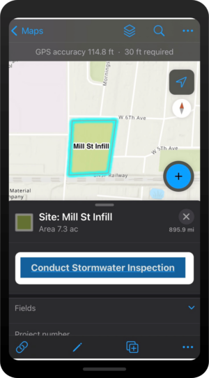
Stormwater inspectors belong in the field, not the office, and their time is better spent documenting construction sites than transcribing paper documentation into an electronic format. Stormwater Construction Activity Management allows you to capture inspection information on-site with digital forms and immediately produce digital reports at the time of inspection.

2. Safeguard water quality.
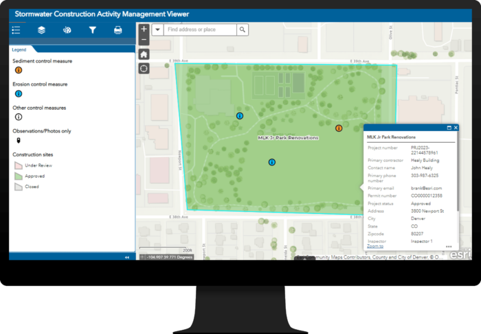
Arguably, the most important purpose of a stormwater inspection is the assurance that your community’s water supply is safe. Stormwater Construction Activity Management includes forms specifically designed to ensure that the correct stormwater control measures are being used and apps to help you monitor the effectiveness of these measures.

3. Support regulatory compliance.
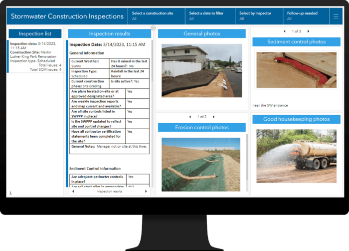
Data is important, but what you do with that data is critical. The inspection data that stormwater inspectors digitally enter from the field automatically uploads to two ArcGIS Dashboards apps included with the Stormwater Construction Activity Management solution. Stormwater personnel in your organization have instant access to field inspection data that they can use to monitor Stormwater Pollution Prevention Plan (SWPPP) compliance.

Managing stormwater runoff at construction sites will always be challenging, but it doesn’t have to be frustrating too. The Stormwater Construction Activity Management solution is the perfect partner for stormwater organizations ready to streamline construction site inspection processes and improve their ability to provide actionable results to stakeholders.
Resources
For more information about the Stormwater Construction Activity Management solution, check out the following resources:
- Learn how to deploy, configure, and use the solution.
- View a demo video.
- Chat with us on Esri Community.


Article Discussion: