Real-time data is transforming how organizations detect, respond to, and manage critical events. ArcGIS Velocity extends ArcGIS into real time, enabling continuous ingestion, analysis, and actuation of streaming data from sensors, IoT devices, and other external intelligence platforms.
The November 2026 release of ArcGIS Velocity introduces new feeds, analytics, and makes enhancement to the user experience for improved usability.
Here are several highlights of the November 2026 release:
| Feature | What it enables | Available in | |
| Feed | AIS | Monitor maritime vessel locations, movements, and navigation activity in real time | ArcGIS Online + ArcGIS Enterprise |
| AeroDefense | Receive live drone detection data for real-time airspace monitoring and analysis | ArcGIS Online + ArcGIS Enterprise | |
| Samsara Ground Intelligence | Ingest detected roadway issues such as potholes and road cracking | ArcGIS Online | |
| Samsara Safety Events | Ingest safety events such as harsh braking, collisions, and distracted driving | ArcGIS Online | |
| Raven Ground Source Truth | Stream real-time fleet, roadway, and work zone intelligence | ArcGIS Online | |
| CompassVision | Ingest fleet and road condition data generated by AI-enabled cameras | ArcGIS Online | |
| Samdesk | Capture real-time global crisis and event alerts | ArcGIS Enterprise | |
| TCP (Server) and UDP (Server) | Receive streaming data from external clients | ArcGIS Enterprise | |
| UDP (Client) | Receive streaming data from external senders | ArcGIS Enterprise | |
| CompassCom | Ingest real-time location and telematics data from vehicles, radios, smartphones, and other devices | ArcGIS Enterprise | |
| Analytic | Summarize Attributes | Calculate rolling statistics over a defined number of observations or period of time | ArcGIS Online + ArcGIS Enterprise |
| Calculate Fields by Regular Expression | Extract, reformat, and validate structured text in streaming data | ArcGIS Online + ArcGIS Enterprise | |
| Drop Duplicates | Reduce repetitive data when features have not changed | ArcGIS Online | |
| Split by Attributes | Transform delimited attribute values into individual records | ArcGIS Enterprise | |
| Output | Samsara Ground Intelligence | Update Samsara Ground Intelligence issues and watchpoints | ArcGIS Online |
| XMPP | Send real-time notifications to individuals or multi-user chat rooms | ArcGIS Enterprise | |
| TCP (Server) | Stream real-time analytic events to connected external clients | ArcGIS Enterprise | |
| Data enhancement | Measure values | Preserve measure values in output geometries to support linear referencing workflows | ArcGIS Online + ArcGIS Enterprise |
| General | ArcGIS Monitor support | Monitor ArcGIS Velocity items and system health | ArcGIS Enterprise |
| Multiple Velocity site federation | Federate multiple ArcGIS Velocity sites with a single ArcGIS Enterprise portal | ArcGIS Enterprise | |
| Reverse proxy support | Configure ArcGIS Velocity to work with an organization’s reverse proxy server | ArcGIS Enterprise | |
| ArcGIS Arcade assistant | Create custom logic for real-time analytic workflows. | ArcGIS Online + ArcGIS Enterprise |
Feeds
AIS
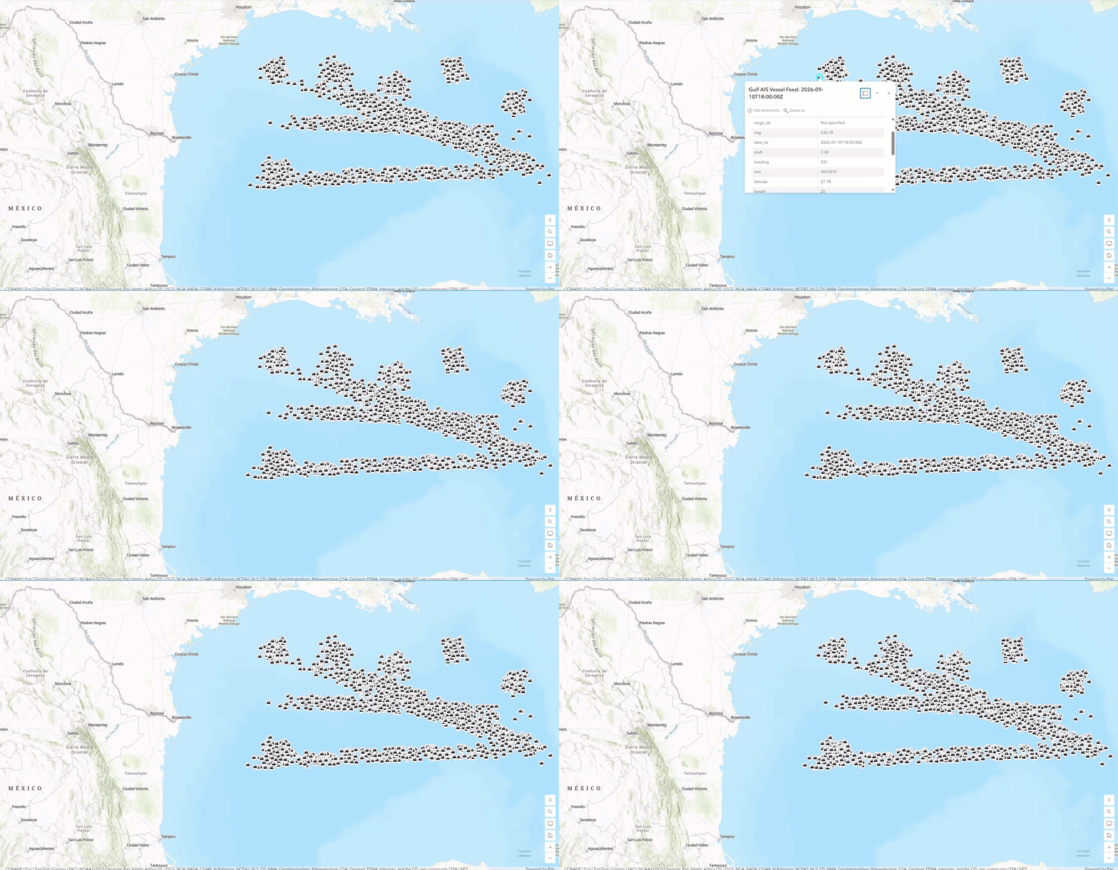
The AIS feed brings real-time maritime vessel data directly into ArcGIS Velocity, enabling organizations to monitor vessel locations, movements, and navigation activity as events occur. By connecting to Automatic Identification System (AIS) data, you can visualize and analyze vessel information such as position, speed, heading, destination, and estimated time of arrival. AIS data is valuable for maritime use cases, including maritime security teams tracking vessels of interest, port operations teams monitoring vessel traffic and berthing activity, and defense and maritime domain awareness organizations analyzing vessel tracks over time.
AeroDefense
The AeroDefense feed type in ArcGIS Velocity connects to the AeroDefense drone detection API to receive live drone and drone pilot position information for real-time monitoring and situational awareness. With the AeroDefense feed, you can easily bring UAS information into ArcGIS Velocity, enabling you to add this information to real-time applications, including for airport operations teams monitoring drone activity near runways and approach paths, public safety teams monitoring drones during large public events, and security operations teams detecting the positions of unknown drones near facilities.
Samsara Ground Intelligence
(ArcGIS Online only)
The Samsara Ground Intelligence feed in ArcGIS Velocity polls the Samsara Ground Intelligence API. Samsara Ground Intelligence uses AI and the Samsara Network to detect road surface issues, such as potholes and road cracking, as vehicles travel throughout a jurisdiction. Bringing this information into Velocity is valuable for organizations such as public works departments identifying and prioritizing road repairs, transportation and maintenance teams monitoring roadway conditions, and GIS analysts maintaining maps of unresolved road issues.
Samsara Safety Events
(ArcGIS Online only)
The Samsara Safety Events feed enables Velocity to ingest fleet safety information from Samsara into ArcGIS. Information that is collected with Samsara Safety Events includes a wide range of driving behavior and condition information, including harsh braking, collisions, speeding, mobile device usage, following distance, lane departure, and other safety-related information. Samsara detects this information with in-vehicle cameras and sensors. By bringing this safety information from Samsara into Velocity, fleet and transportation teams can visualize in ArcGIS where safety events are occurring, detect spatial trends, enrich with other real-time information, and identify locations with recurring safety concerns, and fleet safety teams monitoring events that may require review or coaching. The feed can support applications for fleet safety monitoring, incident response, driver safety workflows, and transportation safety analysis.
Raven Ground Source Truth
(ArcGIS Online only)
The Raven Ground Source Truth feed brings real-time roadway intelligence from Raven Connected into ArcGIS Velocity, where it can be incorporated into real-time analytic workflows. The Raven Ground Source Truth feed continuously delivers AI-detection from geolocated, AI-tagged street-level images directly into agencies’ geospatial workflows as they are captured. This allows public works and transportation teams to monitor everything from infrastructure degradation to dynamic asset inventories using vehicles already on the road. By bringing continuous observations into Velocity and enriching with your existing operational data, you can replace guesswork with absolute certainty and respond to changing road networks faster than ever.
CompassVisionTM
(ArcGIS Online only)
The CompassVision™ feed brings AI-generated winter roadway condition data from CompassCom into ArcGIS Velocity to support real-time snow and ice operations.
CompassVision™ uses AI-enabled vehicle cameras and GPS location data to automatically detect and classify snow-related roadway conditions as winter maintenance vehicles travel their routes. These georeferenced observations provide transportation agencies and public works departments with timely insight into changing winter road conditions across their roadway networks.
Building on the existing CompassCom feed, which provides real-time vehicle location, engine diagnostics, snow materials application data (granular, liquid, and prewet), and air and road temperatures, CompassVision™ adds AI-generated observations of actual roadway conditions.
Together, these data sources provide a more comprehensive picture of winter maintenance operations. With these feeds in Velocity, you can use current information about fleet activity, material usage, environmental conditions, and AI-detected roadway conditions to trigger updates in your maps and dashboards, or design full workflows with automated notifications.
Samdesk
(ArcGIS Enterprise only)
The Samdesk feed is now available for ArcGIS Enterprise deployments of Velocity. This feed was previously released with the June 2026 update of Velocity. For more information, please visit the June 2026 ArcGIS Velocity release blog.
TCP (Server)
(ArcGIS Enterprise only)
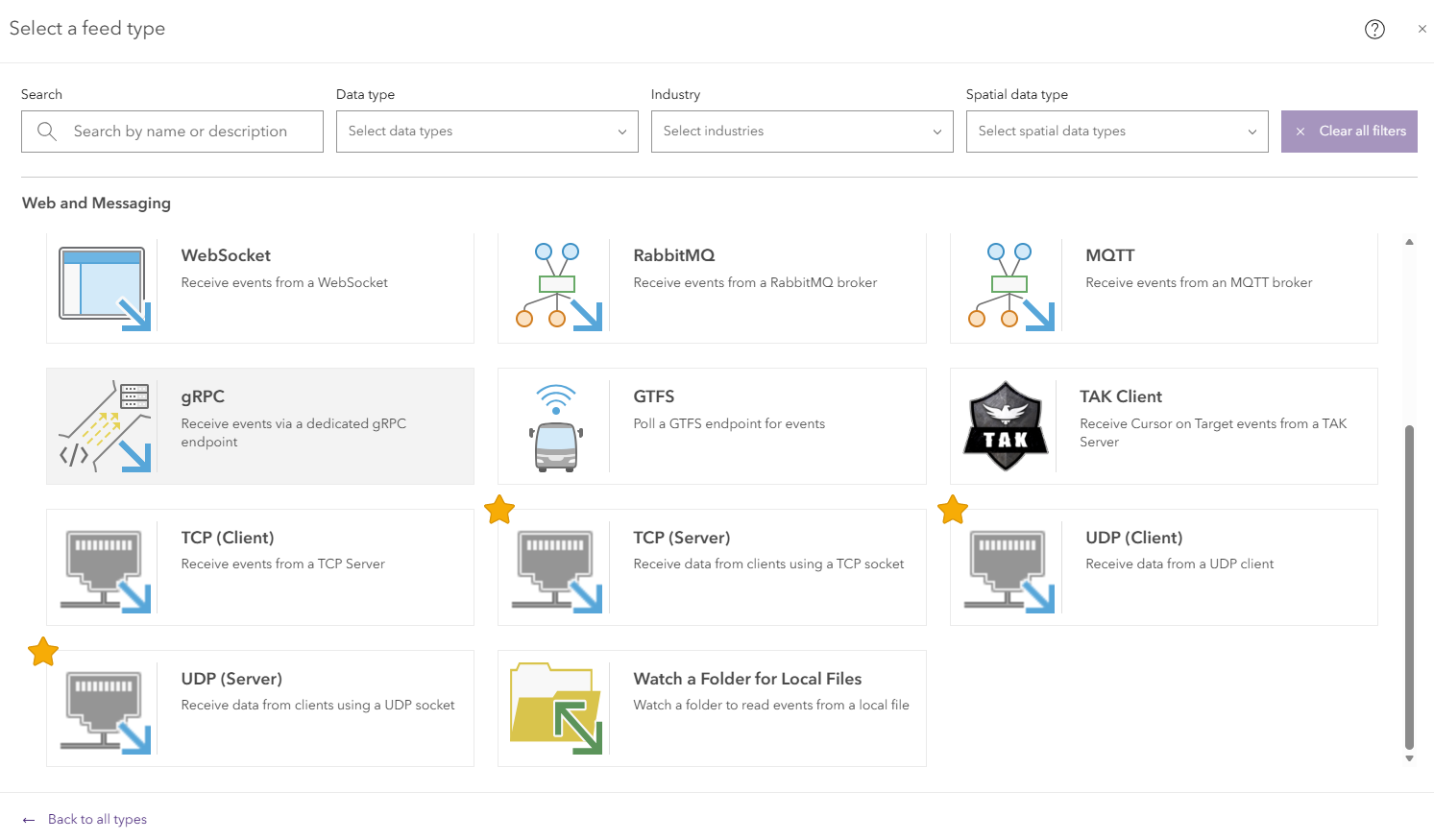
The TCP (Server) feed brings real-time data from external clients directly into ArcGIS Velocity through a TCP socket connection formatted as JSON, GeoJSON, Esri JSON, XML, and delimited text, allowing organizations to ingest a variety of streaming data. TCP (Server) is useful for workflows such as fleet monitoring, asset tracking, and other applications in which external systems continuously send data to Velocity.
UDP (Server)
(ArcGIS Enterprise only)
The UDP (Server) feed brings real-time data from external clients into ArcGIS Velocity through a UDP socket formatted as JSON, GeoJSON, Esri JSON, XML, and delimited text. UDP (Server) is useful for workflows such as utility monitoring, sensor data collection, asset monitoring, and other applications in which external systems send real-time data to Velocity.
UDP (Client)
(ArcGIS Enterprise only)
The UDP (Client) feed brings real-time data from external senders into ArcGIS Velocity by listening for UDP messages on a configured local hostname or IP address and port formatted as JSON, GeoJSON, Esri JSON, XML, and delimited text. UDP (Client) is useful for workflows such as traffic monitoring, sensor data collection, and other applications in which external systems send real-time data to Velocity.
CompassCom
(ArcGIS Enterprise only)
The CompassCom feed is now available for ArcGIS Enterprise deployments of Velocity. This feed was previously released with the June 2026 update of Velocity. For more information, please visit the June 2026 ArcGIS Velocity release blog.
Analytics
Summarize Attributes
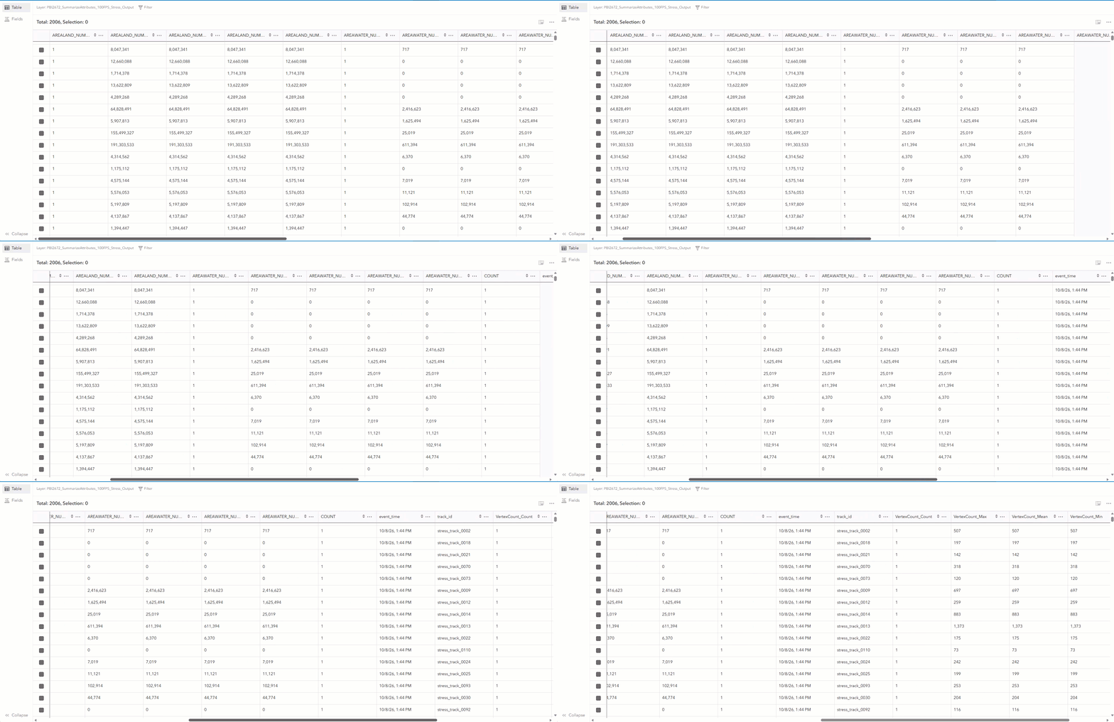
The Summarize Attributes tool summarizes field values to generate a summary table. The resulting output table displays the count of summarized features and any additional specified statistics. It calculates rolling statistics such as count, minimum, maximum, mean, variance, and standard deviation for individual tracks or across an entire stream of data. The tool is useful when you need to understand recent conditions or trends over a defined number of observations or period of time. For example, it can help identify changes in vehicle speeds, monitor sensor conditions, or summarize operational activity for real-time dashboards.
Calculate Fields by Regular Expression
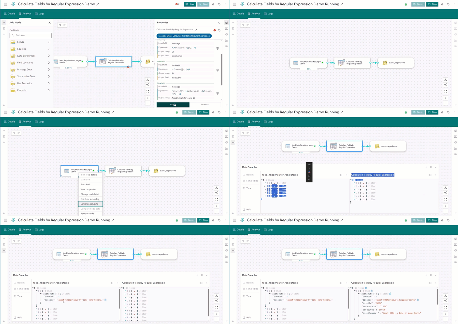
The Calculate Fields by Regular Expression tool in ArcGIS Velocity uses regular expressions to extract, reformat, and validate text in real-time data. It is useful when incoming data contains structured text that needs to be validated or separated into meaningful components. For example, it can validate phone numbers and GUIDs, extract components from street addresses, or parse email addresses into individual fields.
Drop Duplicates
(ArcGIS Online only)
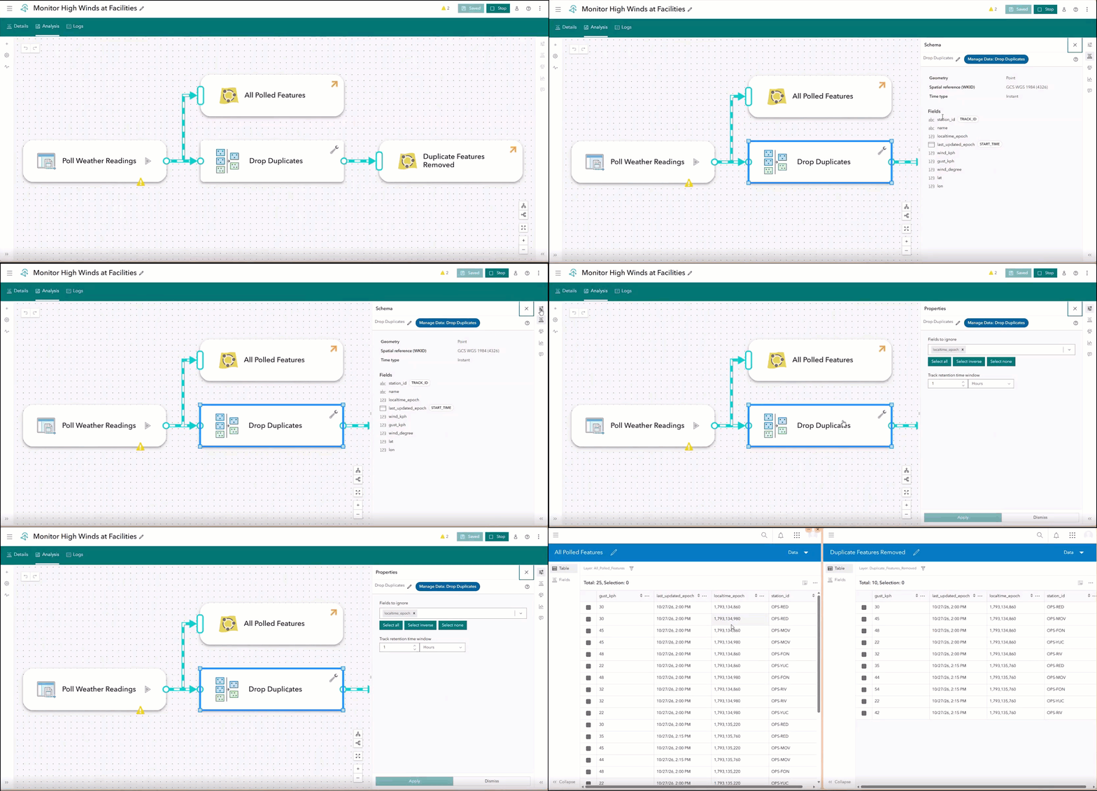
The Drop Duplicates tool in ArcGIS Velocity helps reduce repetitive real-time data by dropping features that are identical to the most recently received feature for the same track ID. By allowing only new or changed features to continue downstream, the tool can prevent unnecessary processing in real-time analytics.
Split by Attributes
(ArcGIS Enterprise only)
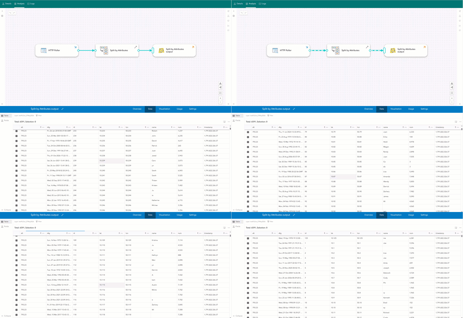
Real-time data can arrive with multiple values packed into a single field, making it difficult to properly configure analytics in Velocity. The Split by Attributes tool in ArcGIS Velocity simplifies this process by automatically parsing delimited values, such as comma-separated lists, semicolons, or forward slashes, into individual records at ingest. Each resulting record retains all original attributes, allowing every value to be independently analyzed, routed, or summarized.
This is especially valuable in common operational scenarios, such as emergency dispatch records referencing multiple response units (E12, L3, M5), utility events listing affected circuits (CIR-104; CIR-991; CIR-120), or weather alerts spanning multiple zones (ZoneA/ZoneB/ZoneC). By treating each value as its own event, real-time data is now ready for immediate analysis.
For organizations migrating from ArcGIS GeoEvent Server, this capability brings the Field Splitter processor functionality into ArcGIS Velocity.
Outputs
Samsara Ground Intelligence
(ArcGIS Online only)
The Samsara Ground Intelligence output in ArcGIS Velocity updates Ground Intelligence issues and creates or updates monitoring points in Samsara. The output pairs with the Samsara Ground Intelligence feed to close the loop between Samsara and external systems.
XMPP
(ArcGIS Enterprise only)
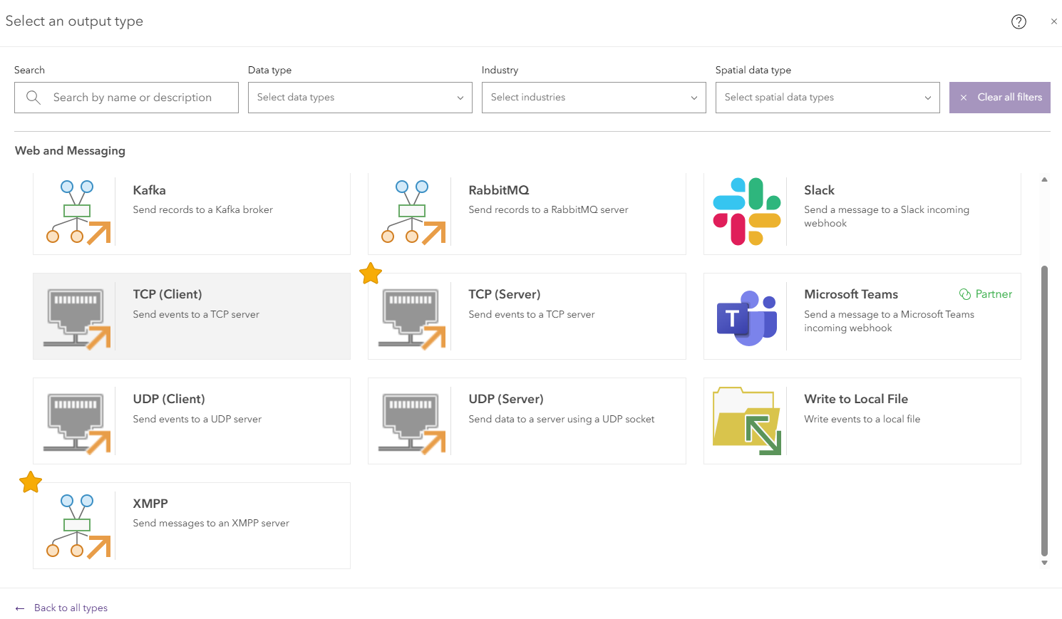
The XMPP output in ArcGIS Velocity enables organizations to send real-time notifications to individual recipients or multi-user chat rooms through an XMPP server. Messages can include information from incoming events, allowing notifications to provide relevant details about the condition that triggered them. This output is useful for operational workflows in which teams need timely notifications about events such as sensor threshold exceedances, shipment delays, arrivals, or other conditions requiring attention.
TCP (Server)
(ArcGIS Enterprise only)
The TCP (Server) output in ArcGIS Velocity streams events from real-time analytics to connected external clients over TCP formatted in JSON, GeoJSON, Esri JSON, and delimited text. It is useful when external systems need to receive analytic results as events occur. For example, a dispatch operation can use the output to send real-time vehicle alerts to connected in-vehicle apps.
Data Enhancements
Support for linear referenced work workflows via Measure (M) value
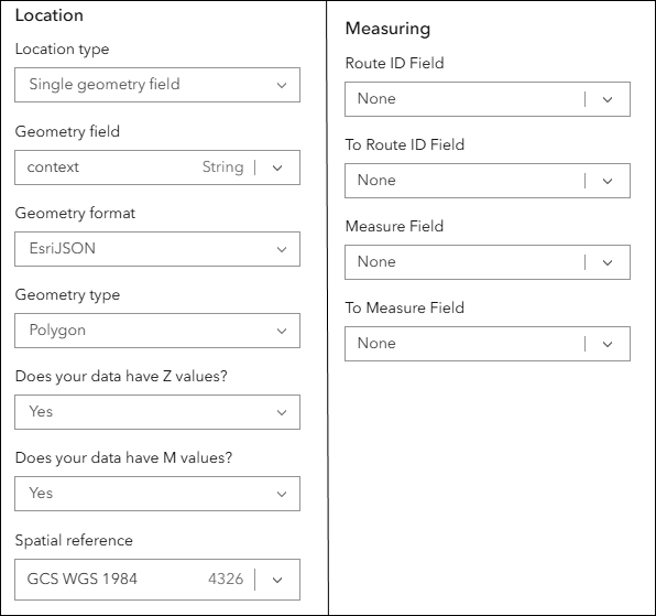
Measure values (M-values), or linear referencing measures, represent locations along a route and are set when routes are created or measures are updated. They are commonly used in linear referencing systems (LRS), such as ArcGIS Roads and Highways and ArcGIS Pipeline Referencing. When data from a feed containing M-values is written to an output feature layer, Velocity preserves the associated M-value metadata for consumption by linear referencing systems. Velocity supports M-values for the point, multipoint, polygon, and polyline geometry types. The M (measure) parameter is optional, as not all data have M-values.
General
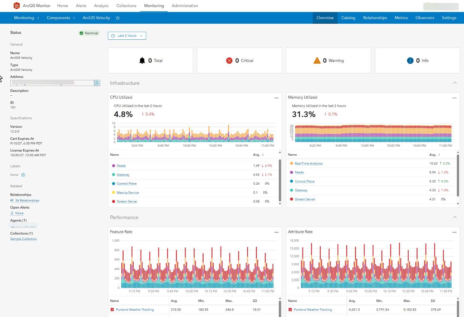
Improve observability for real-time systems with ArcGIS Monitor
(ArcGIS Enterprise only)
With the ArcGIS Enterprise 12.2 release, ArcGIS Monitor now supports ArcGIS Velocity for ArcGIS Enterprise, expanding monitoring capabilities for self-hosted real-time GIS deployments. ArcGIS Monitor provides tools for monitoring the health, performance, and availability of enterprise GIS environments, helping administrators identify issues and maintain reliable operations. Administrators can gain greater visibility into the health and performance of the infrastructure supporting Velocity, helping maintain the reliability and availability needed for real-time workflows.
Multi-site federation
(ArcGIS Enterprise only)
ArcGIS Velocity supports federating multiple Velocity sites with a single ArcGIS Enterprise portal. This allows organizations to separate real-time workloads across development, testing, and production environments or by department, project, or workload requirements. Each site maintains its own feeds and real-time analytics while using the same portal for access, sharing, and content discovery.
Reverse proxy support
(ArcGIS Enterprise only)
ArcGIS Velocity can be configured to work with an organization’s reverse proxy server, providing an additional layer between external clients and the Velocity services running on the internal network. The reverse proxy helps protect internal machines from direct internet access while providing a public URL for accessing Velocity. This allows administrators to hide the port and customize the context. For example, https://mysite.esri.com/velocity/home instead of https://mysite.esri.com:7143/arcgis/home.
ArcGIS Arcade assistant
ArcGIS Velocity now includes the ArcGIS Arcade assistant, making it easier to create custom logic for real-time analytic workflows. The assistant uses generative AI to help you create Arcade expressions using natural language, reducing the time and effort needed to translate your analytic requirements into code. Whether you’re calculating new values, transforming incoming data, or defining custom logic, the Arcade assistant makes it easier to take advantage of Arcade within your real-time analytic workflows.
Questions and feedback
Do you have questions or feature requests for ArcGIS Velocity? Be sure to post your questions and product ideas on the ArcGIS Velocity place in the Esri Community.


Article Discussion: