You’ve studied a place on a map. You’ve tilted it into 3D to see how the terrain rises, how buildings fit into the landscape, and how everything relates spatially. But what if you could go beyond looking at a place from above and experience it from within? Turn around to see what’s behind you. Look up to take in the scale. Explore your surroundings from a whole new perspective.
That’s the idea behind immersive GIS. With XR Viewer (beta), you can bring your existing 3D scenes into virtual reality (VR), turning the scenes you’ve already created into immersive experiences without starting from scratch. Open web scenes created across ArcGIS, including scenes from Scene Viewer and ArcGIS Pro, custom scenes built with ArcGIS Maps SDKs for JavaScript and game engines, and urban planning scenarios created with ArcGIS Urban.
Now, you can interact with those experiences in an entirely new way. The XR Viewer assistant (beta) introduces AI-powered voice interaction, letting you navigate and engage with scenes using voice commands.
Why voice control
The whole point of immersive GIS is presence: the feeling of standing in a place, looking around, and understanding it as if you were there. It’s what makes VR such a powerful lens for geographic data. You’re not looking at a map. You’re in the map.
But every time you reach for a tool, open a menu, or figure out a control, you step back from that feeling. You go from being in the place to operating the software, and then back again. It’s a small interruption, but it’s cumulative. The more you explore, the more you switch between presence and interface.
Voice control changes that. Instead of stopping to navigate a menu, you just say what you want to do—”Take me to the Esri R&D Center Zurich,” “Teleport to street level,” “Tell me more about these zoning plan scenarios”—and the scene responds. You stay in the experience. The more you can do by talking, the more immersive it stays.
Voice control doesn’t just make navigation easier. It preserves the thing that makes XR valuable in the first place: the feeling of being there.
What the XR Viewer assistant (beta) is
XR Viewer (beta) is a desktop application that requires an ArcGIS Online or ArcGIS Enterprise login. Once signed in, select your own scene or a sample scene to get started. The AI assistant can be activated by clicking the assistant widget or using the push-to-talk on the controller*.
Then start navigating by asking questions or giving commands. Ask to move to a location, switch from a tabletop overview to street level, change layer visibility, adjust environmental settings such as weather or time of day, or start a presentation.
The controls you already know, whether handheld controllers or a keyboard, work interchangeably with voice, so you can switch between them whenever you want.
*AI features and assistant capabilities may need to be enabled by your ArcGIS Online or ArcGIS Enterprise administrator. For more information, see Configure AI.
How it makes a difference
The XR Viewer assistant (beta) works with the 3D content you already have. Here are some of the ways it can be used:
- Preparing for the field — An emergency response team uses a web scene built from drone-based reality capture to virtually visit a flood-affected site in VR before anyone sets foot there, discussing access routes and obstacles in real time.
- Helping communities picture change — At a public planning meeting, a planner uses an ArcGIS Urban model to show residents how proposed developments and zoning changes would look and feel at street level, turning abstract density figures into something they can stand in front of and understand.
- Exploring campus from anywhere — Prospective students at a recruitment event use the XR Viewer assistant to guide themselves through a campus and its surroundings, using voice to navigate the experience much like they would with a real tour guide.
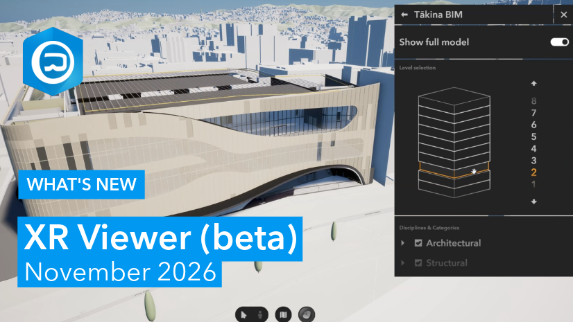
- Reviewing designs in context (AEC) — A project team reviews a BIM model of a proposed structure within its surrounding 3D context, using voice to navigate viewpoints and assess how the design relates to existing conditions on the ground.
- Operating remote sites (natural resources) — A mining team uses a 3D scene of a remote site to brief field crews and stakeholders who can’t travel there, walking the site in XR and discussing infrastructure, access, and safety without leaving the office.
Try it out today
The XR Viewer assistant (beta) is now available through the Early Access Community, a free program open to anyone with an ArcGIS account. Since it’s in beta and the assistant is still learning, not every command will land perfectly on the first try. We welcome you to share your feedback directly through the EAC and help us shape what comes next. To learn more about the other updates included in this release, see “What’s New in XR Viewer (beta) – November 2026“.
Not yet a member? Sign up today for access and instructions on how to download and install the XR Viewer desktop application.
Acknowledgments
Special thanks to Taisha Fabricius, Stefan Arisona, Hasret Guemguemcue, Damla Welti, and Jonas Shriqui — the team behind XR Viewer — and to Krystian Samp and Michael Siebenmann for their contributions to the AI capabilities powering the XR Viewer assistant.



Article Discussion: