Imagery has come a long way in Geographic Information Systems (GIS). It is no longer the special data type that sits off to the side, waiting for the imagery expert to translate it for everyone else. Today, imagery and remote sensing are part of everyday GIS work. It gives maps instant context, helps people see what is happening on the ground, and supports analysis that can reveal patterns, change, and risk at a scale that would be hard to understand any other way.
In ArcGIS, imagery works alongside vector data, surfaces, features, and other geographic information. That matters because as a user, you do not have to leave your familiar workflows just to bring imagery into the picture. You can add it to a map, compare it with other layers, analyze it, share it, and use it to support decisions without turning the entire workflow into a science project.
The first step is knowing where to get the imagery you need. Sometimes that means starting with ready-to-use imagery that is already available in ArcGIS. Sometimes it means using premium commercial imagery for a specific place, date, or level of detail. And sometimes it means bringing in imagery your organization already owns or receives from a provider. The good news is that ArcGIS supports all three paths, so you can start simple and get more specialized when the work calls for it.
Start with ArcGIS Living Atlas
ArcGIS Living Atlas is often the easiest place to begin when you’re looking for imagery. It is Esri’s collection of ready-to-use imagery and data layers, maps, and apps that are already prepared for use in ArcGIS.
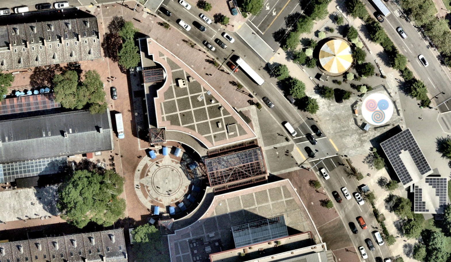
For many workflows, the World Imagery basemap, which is readily accessible from ArcGIS Living Atlas, is the go-to starting point. Built from satellite and aerial imagery from commercial and community-contributed sources, World Imagery provides quick visual context but can also support more advanced work, including AI workflows that use high-resolution imagery as an input. Living Atlas also includes imagery from major Earth observation programs, including Landsat, Sentinel missions, and aerial programs such as the National Agriculture Imagery Program (NAIP) in the United States. These sources make it easier to work with imagery for land cover, environmental monitoring, agriculture, disaster response, and other workflows where location and time matter.
Use Content Store for ArcGIS when you need premium imagery
Content Store for ArcGIS gives you a direct way to access premium commercial imagery from leading satellite, aerial, and drone imagery providers. Instead of searching across separate vendor sites, submitting one-off requests, or stitching together a long procurement process, you can discover and access premium imagery from one app experience that you access through ArcGIS Online.
That is especially helpful when the imagery needs to match a specific requirement. You can look for imagery by area, timeframe, resolution, and other project needs. In some cases, you can also request new imagery to be collected for a place of interest, including satellite tasking and, most recently, drone tasking.
Content Store for ArcGIS also helps simplify the practical side of getting imagery. Prepaid imagery credits or credit card payments can reduce separate purchasing steps, and once the imagery is acquired, users can either download it or host it as an imagery layer in ArcGIS Online. From there, it can be shared more easily with the right people across the organization.

Bring your own imagery, or work directly with providers
Of course, not every imagery workflow begins with ready-to-use content or an in-app purchase. Many organizations already have imagery archives, collect their own imagery through drone or field operations, or receive imagery directly from providers as part of a project.
That imagery can still be part of the ArcGIS experience. The main difference is that imagery collected and managed outside ArcGIS may need to be prepared, organized, and managed so it can be used effectively in maps, analysis, and shared workflows.
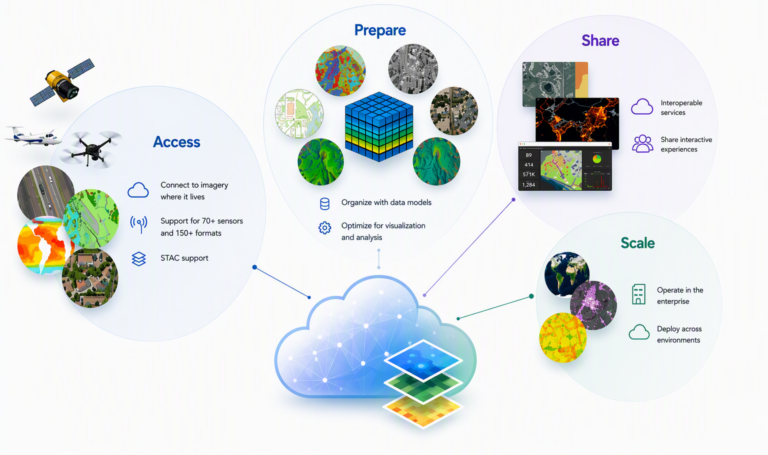
ArcGIS supports several ways to manage imagery depending on how an organization works. Users can upload imagery to ArcGIS Online for a fully managed SaaS experience. Organizations can also manage imagery in file servers, data stores, or cloud object storage with ArcGIS Enterprise or ArcGIS Image Dedicated. This flexibility helps teams align imagery management with their existing infrastructure, governance requirements, and technical capacity.

Wherever it comes from, manage your imagery so it is ready to use
Getting imagery into ArcGIS is only the beginning. To be useful, imagery needs to behave like GIS data, not a folder full of files.
ArcGIS includes comprehensive image management capabilities. It helps organize imagery with its spatial reference, time, sensor details, and processing rules intact. That means imagery can be indexed, searched, filtered, visualized, and analyzed as a dynamic source of geographic information. Large collections can become seamless imagery layers instead of a pile of individual scenes that someone has to manage one at a time.
This also matters when imagery lives in different places. Organizations may host imagery in ArcGIS, store it in public clouds, maintain it in enterprise systems, or connect to external imagery catalogs. Support for open standards such as the Spatio Temporal Asset Catalog (STAC) can help you discover and work with cloud-based imagery without unnecessary copying or duplication.
The payoff is simple: managed imagery is easier to find, easier to share, and easier to use consistently across mapping, analysis, and AI workflows.
Put your imagery to work with analysis and AI
Once imagery is accessible and managed, it becomes much more than a backdrop. It becomes a source of information that can help answer questions, monitor change, and reveal what is happening across a location or over time. Advances in image analysis and AI are making it easier to turn imagery into actionable information, helping organizations identify patterns, monitor change, and extract insights at scales that would be difficult to achieve manually
Different types of remotely sensed data bring different strengths. Optical imagery shows familiar visual context. Multispectral and hyperspectral imagery can reveal material properties that are not visible to the human eye. Synthetic Aperture Radar (SAR) data can capture information about surface structure, even in conditions where optical imagery may be limited. Light Detection and Ranging data (Lidar) provide elevation and three-dimensional detail. Together, these data types help users understand a place from more than one angle.
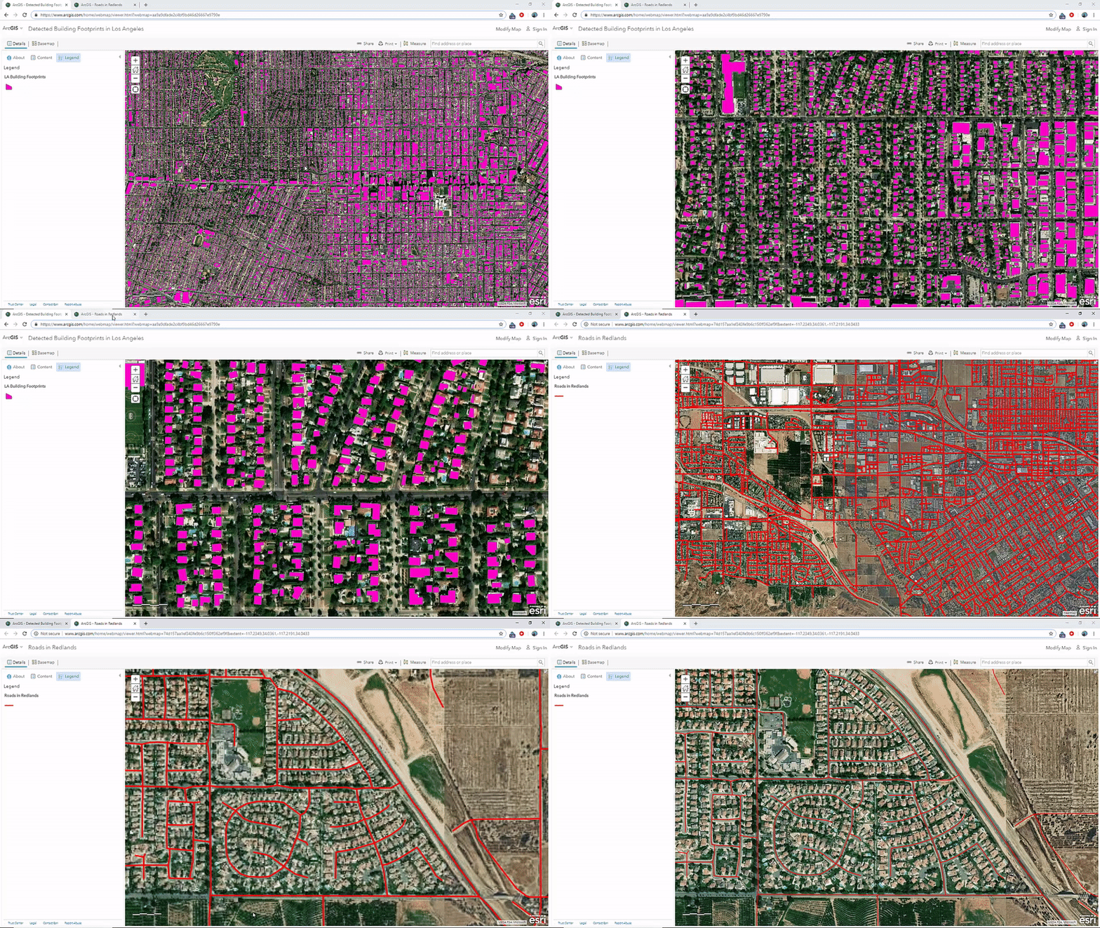
ArcGIS brings these data types into a consistent GIS experience, whether the goal is visualization, analysis, or AI-assisted information extraction. Models can be applied to imagery to identify patterns, classify features, detect change, and extract information across large areas and long time spans.

Imagery Becomes Action
Imagery plays a central role in any modern GIS. It adds context to maps, helps confirm what is happening on the ground, and serves as a critical data source for analysis and insights.
And, with ArcGIS, finding the right imagery has never been easier. Whether you’re starting with ArcGIS Living Atlas, accessing premium content through Content Store for ArcGIS, or bringing in imagery from your own providers and collections, ArcGIS gives you multiple ways to get the imagery you need.
Just as important, ArcGIS helps you move beyond simply acquiring imagery. By bringing imagery access, management, analysis, and AI together in the same GIS workflow, ArcGIS makes it easier to discover, organize, share, and use imagery across your organization.
Regardless of where your imagery comes from, ArcGIS helps you get it, manage it, and put it to work.
To read more about imagery in GIS, read Navigating the Imagery Landscape.

Article Discussion: