If you’ve ever heard someone say, “We created a digital twin because we generated a 3D mesh,” you’re not alone. It’s a common (and understandable) mix‑up. Reality mapping outputs—like True Orthos, point clouds, 3D textured meshes, or Gaussian splats—can look like a “twin” because they’re visually rich and spatially accurate.
But here’s the key distinction:
Reality mapping outputs are not digital twins. They are a visual data layer that can power a digital twin, often serving as the most credible foundation a twin can have.
Is reality mapping the same as a digital twin?
No. Reality mapping creates spatially accurate visual representations of the real world, typically as “snapshots” in time. A digital twin is a connected, evolving representation of assets, sites, and systems that can incorporate live data, relationships, rules, and analytics to support outcome driven decisions as part of a broader progression toward operational and predictive understanding.
Think of it this way:
- Reality mapping answers: “What does it look like, where is it, and how has it changed?”
- Digital twins answer: “What’s happening now, why, what could happen next, and what should we do?”
Reality mapping provides the visual truth that makes digital twins more understandable, verifiable, and actionable. It typically represents an early—but essential—stage in a digital twin journey, where organizations establish a reliable visual baseline before integrating systems, real‑time data, and analytics to support more advanced monitoring and decision‑making
What is a digital twin?
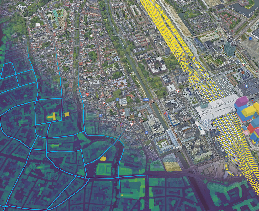
A digital twin is an integrated data-driven virtual representation of real-world entities and processes, with synchronized interaction at a specified frequency and fidelity.
- Digital twins are motivated by outcomes, driven by use cases, powered by integration, built on data, enhanced by physics, guided by domain knowledge, and implemented in dependable and trustworthy IT (Information Technology)/OT (Operational Technology)/ET (Engineering Technology) systems.
- Digital twin systems transform business by accelerating and automating holistic understanding, continuous improvement, decision-making, and interventions through effective action.
- Digital twin systems are built on integrated and synchronized IT/OT/ET systems, use real-time and historical data to represent the past and present, and simulate predicted futures
- Digital twin prototypes use data to model and simulate predicted futures before being integrated into IT/OT/ET Systems and before synchronization with the real-world entity or process
A digital twin is valuable because it becomes a decision environment: a place where teams can monitor, analyze, forecast, and coordinate.
In short: A digital twin isn’t just a static representation, it’s a dynamic representation, tightly coupled with the real word that helps people make better outcome-driven decisions over time. Digital twins connect disciplines, platforms, and people which requires a system of systems approach to design and implementation.
Learn more about Geospatial Digital Twins and how they help organizations quickly understand complex systems and make informed decisions.
What is reality mapping?
Reality mapping is the process of capturing and creating accurate digital representations of the real-world using remotely sensed data. Converting the real world into spatially accurate visual data that people can measure, compare, and use as up-to-date context.
Reality mapping typically involves:
- Collecting real-world observations (commonly imagery, video, or lidar)
- Processing and structuring those observations into spatial products
- Publishing outputs that can be viewed, measured, and analyzed in context
Common reality mapping outputs include:
- True Orthos (map-accurate imagery)
- Point clouds (dense 3D measurements)
- 3D meshes (photorealistic surface models)
- Digital surface/terrain models (elevation)
- Oriented imagery or geospatial video (location-aware visual context)
- Gaussian splats (highly realistic 3D visualization)
These outputs provide a powerful answer to “What is there?” and “What changed?” especially across large areas and complex sites.
Explore Esri’s reality mapping capabilities here.
Why do people confuse reality mapping outputs with digital twins?
Reality mapping outputs are highly visual, realistic, and easy to understand, making them immediately intuitive for a wide range of users. Because people naturally connect with what they can see, these outputs often feel complete on their own.
At the same time, digital twins combine many forms of information—such as system behavior, relationships, analytics, and predictions—that are less visible and more abstract. This can make reality mapping feel more tangible, while the broader capabilities of a digital twin are less obvious.
It’s also important to recognize that reality mapping outputs are observational snapshots in time, while digital twins are designed to evolve by integrating data and reflecting changing conditions.
As a result, reality mapping is often mistaken for the end state, when in reality it is a foundational step in a broader digital twin journey. This difference becomes clearer when you compare how each is typically used.
Reality mapping outputs are usually:
- Observational (captured from the real world)
- Descriptive (showing what exists and what changed)
- Time-based snapshots (even if captured often)
A digital twin, by contrast, is typically:
- Connected to ongoing updates (sensors, systems, schedules, inspections)
- Contextual (relationships, identity, lineage, metadata)
- Operational (monitoring, alerts, workflows, decisions)
- Often predictive or prescriptive (what-if scenarios, optimization)
Here’s a helpful analogy:
Reality mapping is like capturing the census count. A digital twin is the city it attempts to describe. The count captures what existed at a moment; the city keeps moving, decaying and rebuilding whether the count reflects it or not.
If reality mapping isn’t the twin, what role does it play?
Reality mapping provides the visual foundation that anchors a digital twin to a realistic representation of the real world.
That foundation matters because it:
- Builds trust. Stakeholders believe what they can see and verify.
- Reduces ambiguity. Visual context resolves misunderstandings faster than spreadsheets and diagrams.
- Improves alignment. Different teams can coordinate around a shared, measurable view of the world.
- Speeds decisions. With a credible visual reference, teams spend less time debating “what’s true” and more time acting.
In practice, reality mapping becomes a baseline layer you can reference alongside models, assets, telemetry, and analytics, providing a visual foundation that supports more advanced capabilities over time, from AI‑driven analysis and change detection to immersive experiences that help teams better understand and interact with real‑world context.
What value does reality mapping add to digital twins?

Reality mapping adds value in ways that go well beyond “better visuals.” Here are the most common contributions:
1) A measurable, real-world reference layer
Reality mapping outputs aren’t just pictures, they’re spatially grounded. In ArcGIS, reality mapping outputs retain their spatial fidelity across both 2D and 3D environments—allowing teams to confidently measure distances, areas, heights, and volumes from the same dataset without losing context.
2) Faster comprehension for broader audiences
Not everyone thinks in CAD layers, schematics, or dashboards. Reality mapping makes the environment instantly understandable to planners, operators, inspectors, executives, and the public.
3) Better change awareness and progress tracking
When you can compare visual baselines across time, it’s easier to answer:
- What changed?
- Where did it change?
- How much did it change?
- Does what we see match what was expected?
4) More context for analysis and alerts
Even when a twin is powered by sensors and analytics, reality mapping helps teams interpret results, especially when something looks “off” and you need visual confirmation. When combined with analytics and geospatial AI in ArcGIS, reality mapping provides essential visual context—helping teams interpret sensor readings, detect anomalies, and validate results against what’s actually happening on the ground.
5) More effective collaboration and handoffs
Reality mapping creates a shared reference that supports communication across roles—engineering, operations, GIS, safety, compliance, contractors, and leadership.
In this case study, read about how Massachusetts DOT Aeronautics Division created a centralized data hub of all their drone imagery to streamline workflows, accelerate decision-making, and empowers them to make informed decisions.
When does reality mapping become essential for digital twin initiatives?
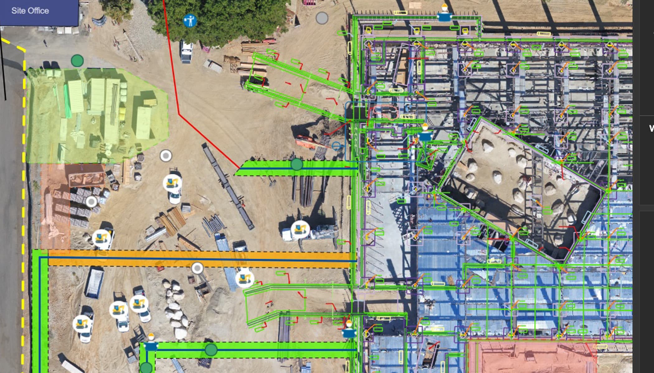
Reality mapping becomes a strategic advantage when:
- The environment is complex (dense infrastructure, multi-level structures, hard-to-document sites)
- Understanding relies heavily on abstract or disconnected data (such as CAD drawings, 2D maps, or analytic outputs), making it difficult for teams to interpret conditions without a clear visual reference grounded in reality
- Photorealistic context is critical to understanding other content
- The site changes frequently (construction, mining, disaster response, vegetation management)
- Teams are distributed (remote decision-making, multi-contractor coordination)
- Trust is critical (safety, compliance, public transparency, auditability)
In these cases, a purely model-driven approach can drift from reality over time—especially when updates are delayed or incomplete. Reality mapping helps maintain an “eyes on the ground” layer that remains verifiable.
How do reality mapping and digital twins work together in a mature strategy?
Digital twins don’t emerge fully formed—they evolve over time. Reality mapping typically represents an early and essential stage in that maturity curve, where organizations establish a spatially accurate, visual understanding of real‑world conditions. From there, additional data, systems, and analytics are layered in to support more advanced monitoring, analysis, and decision‑making.
A helpful way to think about it is as a layered stack:
- Reality mapping: visual, measurable baseline of the real world
- Assets & identity: what things are, where they are, and how they’re categorized
- Systems & telemetry: sensor feeds, operational systems, inspections, schedules
- Rules & analytics: thresholds, alerts, trend analysis, performance insights
- Decision workflows: actions, assignments, approvals, reporting, outcomes
Reality mapping strengthens the entire stack by grounding it in visual evidence and spatial context.
You don’t replace a digital twin with reality mapping. You increase the twin’s credibility and usability by adding reality mapping.
Platforms like ArcGIS are purpose‑built to support this layered approach—bringing together reality mapping outputs, asset data, sensor feeds, analytics, and workflows within a common geospatial system. This integration is what allows digital twins to evolve over time, rather than remain static models.
Watch this short video on how engineering firm Portcoast helped the government of Vietnam by building a complete Geospatial Digital Twin of their busiest shipping port.
What should organizations consider to avoid digital twin false starts?
Digital twin initiatives don’t typically fail because of technology—they stall when expectations, outcomes, and implementation approaches are misaligned. The most common risk is expecting a single dataset—often a visually impressive 3D model—to deliver immediate return on investment.
In practice, successful digital twins are built by starting with the problem and working backward—aligning data, systems, and capabilities to the outcomes the organization is trying to achieve.
Here are practical principles to reduce risk and maximize value:
1) Don’t confuse a deliverable with a capability
A mesh, point cloud, or True Ortho is a powerful deliverable. A digital twin, however, is an evolving capability—built over time by connecting visual data, systems, analytics, and workflows to support ongoing outcomes.
2) Start with the outcomes you need to achieve
Work backwards from questions like:
- What decisions will we make faster or better?
- What risks do we need to reduce?
- What operations do we need to optimize?
Then determine what data layers—including reality mapping—are required. Organizations that start with technology rather than outcomes often introduce unnecessary complexity and risk, delaying time to value.
3) Treat the visual foundation as a living asset
A baseline is most valuable when it’s maintained. Establish refresh approaches (cadence, triggers, and governance) so the foundation remains relevant as conditions change. As digital twins mature, this visual foundation becomes even more critical, ensuring analytics, AI, and system insights are grounded in current, real‑world conditions.
4) Make “trust” a first-class requirement
If stakeholders don’t trust the twin, they won’t use it. Reality mapping is one of the most effective tools for building and maintaining that trust. Visual verification plays a key role in reducing uncertainty, especially as digital twins incorporate more complex data, automation, and predictive capabilities.
5) Use structured design approaches to reduce risk and accelerate value
Successful digital twin initiatives rarely start with technology, they start with a clearly defined problem and a path to measurable outcomes. Structured approaches, such as problem‑first design frameworks, help organizations validate priorities, align stakeholders, and map the data, capabilities, and workflows needed to achieve those outcomes.
In practice, many organizations leverage structured engagements—such as digital twin workshops and innovation sprints offered through Esri Professional Services—to accelerate this process, align stakeholders, and rapidly demonstrate value before scaling. These approaches reduce the risk of false starts and help ensure that digital twin investments deliver meaningful, sustained impact.
Ultimately, the most successful digital twin initiatives follow a structured design approach—starting with clearly defined problems, aligning to measurable outcomes, and iteratively building the data, analysis, and workflows needed to support them. This reduces risk while ensuring the twin delivers meaningful, sustained value over time.
Final Takeaway: Reality mapping provides a trusted visual representation of reality – Digital Twins dynamically model reality to drive outcomes
If you remember only one idea, make it this:
Reality mapping provides visual truth. Digital twins deliver drive outcomes.
Reality mapping isn’t the digital twin, but it is often what makes the twin usable at scale, across teams, and over time. When you position reality mapping as the visual foundation, you set clearer expectations and build a stronger path from data to decisions.


Article Discussion: