Turning 2D and 3D representations of the real world into action with ArcGIS
If you’ve recently completed a reality mapping project—processing imagery into True Orthos, point clouds, 3D meshes, or Gaussian splats—you’ve likely reached a familiar moment:
The outputs look impressive. They’re detailed, accurate, and easy to explore.
And then the question comes next: “What else can I do with them?”
This is where many teams pause, sometimes treating reality mapping outputs as a finished product rather than the starting point for something much more valuable. In reality, these outputs are not just visualizations. They are high‑value data assets designed to support analysis, collaboration, and decision‑making. This article explores how to move from visual output to real‑world impact.
What is reality mapping?
Reality mapping is the process of capturing imagery and sensor data from drones, crewed aircraft and satellites, and transforming it into accurate digital representations of the real-world. In ArcGIS, these representations become actionable data. Users can explore real-world conditions, measure features, monitor change over time, and integrate this information with other GIS data to support planning and decision-making. Reality mapping enables organizations to move beyond static imagery and instead work with spatially accurate context that reflects what exists on the ground.
Reality mapping typically involves:
- Capturing data from drones, crewed aircraft, and satellites in the form of imagery, video, or lidar
- Processing those observations into spatial products
- Publishing outputs that can be viewed, measured, and analyzed in context
Common reality mapping outputs include:
- True Ortho: A geometrically corrected image that is accurately aligned to a map, ideal for accurate 2D measurements and mapping features
- Point cloud: A dense collection of 3D points representing the shape of surfaces, used for precise elevation, height, and volumetric analysis
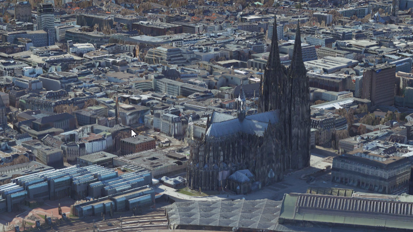
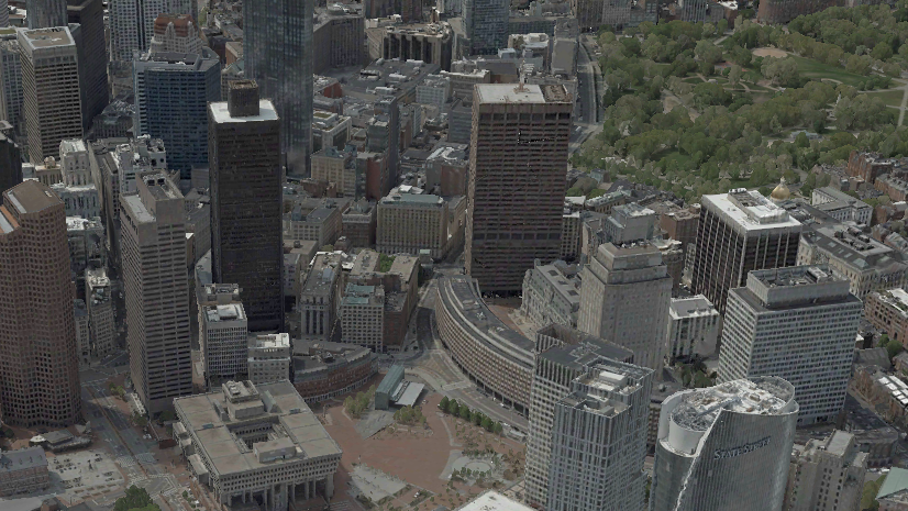
- 3D mesh: A photorealistic 3D model that represents terrain and structures and provides realistic context for visualization, planning, and simulations
- Digital elevation models: a 2D raster showing surface or terrain (bare earth) elevation
- Oriented imagery: Georeferenced imagery that can be explored from its original camera perspective, useful for inspections and visual verification
- Geospatial video: Video that is synchronized with location and orientation data, allowing each frame to be viewed and analyzed in geographic context
- Gaussian splats: Highly detailed 3D visualizations optimized for performance, ideal for immersive exploration and communicating real-world context
Together, these outputs help answer two fundamental questions: what is there, and how has it changed.
Each of these outputs serves a different purpose. Understanding what you can do next starts with knowing which output is best suited for the type of question you’re trying to answer—whether that’s measuring conditions, visualizing context, detecting change, or extracting features.
To learn more, explore Esri’s reality mapping capabilities.
Are reality mapping outputs just for visualization?
No. While they are visually compelling, reality mapping outputs are designed to be used alongside other GIS data. In ArcGIS, they can be layered with assets, infrastructure data, inspection records, and plans, providing the context needed to analyze conditions and make informed decisions. They may look like real-world scenes, but they function as measurable, spatial datasets that support analysis in both 2D and 3D.
What exactly do I have after reality mapping is complete?
When processing is complete, you don’t just have a visual representation, you have reality mapping outputs: spatial datasets that represent real-world conditions.
These outputs are:
- Georeferenced, tied to real-world coordinates, so they align with other GIS data
- Measurable, support measurement of distances, areas, volumes, and elevation
- Scalable, from individual sites to large geographic regions
- Repeatable, can be captured repeatedly to compare conditions over time
In ArcGIS, these outputs can be published and shared through ArcGIS Online or ArcGIS Enterprise. Once published, they become accessible across teams, applications, and workflows.
They serve as a:
- Baseline for existing conditions
- Reference layer for decision‑making
- Source of truth for what exists in the physical world
Most importantly, they are designed to be used—not archived.
What kind of answers can I gain from reality mapping outputs?
1. Measure and quantify what’s on the ground
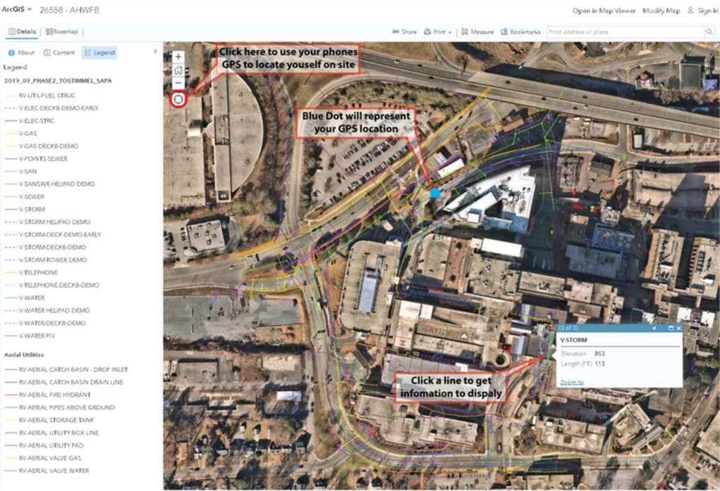
ArcGIS users can measure real-world conditions directly from reality mapping outputs—but the type of measurement depends on the output being used. For example, true orthos are ideal for accurate distance and area measurements in 2D, while point clouds and 3D meshes enable height, elevation, and volume calculations.
These outputs allow teams to measure:
- Distance and area from True Orthos
- Elevation and height from point clouds, surface models, and 3D meshes
- Volume and material quantities from point clouds and digital surface models
- Surface conditions and features from True Orthos and high-resolution imagery, with 3D meshes and Gaussian splats providing additional visual context
In ArcGIS, these measurements can be performed in both 2D maps and 3D scenes, ensuring consistent analysis across perspectives.
As shown in this case study, organizations like Brasfield & Gorrie use reality mapping to improve site operations by enabling accurate measurements and progress tracking directly from visual data, reducing reliance on manual processes.
2. Monitoring change over time
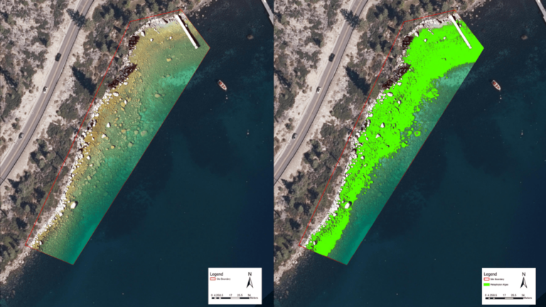
By comparing outputs captured at different points in time, teams can detect change, but some outputs are better suited for this than others. True Orthos and digital surface models are especially effective for comparing conditions over time, while 3D meshes provide a more immersive way to visualize how environments evolve.
These outputs allow teams to:
- Detect physical changes across a site or region using True Orthos and digital surface models
- Monitor progress against plans or schedules using True Orthos and 3D meshes
- Identify deviations or unexpected conditions using True Orthos, 3D meshes, or Gaussian splats
- Document before-and-after states using repeatable outputs such as True Orthos, 3D meshes, digital elevation models, and Gaussian splats
ArcGIS supports this through imagery time series and change detection workflows, which help teams systematically compare conditions and highlight areas of change.
This transforms questions like “What changed?” from a subjective discussion into a clear, visual, and measurable answer.
For example as shown in this article, The Tahoe Environmental Research Center, use drone-based reality mapping to visually detect and quantify change of algae blooms in Lake Tahoe over time, enabling faster response and better decision-making.
3. Understand the impact of development
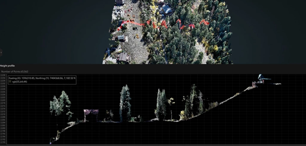
Beyond measurement and monitoring change, reality mapping enables spatial analysis such as visibility, slope, and spatial relationships. Outputs like 3D meshes and terrain models are particularly valuable here, as they provide realistic context for understanding how development interacts with the surrounding environment.
These outputs make it possible to:
- Analyze visibility and line-of-sight using 3D meshes and digital terrain models
- Evaluate slope and terrain relationships using digital elevation models
- Understand proximity and spatial relationships between features by combining reality mapping outputs with other GIS layers
- Assess how development interacts with the surrounding environment using 3D meshes or Gaussian splats for realistic context
ArcGIS spatial analysis tools make it possible to combine reality mapping outputs with other geospatial layers to generate deeper insight into terrain, infrastructure, and planning scenarios.
Local governments, like Greater Salt Lake Municipal Services District, have used drone and GIS workflows to enhance planning decisions, helping teams better understand development impacts and infrastructure relationships.
4. Detect, classify or extract objects
Reality mapping outputs are especially effective inputs for geospatial AI because they provide high-resolution, spatially accurate representations of real-world conditions. This level of detail allows AI models to reliably detect objects, identify patterns, and extract features across large areas. High-resolution outputs like True Orthos and point clouds are commonly used as inputs for AI workflows, where they support reliable object detection and feature extraction across large areas.
Using capabilities such as deep learning, object detection, and automated change detection, teams can:
- Identify and extract features at scale using True Orthos and point clouds
- Detect patterns across large areas using 3D meshes, True Orthos, and point clouds combined with AI workflows
- Automate time-based comparisons using True Orthos and digital surface models
- Improve consistency and reduce manual interpretation using AI applied to imagery and 3D data
Traditionally, many of these tasks required manual inspection—either in the field or by reviewing imagery one image at a time. Reality mapping changes this by making analysis scalable and repeatable.
The result is faster insight, more consistent interpretation, and the ability to focus human attention where it matters most.
How do these outputs improve communication and collaboration?
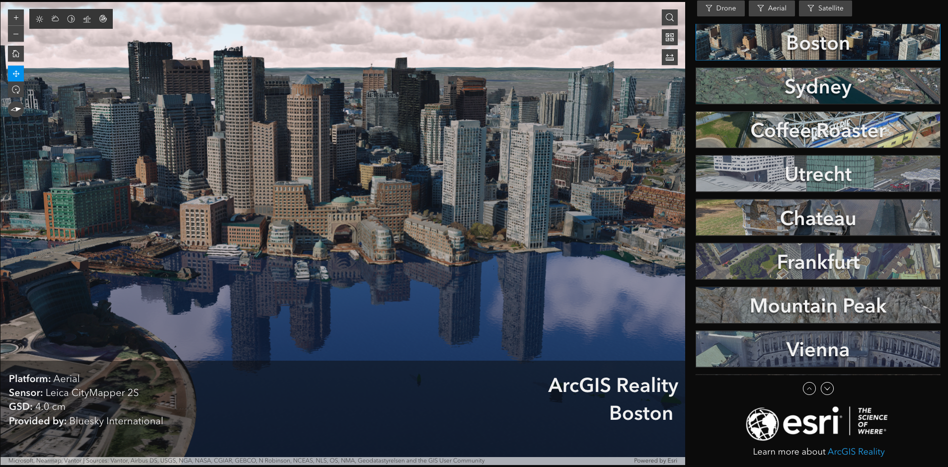
Reality mapping outputs create a shared visual reference that improves communication across teams. For communication and stakeholder engagement, 3D meshes and Gaussian splats offer highly realistic visualizations that make it easier for non-technical audiences to understand real-world conditions.
They help:
- Align technical and non‑technical stakeholders
- Bridge gaps between field and office teams
- Reduce misinterpretation of plans or reports
In ArcGIS, these outputs can be shared through web scenes, apps, and experiences, making it easy to distribute and explore content across organizations.
Interactive 3D experiences—such as those created in ArcGIS Experience Builder or web-based scene viewers—allow stakeholders to engage with data in a more intuitive way. Instead of relying on drawings or spreadsheets, teams can interact with a common representation of reality.
How do reality mapping outputs combine with other data?
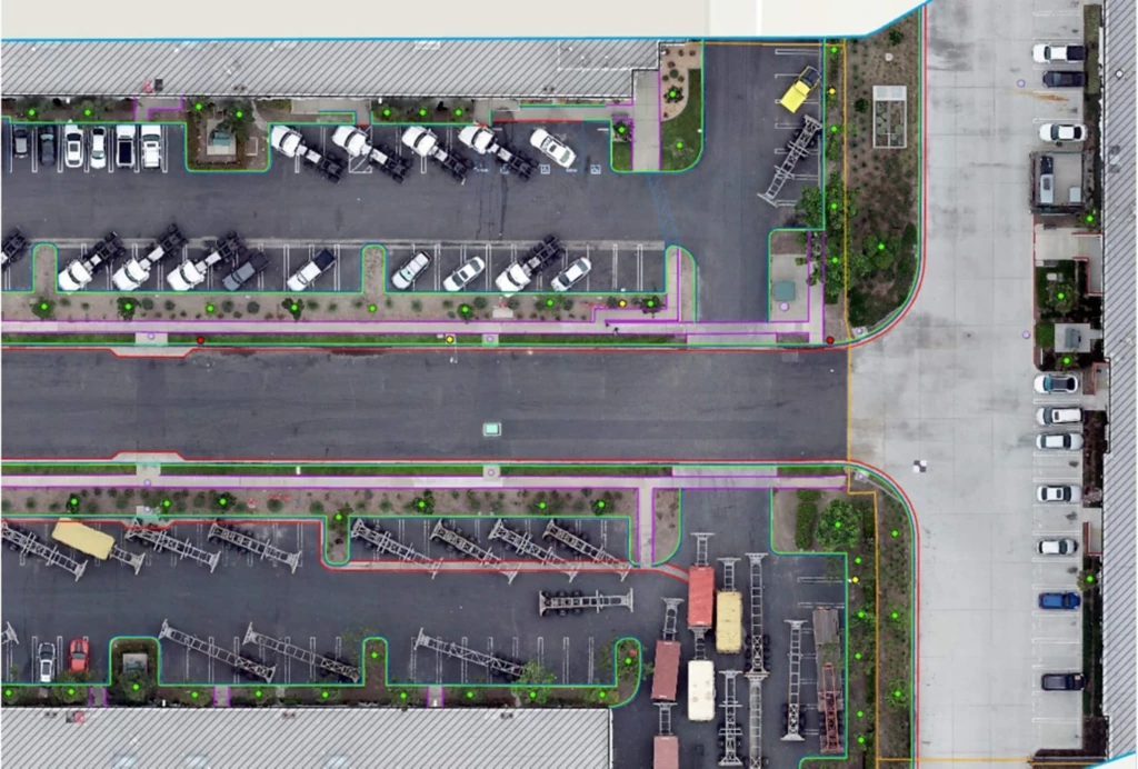
Reality mapping outputs become significantly more powerful when used alongside other data.
They can be combined with:
- Asset inventories (via ArcGIS feature layers)
- Inspection records
- Schedules and plans
- Operational or sensor data
Within ArcGIS, this integration happens naturally by layering data into a shared geospatial context—making it easier to see relationships between systems and the real world.
This adds meaning to otherwise abstract data:
- A maintenance issue becomes clearer when seen in context
- A sensor alert becomes actionable when tied to location
Organizations using GIS and drone workflows, such as environmental engineering firm Dudek, often bring these datasets together to create a more complete understanding of their environment.
From visual deliverable to decision asset
Reality mapping outputs are most valuable when they move from:
Something you look at
to
Something you use to decide
With ArcGIS, these outputs become part of a broader geospatial system—where they can be analyzed, shared, and integrated into workflows that support real-world outcomes.
They are not the finish line. They are the foundation for better, faster, and more confident decisions.

Article Discussion: