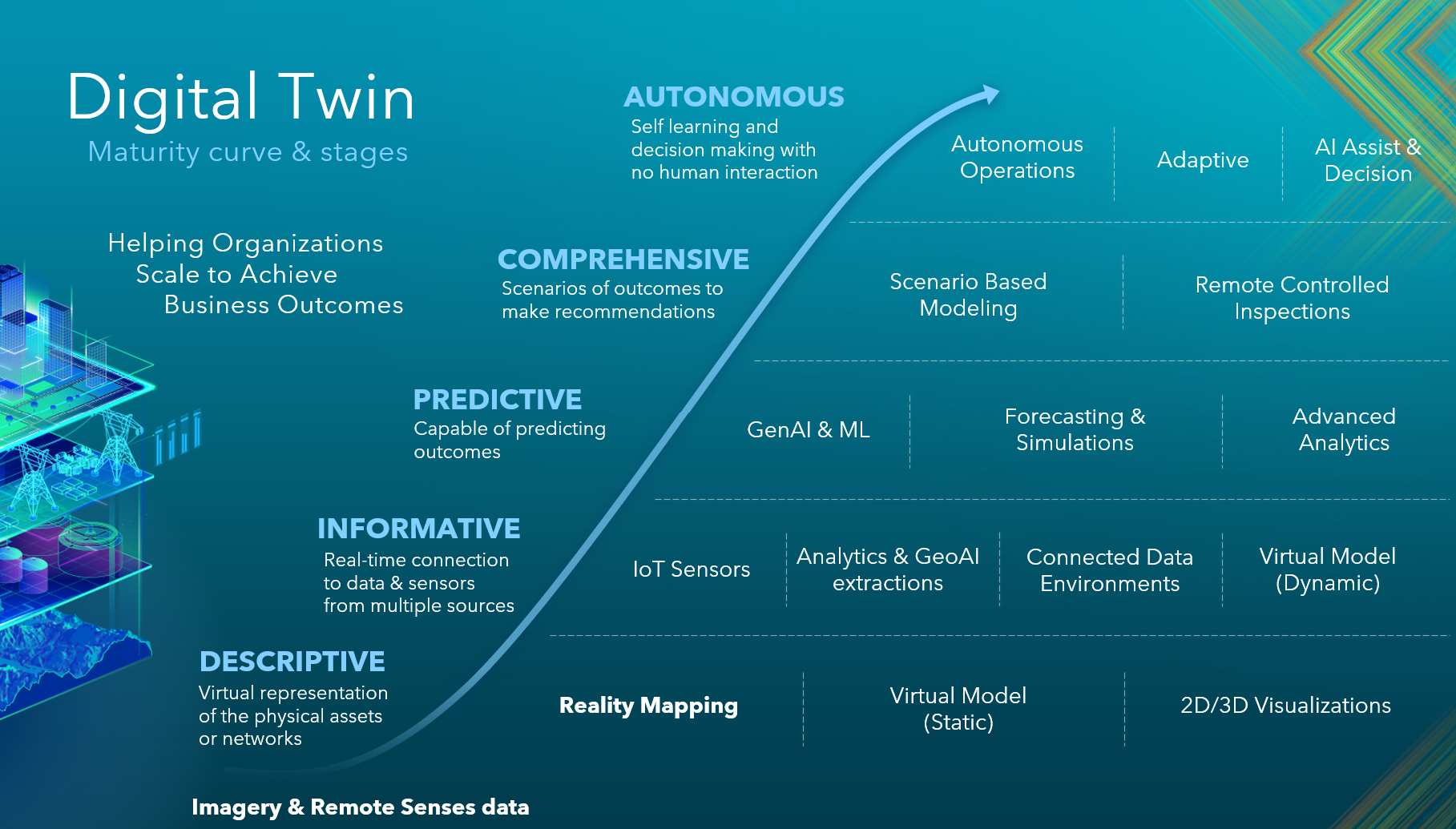
Cities across the world are embracing Digital Twin technology to improve planning, infrastructure management, and sustainability. Building a Digital Twin at city scale requires accurate, up-to-date geospatial data. Traditionally, this meant commissioning costly aerial surveys or relying on satellite imagery for broad coverage. These methods remain important, but organisations now have a more accessible option: large-area drone capture.
Drones offer flexibility and affordability, making them ideal for projects where rapid deployment and detailed coverage are essential. They complement aerial and satellite imagery rather than replace them, providing a practical way to capture high-resolution data for urban environments.
Why Large-Area Drone Capture Matters
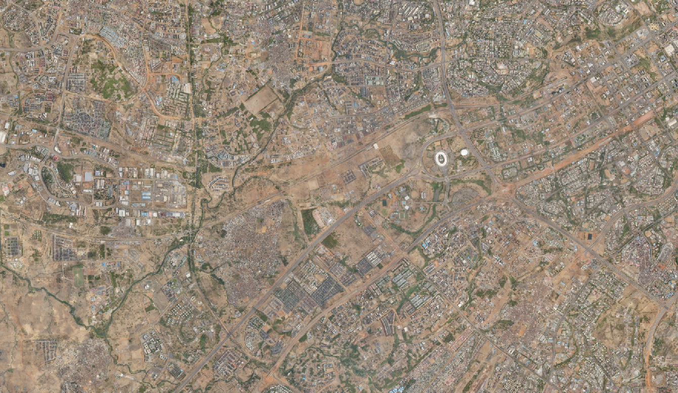
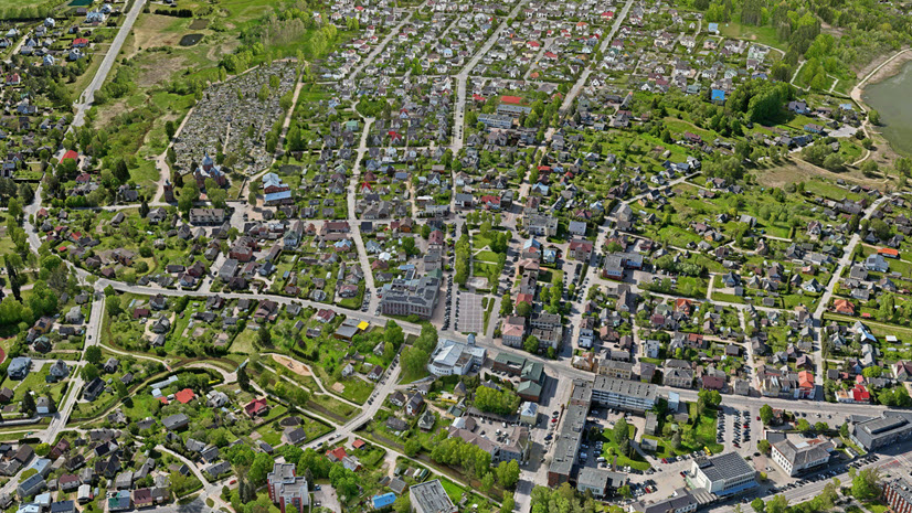
Urban areas are complex and constantly changing. Roads are upgraded, new buildings rise, and green spaces evolve. To manage this complexity, planners and decision-makers need a complete and current representation of reality. Large-area drone capture delivers the detail required for accurate 3D modelling, forming the foundation of a Digital Twin that supports smarter decisions.
The advantage lies in accessibility. Drones can be deployed quickly, often without the logistical hurdles of traditional aerial surveys. This makes them particularly valuable for cities in the Middle East, Africa and Europe, where infrastructure projects and climate adaptation initiatives demand timely, high-quality data.
From Data to Digital Twin
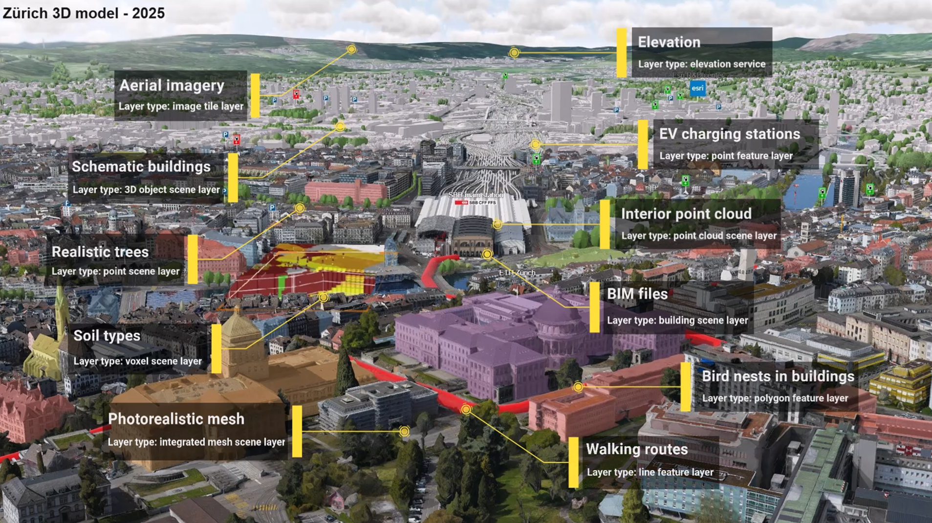
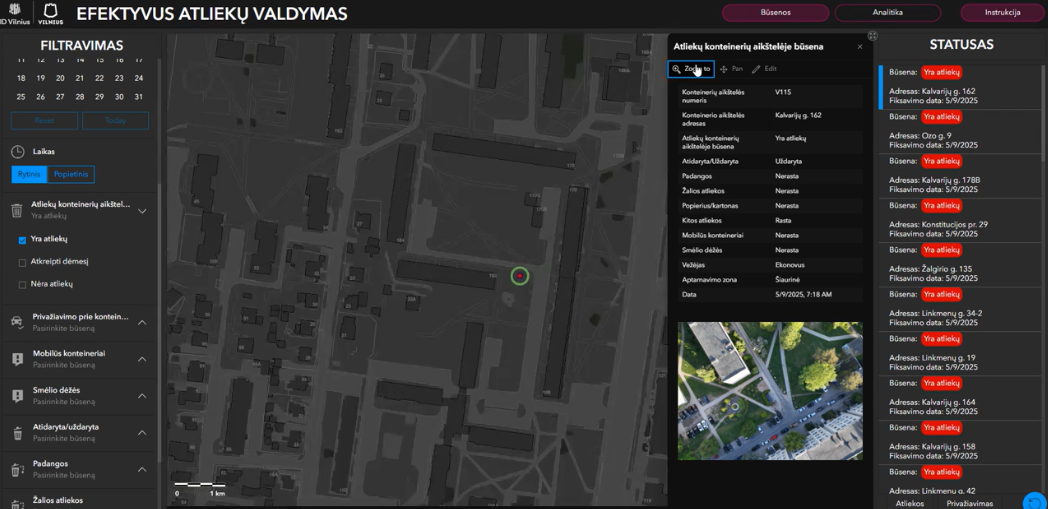
Capturing imagery is only the first step. The real transformation happens when this data becomes part of an enterprise system. With the Esri’s Reality Mapping solutions drone imagery is processed into True Orthos, Digital Surface Models, and photorealistic 3D meshes. Advanced outputs like Gaussian Splats add fine-grained detail and enable smooth streaming of complex scenes.
These layers are then published to ArcGIS Enterprise or ArcGIS online, where they integrate with IoT sensor feeds, BIM models, GIS datasets and much more. This creates a connected environment where reality data powers dashboards, analytics, and immersive 3D experiences.
Operational Twins with ArcGIS Indoors
Digital Twins are not limited to city-scale projects and can deliver immense value at the building and campus level. With ArcGIS Indoors, organisations can create an operational twin of their facilities that combines floor plans, asset locations, and real-time sensor data into an interactive map.
This capability transforms maintenance planning by allowing teams to visualise and manage assets such as HVAC systems, lighting, and security equipment within a spatial context. It also improves space management, enabling organisations to track occupancy, optimise layouts, and plan renovations with confidence using accurate indoor maps.
In critical situations, emergency responders benefit from precise indoor navigation and asset information, improving response times and safety. By extending the Digital Twin concept indoors, organisations gain a holistic view of their operations from the city streets to the corridors of their buildings.
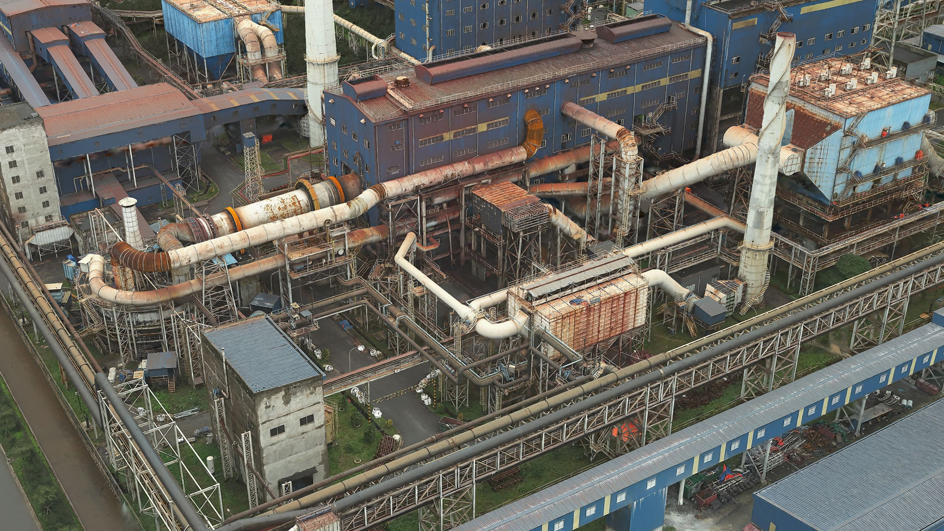
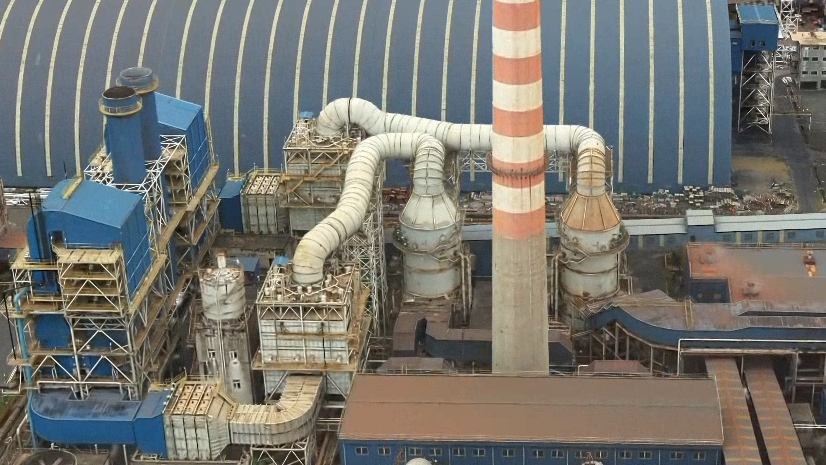
Utilities and Infrastructure Management
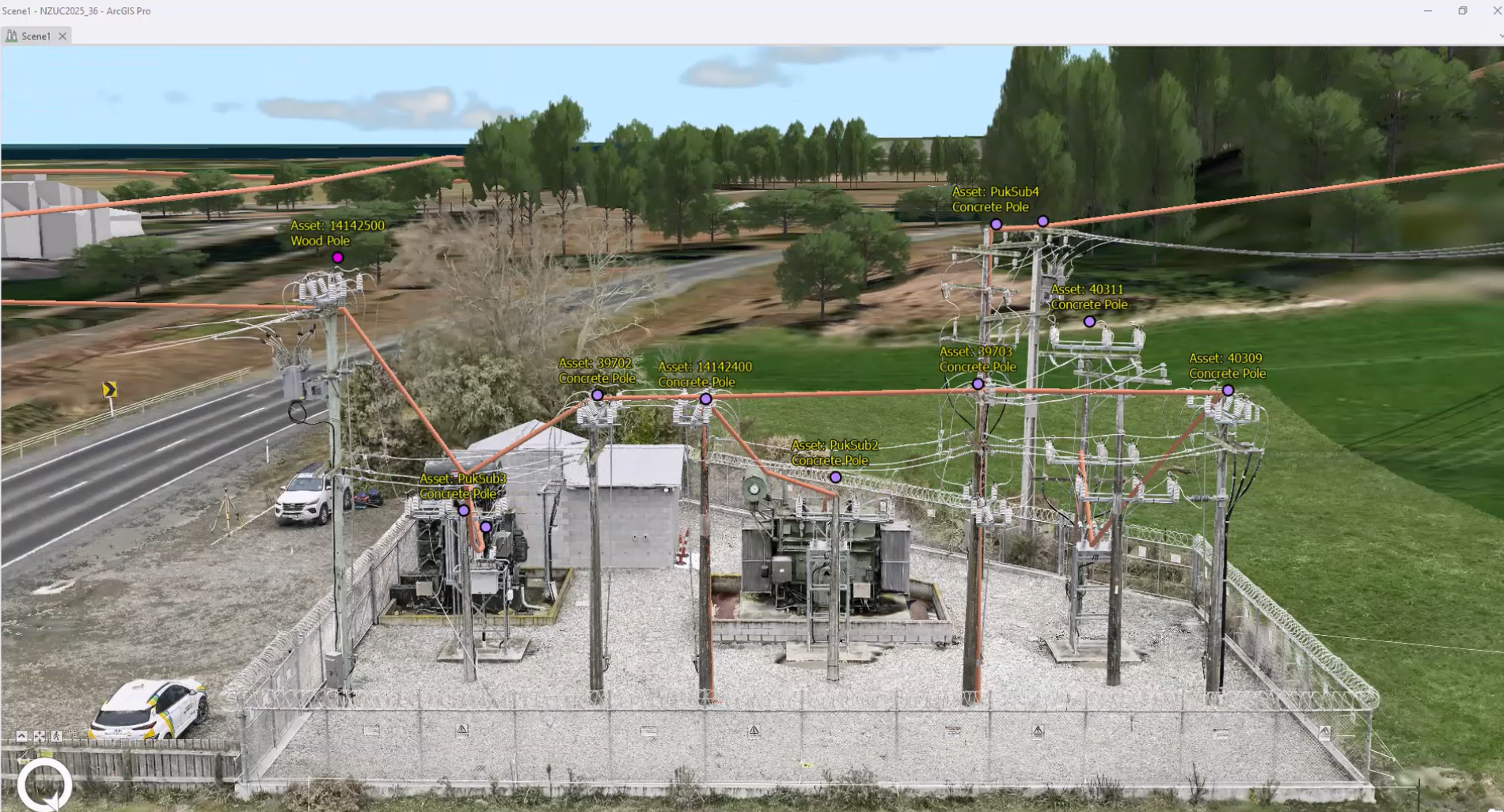
Digital Twins also play a vital role in managing utilities and critical infrastructure. Utility providers can use drone-derived 3D models and lidar to inspect power lines, pipelines, and water networks across large areas without the need for costly field surveys. These models enable proactive maintenance by identifying vegetation encroachment, structural issues (where visible from the sky), or potential hazards before they become critical.
When integrated with ArcGIS Enterprise, inspection data can be linked to asset management systems, creating a seamless workflow for scheduling repairs and prioritising investments. Combined with real-time sensor feeds, utilities gain a powerful operational view that supports resilience, reduces downtime, and improves safety for both workers and the public.
The Esri Advantage
Esri’s ecosystem ensures that large-area drone capture is not just a data collection exercise but a strategic capability that connects every part of the workflow. ArcGIS Enterprise provides governance, scalability, and secure sharing, which together form the backbone of an integrated system.
Solutions like Scene Viewer and Experience Builder make 3D data accessible through intuitive web applications, while GeoAI brings automation to feature extraction and predictive modelling. Oriented Imagery adds context for inspection and validation, and ArcGIS Indoors extends the Digital Twin concept inside buildings for operational efficiency.
Dashboards tie everything together by delivering real-time operational views linked to the Digital Twin. Together, these tools transform raw imagery into actionable intelligence, enabling cities and organisations to plan, monitor, and adapt with confidence.
Conclusion
Large-area drone capture is transforming how cities build Digital Twins. While aerial and satellite imagery remain essential, drones provide a practical and accessible way to collect high-resolution data. Combined with Esri’s enterprise platform this data becomes a living asset that powers smarter decisions for urban planning, infrastructure maintenance, and campus management.

Article Discussion: