For civil engineers, the foundation of a successful project lies in understanding the site’s existing conditions from the outset. With project timelines growing ever tighter and regulatory requirements more demanding, access to accurate, up-to-date geographic information system (GIS) data can make the difference between a smooth approval process and costly delays.
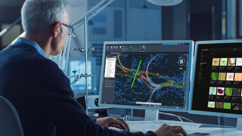
By integrating ArcGIS Living Atlas with Autodesk Civil 3D, engineers have self-serve access to geospatial data to enrich their designs with real-world context. With a deeper understanding of existing conditions and environmental constraints early on, teams can reduce risk and streamline permitting.
Tap into the world’s foremost collection of GIS content
ArcGIS Living Atlas is a continually evolving collection of global geographic information curated by Esri and its partners. It offers a wealth of authoritative data that can be added to Civil 3D designs, including imagery, basemaps, boundaries, transportation, earth observations, landscape, urban systems, demographics, and more. This content is updated regularly and can be combined with your own project data to create GIS-informed designs, perform analysis, and improve decision-making.
While many layers are currently US-centric, the workflow and integration apply to civil engineering projects worldwide, with regional Esri distributors steadily expanding international content in ArcGIS Living Atlas to support locally relevant CAD and GIS-driven design outcomes.

Enable CAD and GIS integration in Civil 3D
Beyond Esri maps (or basemaps) available natively in Civil 3D 2025 and later, the true power of GIS integration is unlocked using ArcGIS for AutoCAD. This no-cost Esri plug‑in bridges Civil 3D with authoritative GIS content, including ArcGIS Living Atlas. It enables civil designers and engineers to bring real-world conditions into existing CAD workflows and collaborate with GIS teams without leaving the familiar Civil 3D design environment.
From there, ArcGIS for AutoCAD helps engineers to layer in parcels, floodplains, wetlands, soils, transportation networks, building footprints, and more to provide critical context to spatially inform design decisions from plan to delivery. Because this data aligns automatically with Civil 3D coordinate systems, teams gain accurate, location-aware insights for supporting more sustainable, resilient land development projects without added data preparation.
Curated, ready-to-use AEC content
ArcGIS for AutoCAD includes a curated set of ArcGIS Living Atlas layers selected specifically for architecture, engineering, and construction (AEC) workflows. Rather than searching the full Living Atlas catalog, civil designers and engineers can browse a focused collection of layers most relevant to land development, infrastructure, and site planning. This curation reduces discovery time and ensures the content has been vetted for use during planning and design.
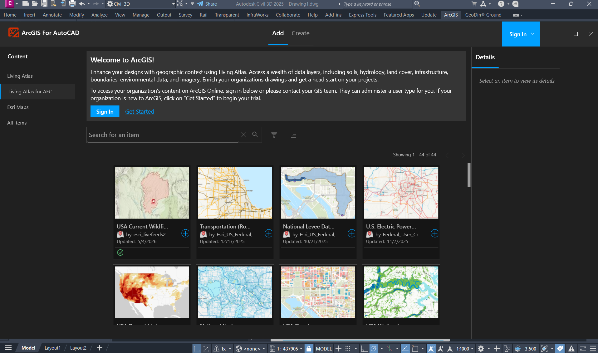
Add GIS data to a land development project in Civil 3D
To illustrate the practical role of GIS in civil design, let’s look at a typical land development project in Civil 3D. The following use cases demonstrate how ArcGIS Living Atlas layers provide reliable, early-stage context that supports sound engineering decisions before surveys and detailed design begin.
Establish existing conditions with aerial imagery
Before committing to alignments, grading, or layouts, civil engineers need confidence in what exists on the ground. Using Esri aerial imagery built into Civil 3D 2025 and later, engineers can gain an up-to-date view of terrain, vegetation, and existing development to validate assumptions and identify constraints.
Because the high-resolution imagery is maintained and updated regularly, it provides a consistent, reliable reference for feasibility studies and site layout. This helps engineers spot potential access issues, conflicts, or environmental considerations early, when changes are far less costly.

Validate property boundaries with parcel data
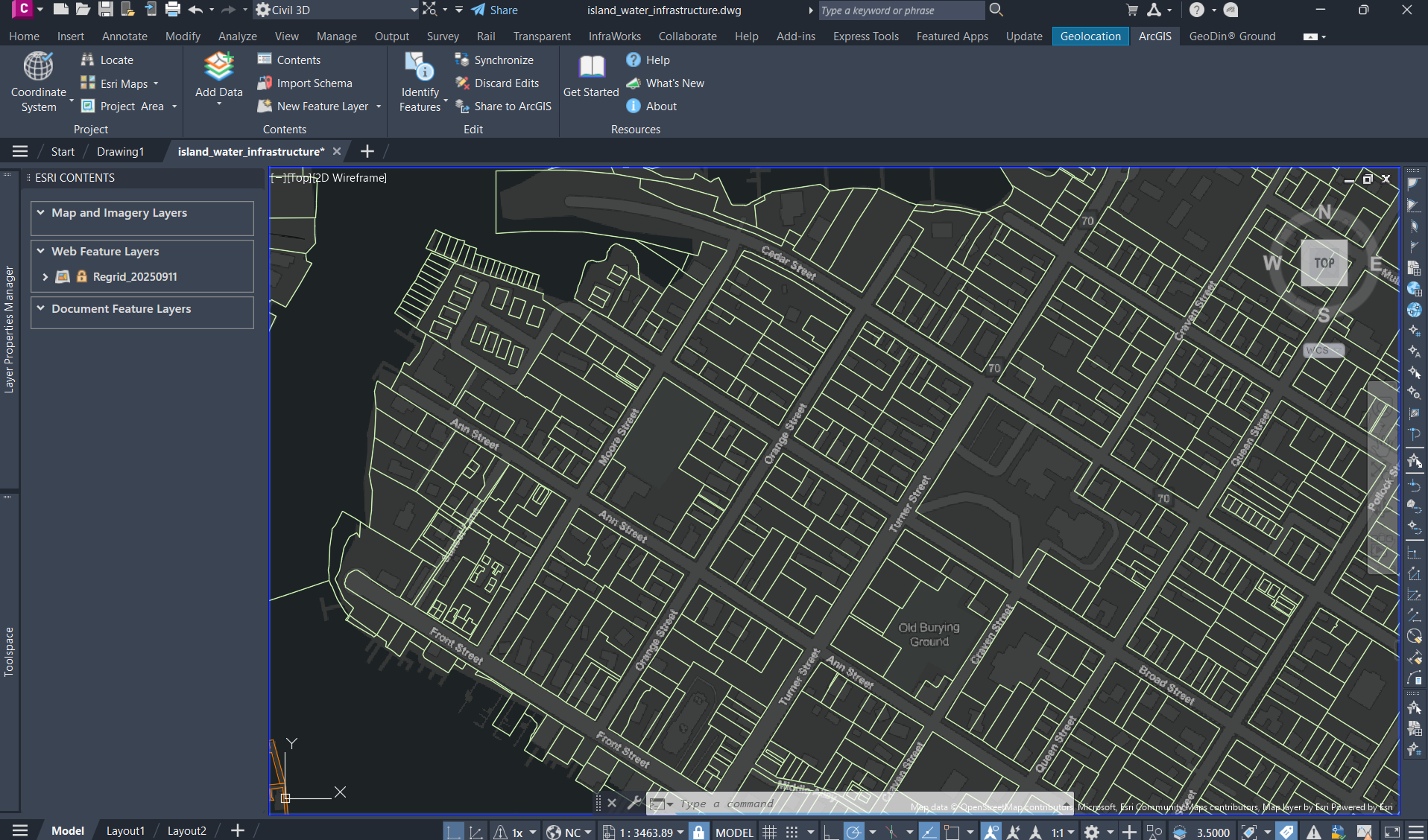
Early design decisions depend on knowing where legal boundaries begin and end. Adding authoritative parcel data into Civil 3D enables engineers to quickly validate property extents, assess ownership constraints, and support site layout decisions before detailed survey data is finalized. This early visibility helps align design assumptions with zoning and permitting requirements and reduces the risk of boundary-related issues later in the project.
Using ArcGIS for AutoCAD, engineers can bring parcel data into Civil 3D from ArcGIS Living Atlas, an organization’s ArcGIS content, or premium data providers like ReGrid and ReportAll.
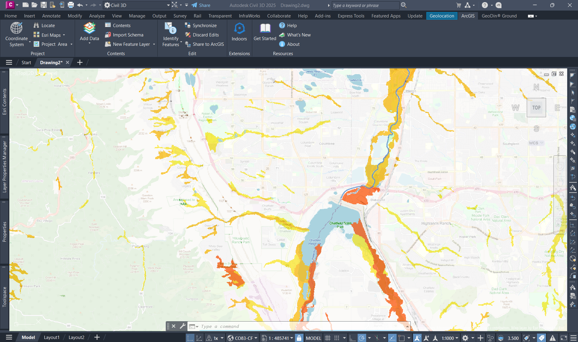
Identify flood risk early with floodplain data
Understanding where flood risk exists is essential to responsible site planning. Adding floodplain data from ArcGIS Living Atlas provides a reliable, planning‑level view of flood‑prone areas that can be used to test assumptions and guide grading, drainage, and layout decisions in Civil 3D.
Incorporating this information early helps engineers address regulatory expectations proactively and avoid costly surprises related to compliance, insurance, or constructability later in the project.
Identify environmental constraints early with wetlands data
Wetlands are a common source of permitting risk and schedule uncertainty if identified too late. By referencing authoritative wetlands data from ArcGIS Living Atlas in Civil 3D, engineers can flag protected areas and evaluate potential buffer requirements early, when site layout and grading alternatives are still flexible.
This early screening helps inform feasibility, supports coordination with environmental specialists, and reduces the likelihood of redesigns or permit delays once formal delineations are underway.
Evaluate constructability factors early with soil data
Before committing to grading plans or foundation strategies, engineers benefit from an early understanding of subsurface conditions. Adding soil data from ArcGIS Living Atlas provides a reliable, location‑aware reference that supports initial constructability assessments and highlights areas that may require closer geotechnical review.
This early insight allows teams to plan more deliberately, anticipate challenges, and avoid surprises during construction, while still relying on formal geotechnical investigations for final design decisions.
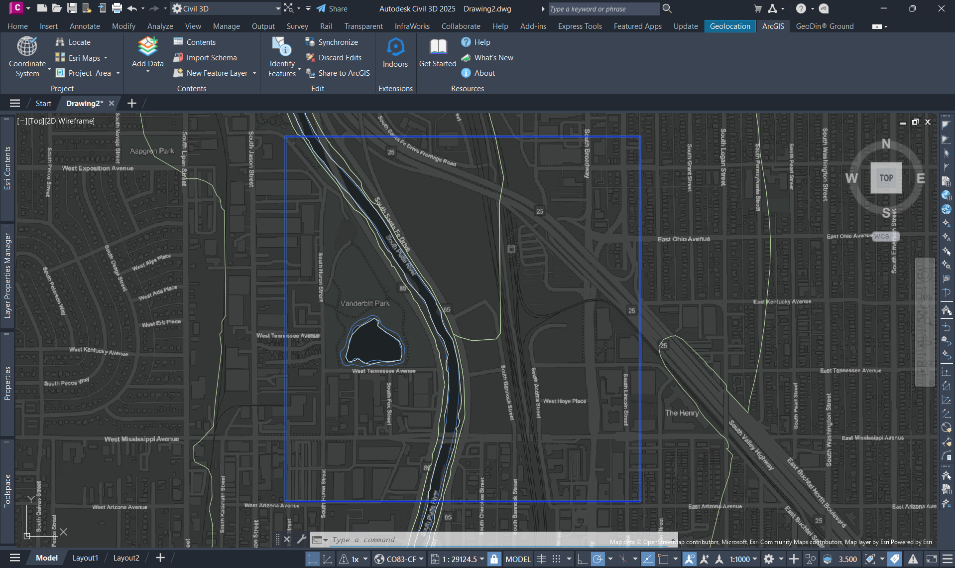
Plan site access and connectivity with transportation data
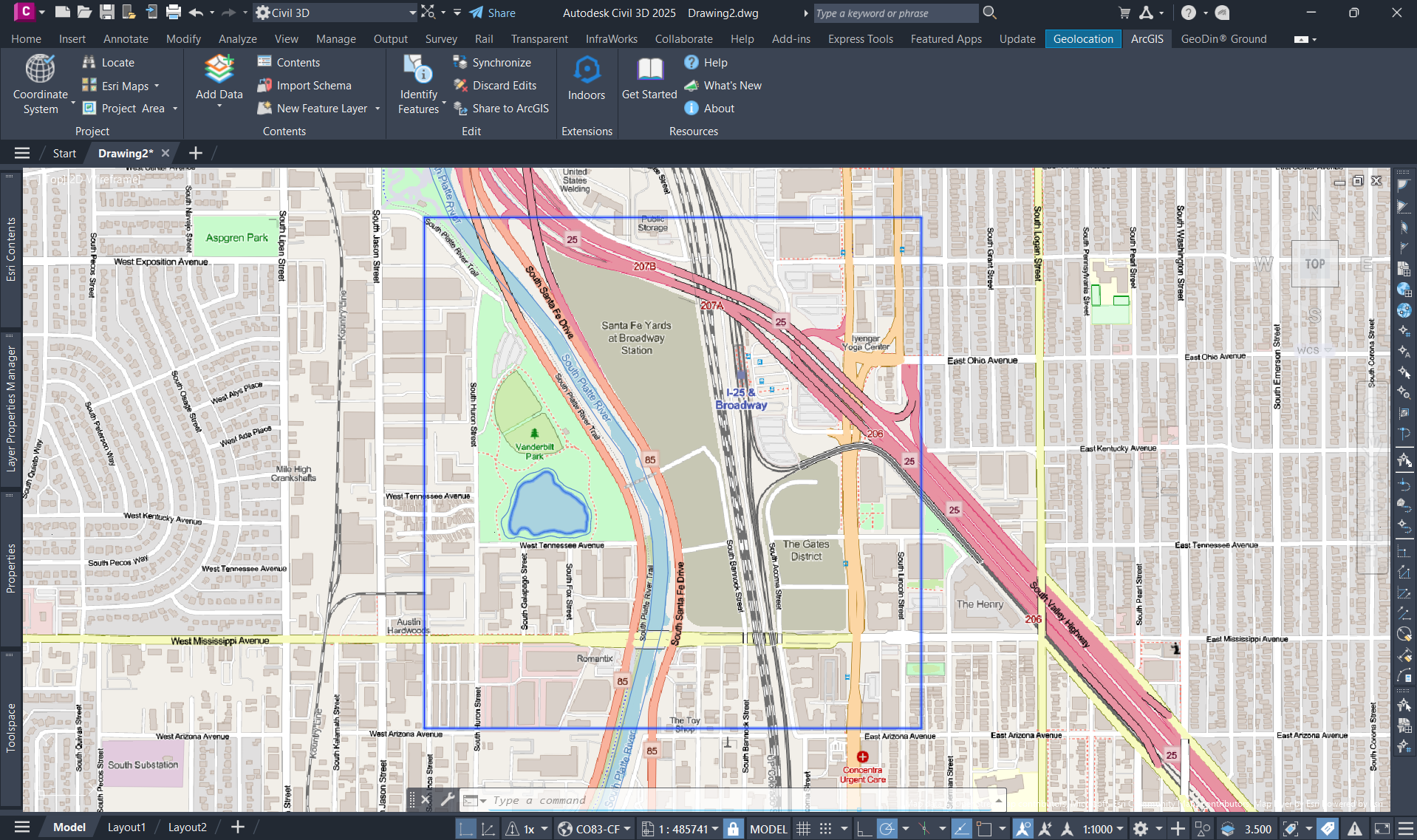
Understanding how a site connects to surrounding infrastructure is essential before finalizing layouts or construction sequencing. By referencing authoritative transportation data from ArcGIS Living Atlas in Civil 3D, engineers can visualize existing road networks to inform access planning, material delivery routes, and emergency egress during early design.
This planning‑level context supports coordination with agencies and contractors, helps identify potential constraints early, and reduces the risk of access‑related changes later in construction.
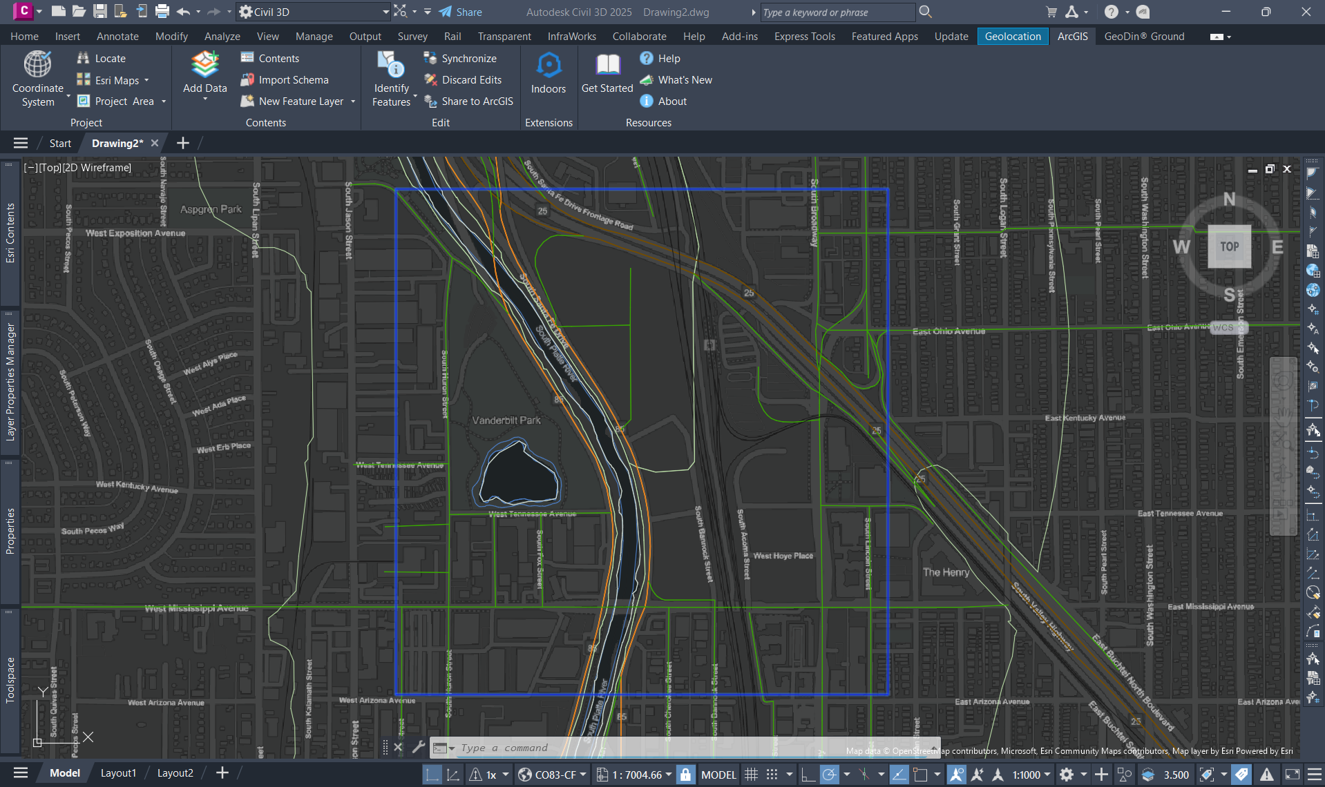
Understand surrounding development with building footprint data
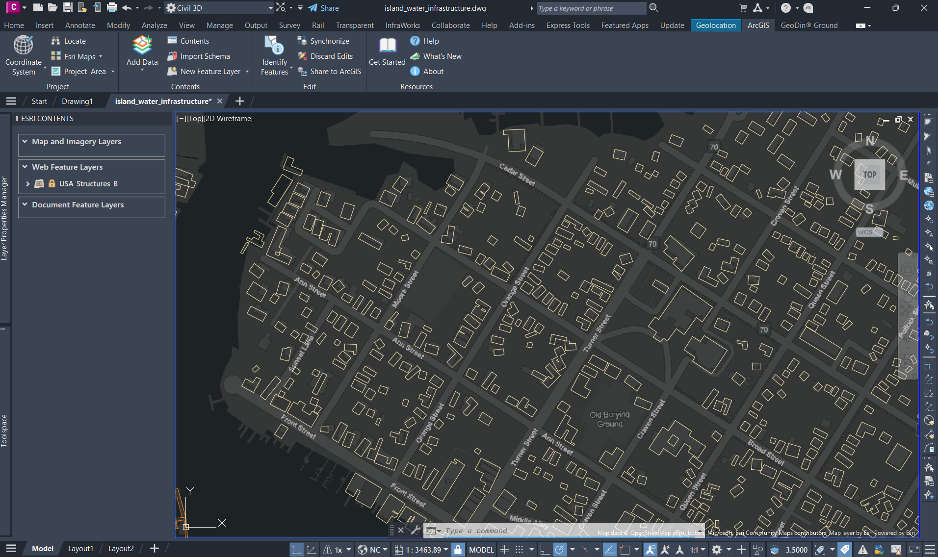
Early awareness of surrounding development helps engineers anticipate constraints and avoid design conflicts. Adding building footprint data from ArcGIS Living Atlas provides a reliable view of existing structures around a project site, supporting preliminary utility planning, infrastructure coordination, and impact evaluation in Civil 3D.
Incorporating this context early enables teams to test assumptions, communicate more clearly with stakeholders, and reduce the risk of late-stage design adjustments driven by overlooked site conditions.
Take the next step and get started
The examples above are only seven ways that you can spatially inform your Civil 3D designs using ArcGIS Living Atlas together with ArcGIS for AutoCAD.
Whether you’re working on a local subdivision or a major infrastructure project, integrating ArcGIS Living Atlas data into your Civil 3D workflows enables you to enrich your designs with real-world context, streamline permitting, and reduce risk.
Get started with ArcGIS for AutoCAD in Civil 3D
Download ArcGIS for AutoCAD at no cost. Once installed in Civil 3D, log in with your ArcGIS account to unlock access to content in ArcGIS Living Atlas of the World. Assigning an ArcGIS user type to your account determines what you can do:
- Viewer user type: View and use ArcGIS Living Atlas layers and your organization’s GIS content in Civil 3D.
- Contributor user type: Everything included in Viewer, plus editing GIS data as CAD for two-way collaboration between design and GIS teams.
- Creator user type: Everything included in Contributor, plus creating GIS content from CAD.
- Professional user type: Everything included in Creator, plus support for branch versioning to manage multi-user editing across teams.
Start learning today with this tutorial series covering how to work with coordinate systems, add existing conditions, build surfaces, and collaborate using ArcGIS for AutoCAD.






Article Discussion: