At User Conference last year, we found ourselves working under a huge banner that read “GeoEnrichment.” A number of users approached us with the same question: “What is that?” Many of us at Esri have encountered some version of this crucial question from users who have heard the term but are confused about what “GeoEnrichment” refers to.
Beneath the flashy banner of “GeoEnrichment” lies the nuts and bolts: ArcGIS GeoEnrichment℠ Service. This service provides Esri’s industry-leading demographic data as an online data source that can be used in your geographic analyses. It is accessible in many ArcGIS products you might already use every day. Intrigued? Let’s go further.
In this Got five minutes? Get to know… article, we’ll answer some of the fundamental questions around data enrichment delivered through ArcGIS GeoEnrichment Service:
- What is data enrichment?
- Why would I want to enrich something?
- How can I access data enrichment tools?
- How much does it cost?
- What data variables can I enrich with?
We will also discuss similar forms of data enrichment using local Business Analyst data in products like ArcGIS Pro. Here we go!
What is data enrichment?
In very simple terms, here’s how it works: Esri stores a wealth of demographic, spending, and business data on our servers. You request access to the data—for instance, by using the Enrich Layer tool in ArcGIS Online. The data is added to your map in the area you specify (no matter how oddly shaped that area may be) and there you have it; you’ve just used ArcGIS GeoEnrichment Service, even if you weren’t aware of it.

As an example, say you create a 15-minute walk-time around your grocery store. You could use the Enrich Layer tool to add the number of households inside the area, or their average spending per year on groceries. Those are just two of the more than 15,000 Esri data variables available to enrich with, and data enrichment can be performed in 170+ countries.

You can data enrich “standard” geographic areas such as ZIP Codes and county boundaries, or custom geographic areas like the walk-time polygon, buffer rings, or hand-drawn polygons. Even square grids or hexagons can be enriched with Esri’s demographic data!
Why would I want to enrich something?
Data enrichment is a good way to learn more about the areas you’ve mapped. It saves you time trying to locate, assemble, and calculate data variables you may need for an analysis. Plus, the data is frequently updated—for example, in the United States, Canada, and Europe, the demographic data gets updated every year.
Imagine you work at a bank and are trying to understand why some branches are gaining more business than others. You have a theory: maybe these branches are in areas that are growing faster, and are just being affected by local population trends. But you aren’t a demographer, and locating and assembling the correct census population tables for analysis would be time-consuming.
Fortunately, you can data enrich your bank territories with the Esri 2020-2023 Population Compound Annual Growth Rate variable to quickly see which areas are gaining (or maybe losing) population. Importantly, you are able to data enrich just your areas of interest like the bank territories. No need to spend time extracting only what you need from larger county or state datasets.

To take your investigation even further, you could also enrich with banking-related behavioral data variables. For instance, you could look at the percentage of people in these areas who primarily bank online rather than going into a bank; maybe these preferences account for some of the differences you are seeing.
Having all this information at your fingertips allows you to begin problem-solving your unevenly performing bank locations in minutes.

How can I access data enrichment tools?
You can access ArcGIS GeoEnrichment Service in a number of ArcGIS products, including ArcGIS Online, ArcGIS Business Analyst Web App, ArcGIS for Microsoft 365, and more. GeoEnrichment Service is also available as a REST service for the developer community and is accessible through a number of APIs.
If you use ArcGIS Pro, you can perform data enrichment in two ways:
- by connecting to online data through ArcGIS GeoEnrichment Service, or
- by using local data downloaded to your machine from Esri.
Yes, you read that correctly—enrichment with local Esri Business Analyst data is possible in Pro! More on this a little later.
Since this is a Got five minutes? article, we can’t cover every use case but will walk through ArcGIS Online, ArcGIS Pro, and ArcGIS Developers examples below.
Data enrichment in ArcGIS Online
Data enrichment can be performed directly in ArcGIS Online, using ArcGIS GeoEnrichment Service. You can data enrich an existing web layer or even custom drawn sketches.
Once logged into ArcGIS Online, the Enrich Layer tool will be found by clicking the Analysis button on the right side of the interface, and then selecting the Enrich Layer tool.

In this image, we’ve data enriched a custom-drawn rectangle sketch directly in ArcGIS Online with 2023 Total Housing Units. Nice!

Data enrichment in ArcGIS Pro
You can perform data enrichment in ArcGIS Pro in a couple of ways: by accessing ArcGIS GeoEnrichment Service (aka connecting to online data or a portal), or by using demographic data you downloaded from Esri (aka Business Analyst local data).
The first option doesn’t require any Business Analyst licensing; you can just use the Enrich tool in the Analysis toolbox > Statistics toolset. This tool uses the online data source to perform data enrichment. You do need an ArcGIS Online organizational account with at least a Publisher role.
The second option requires an ArcGIS Business Analyst software license or subscription and locally stored Business Analyst data. With those, you can then use the Enrich Layer tool in the Business Analyst toolbox > Analysis toolset to perform data enrichment.

If you want to enrich using locally stored Esri Business Analyst data be sure to set your local data as the data source. Note that you can still use online data as your data source if preferred.

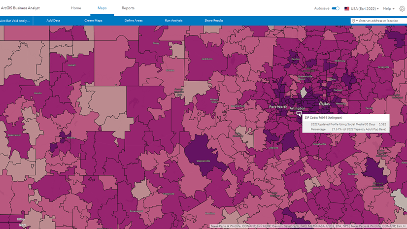
Once you specify an area and what data you’d like to enrich with, the tool runs the calculation and appends the information to your feature class. The figure below shows Esri 2020-2023 Population Compound Annual Growth Rate, enriched in ArcGIS Business Analyst Pro:

Developer service: ArcGIS GeoEnrichment Service
There are many resources covering how developers can use ArcGIS GeoEnrichment Service. The GeoEnrichment Service page is a great place to get started, and the Enrich method is extensively documented. To access ArcGIS GeoEnrichment Service as a developer, you need either an ArcGIS Developer account or an ArcGIS Online account along with an access token.
How would a developer use ArcGIS GeoEnrichment Service? Here’s an example: Perhaps a developer has created a mobile app for commercial real estate brokers. This app enables the user to draw a shape on a map and get the Esri Daytime Population estimate for the area. The app sends a request to the service, the calculation is made, and an estimate is sent back to the app and made available to the user. This is similar to the data enrichment process used within ArcGIS software products, but infinitely customizable to the developer’s specific needs.
How much does data enrichment cost?
This depends on whether you have Esri’s Business Analyst data saved locally or are using data stored online.
If you are working in ArcGIS Pro or ArcGIS Enterprise and have Business Analyst data stored locally, good news: there is no credit charge to data enrich.
If you are using online data as your source for data enrichment—essentially pulling the data over the internet into your system via ArcGIS GeoEnrichment Service—this costs credits to your organization. To understand the credit usage, see the Enrich section of the Geoprocessing tools that use credits page. Many tools will provide an estimated credit usage before you run them.

For developers, there is a charge to access ArcGIS GeoEnrichment Service, but it is not a credit model. The pricing model is based on the number of requests. This is summarized on the Developers pricing page.
What data variables can I enrich with?
There is a large catalog of data enrichment variables you can use. The main hub for exploring the variables is the data browser.
Within the data browser, data enrichment variables are organized using a two-tier system of data categories and data collections. Data categories are broad data groupings, such as Population or Housing. Within each category, variables are further organized within finer data collections, such as the Generations collection within the Population category, shown in the image below. The number of data categories and collections varies by country.
For developers, there is also a Data Collection Finder tool to help locate variables.

Data enrichment is a big topic to cover—we hope this article gets you started using GeoEnrichment products and services. Keep an eye out for more articles in the Got five minutes? Get to know… blog series.
Happy exploring!


Article Discussion: