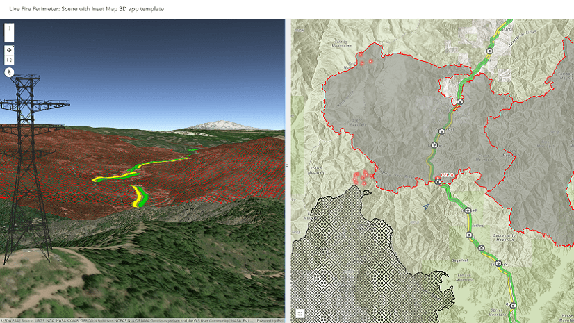
September 19, 2018 | Philip Mielke | 3D Visualization & Analytics New 3D Web App Template: Scene with Inset Map
July 2, 2018 | Derek Law | Decision Support Strategies & Best Practices for using Dashboards on your Smartphone
April 12, 2018 | Emily Windahl | Imagery & Remote Sensing Two New Configurable Apps for Imagery (April 2018)
March 15, 2018 | Derek Law | Announcements Top 5 Questions about Operations Dashboard for ArcGIS & Esri Dev Summit report
March 14, 2018 | Kelly Gerrow-Wilcox | Sharing and Collaboration Configurable Apps Announcement – Maps and Apps Gallery Moving to Mature Support Phase with April Release of ArcGIS Online
December 8, 2017 | Matt Payne | Sharing and Collaboration What's New in Configurable Apps (December 2017)
November 9, 2017 | Beth Romero | Imagery & Remote Sensing Getting started with the Image Interpretation (beta) configurable app
September 27, 2017 | Matt Payne | Sharing and Collaboration What's New in Configurable Apps (September 2017)
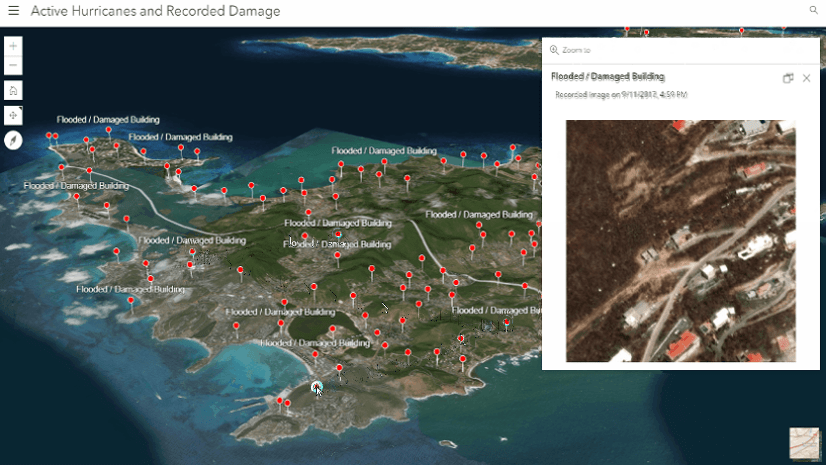
September 11, 2017 | Russell Roberts | 3D Visualization & Analytics Creating 3D web apps in ArcGIS Online – Tracking Hurricane Irma
August 21, 2017 | Kelly Gerrow-Wilcox | Sharing and Collaboration Configurable Apps Announcement – Public Gallery Template Moving to Mature Support Phase with September Update of ArcGIS Online
June 23, 2017 | Kelly Gerrow-Wilcox | Sharing and Collaboration Mastering the Space Time Continuum: Considerations for Publishing Date Fields to the Web
April 30, 2017 | Kelly Gerrow-Wilcox | Sharing and Collaboration Best Practices for using Tile Layers as Operational Layers
April 12, 2017 | Kelly Gerrow-Wilcox | Sharing and Collaboration Table to App – Part 2: Configure the App (Geo List)
March 3, 2017 | Allan Laframboise | Sharing and Collaboration Styler: A new configurable app template for creating 2D and 3D map apps