The March 2016 release of GeoPlanner for ArcGIS features a redesigned user experience that simplifies and streamlines your planning and design workflows. Also, with this release GeoPlanner supports Portal for ArcGIS 10.4.
Below are the highlights of this release. Look out for a complete list of updates and more information about each in GeoPlanner’s help.
Improved User Interface and Experience
We have revamped GeoPlanner’s user interface so that your workflows are more productive and efficient.
Moveable Dashboard
Now you can drag the Dashboard to different locations within the app to help you better visualize your plans, and get real-time feedback on the impact of your designs. The Dashboard is always available from any segment by just clicking its icon on the map toolbar.
Access to Authoritative Data
Authoritative datasets are essential to understand the context of your planning projects. GeoPlanner’s Add Data tool now has a curated option that helps you discover quality datasets from the Living Atlas of the World.
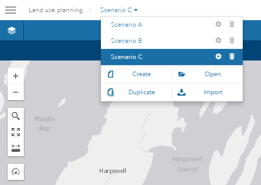
Easily Accessible Scenarios
You can now access GeoPlanner’s scenario tools from inside any segment by clicking the Scenario dropdown from the application toolbar. This increases your productivity by reducing your mouse clicks.
Better Organized Tools
To simplify and streamline your work in GeoPlanner, we consolidated tools from the app’s previous seven segments into three segments and made other tools globally available.
The Add Data, Analyze, and Modeler tools are now located in the Explore segment, which helps you understand site context before you start a design.

We also renamed the Create segment to the Design segment, and moved all sketching, painting, selection, and attribute editing tools into it. The Design segment helps you build site proposals.

And since comparison and evaluation tasks are interrelated, we grouped the following four tools into the Evaluate segment: Side-by-Side compare, Swipe compare, Consensus, and KPI Report. The Evaluate segment is useful for assessing the effectiveness of your designs.

We also moved several tools to a floating toolbar on the map to make them easy to find and reduce your mouse clicks. These tools include Project Extent, Bookmarks, Placefinder, Zoom In and Out, Measure, and Dashboard.
Other tools that have project-oriented functionality have been moved to the Project Backstage so you see them only when you need to. These include Project Create, Open, Properties, Save, and Print Map.
Support for Portal for ArcGIS 10.4
GeoPlanner now has support for Portal for ArcGIS 10.4, which means that the app will be available within your intranet. If you have deployed Portal and ArcGIS 10.4 for Server, you can purchase GeoPlanner and access the app from My Esri within the next few weeks.
We’re excited to provide these updates to you because they will make your job faster, easier, and more productive. If you have not tried GeoPlanner yet, sign up for a free trial here. To learn more about how the app can optimize your planning and design workflows, check out the documentation here.

Article Discussion: