Welcome to the 2019 Esri User Conference (UC) guide for developers! GIS – The Intelligent Nervous System is our theme for this year, and just as vital as our nervous system is as a way to communicate important information to our bodies, so, too, is GIS to our world. We rely on a multitude of ways to communicate vital information to help us answer questions and resolve issues.
We apply this messaging to what we do as developers each and every day, and the Esri UC is one of the events that allows us to demonstrate this through our technical sessions, demo theaters, and activities. So read along to find out ways to maximize your experience as a developer at Esri UC.
Before you get started for the week, be sure to download the Esri Events app to help you build your own personalized agenda. We will be providing you with some suggested tech sessions, events, and activities that you may want to include and be reminded of when they come up throughout the week.
And, if after reading this blog, you still have some questions about UC, check out the Q&A and review the “Developers” section.
::rubbing hands together:: Let’s get going!

Developer Island
You can find us in Hall A from Tuesday through Thursday sandwiched between the Open Data Island and the Startup Zone. Stop by to say “hi” to the Developer Experience team, get your questions answered about the latest in API or SDK development, or even check out the latest in our vector tile style editor.
Right behind the island in Demo 7 and 8, you can find all of our developer-related presentations demonstrating new tools and features that will inspire you to jump right in and get started or continue building the apps that continue to work and inspire!
Demo Theaters
Be sure to check the demo theater schedules in the Esri Event app or the schedules that are placed right outside of the demo theaters to see which one you want to attend. Here they are – you won’t want to miss them!
Tuesday, July 9
Operations Dashboard for ArcGIS: Monitoring Field Edits | 10:00am – 10:45am | Demo Theater 7
Engaging Your Community With Open Data | 11:15am – 12:00pm | Demo Theater 7
ArcGIS API for Python: Experience ArcGIS in a Notebook | 10:00am – 10:45am | Demo Theater 8
ArcGIS API for JavaScript: Tips and Tricks for Developing and Debugging Apps | 11:15am – 12:00pm | Demo Theater 8
ArcGIS Runtime SDK for iOS and macOS: Building Apps | 12:15pm – 1:00pm | Demo Theater 8
ArcGIS API for Python: Integrating Machine Learning and Deep Learning | 1:15pm – 2:00pm | Demo Theater 8
Open Source Apps: A Resource to Expedite Your Runtime App Development | 2:30pm – 3:15pm | Demo Theater 8
Wednesday, July 10
Using Your Own Authentication System with ArcGIS Online | 1:15pm – 2:00pm | Demo Theater 7
Web AppBuilder for ArcGIS: Creating 3D Web Apps | 2:30pm – 3:15pm | Demo Theater 7
ArcGIS Pro SDK for .NET: Getting Started | 10:00am – 10:45am | Demo Theater 8
ArcGIS API for Python: Pandas and Spatially Enabled DataFrame | 11:15am – 12:00pm | Demo Theater 8
ArcGIS Runtime SDK for Qt: Building Apps | 12:15pm – 1:00pm | Demo Theater 8
Using TypeScript with ArcGIS API for JavaScript | 2:30pm – 3:15pm | Demo Theater 8
ArcGIS API for Python: Experience ArcGIS in a Notebook | 4:00pm – 5:00pm | Demo Theater 8
Thursday, July 11
Extend Your Big Data Analysis Through Python in GeoAnalytics Tools | 10:00am – 10:45am | Demo Theater 7
Visualization & Exploration of Large Datasets Using Feature Binning | 12:15pm – 1:00pm | Demo Theater 7
Accessible Web Mapping Apps: ARIA, WCAG and 508 Compliance | 10:00am – 10:45am | Demo Theater 8
ArcGIS Runtime SDK for Java: Building Apps | 11:15am – 12:00pm | Demo Theater 8
ArcGIS API for Python: Migrating Your Content | 12:15pm – 1:00pm | Demo Theater 8

Tech Sessions
Here are the developer-focused tech sessions you will want to look out for throughout the week. Search for them in your Event app and mark them so you can be sure to attend.
Tuesday, July 9
Building Web Apps with the ArcGIS API for JavaScript | 8:30am – 9:30am | SDCC – Room 17B
ArcGIS Pro SDK for .NET: An Introduction | 1:00pm – 2:00pm | SDCC – Room 02
Editing with the ArcGIS API for JavaScript | 1:00pm – 2:00pm | SDCC – Room 05B
Python: Introduction to Map Automation | 1:00pm – 2:00pm | SDCC – Ballroom 06 F
Python: Raster Analysis | 2:30pm – 3:30pm | SDCC – Room 30A
ArcGIS API for JavaScript: An Introduction | 4:00pm – 5:00pm | SDCC – Room 04
ArcGIS API for Python: An Introduction | 4:00pm – 5:00pm | SDCC – Ballroom 06 F
Working with Feature Layers in the ArcGIS API for JavaScript | 4:00pm – 5:00pm | SDCC – Room 33 A/B
Wednesday, July 10
ArcGIS API for JavaScript: An Introduction | 8:30am – 9:30am | SDCC – Room 16A
ArcGIS Runtime SDKs: Building Cross-Platform Apps | 8:30am – 9:30am | SDCC – Room 05 B
Python: Map Automation in ArcGIS Pro | 8:30am – 9:30am | SDCC – Room 08
ArcGIS API for Python: Imagery Analysis | 10:00am – 11:00am | SDCC – Room 16A
ArcGIS API for JavaScript: What’s New | 1:00pm – 2:00pm | SDCC – Room 16 A
ArcGIS API for Python: Administering Your Web GIS | 2:30pm – 3:30pm | SDCC – Room 16 A
ArcGIS API for Python: An Introduction | 2:30pm – 3:30pm | SDCC – Room 02
Customizing ArcGIS API for JavaScript Widgets | 2:30pm – 3:30pm | SDCC – Room 05 B
Editing with the ArcGIS API for JavaScript | 4:00pm – 5:00pm | SDCC – Room 16A
Python: Raster Analysis | 4:00pm – 5:00pm | SDCC – Room 30A
Thursday, July 11
ArcGIS API for Python for Analysts and Data Scientists | 8:30am – 9:30am | SDCC – Room 03
ArcGIS API for Python: Deep Dive into the API | 8:30am – 9:30am | SDCC – Room 09
ArcGIS Runtime SDKs: Building Cross-Platform Apps | 10:00am – 11:00am | SDCC – Room 31 A
ArcGIS Runtime SDKs: Building Android Apps | 1:00pm – 2:00pm | SDCC – Room 31 A
ArcGIS Runtime SDKs: Building .NET Apps | 2:30pm – 3:30pm | SDCC – Room 30 D
ArcGIS Runtime SDKs: Building Offline Applications | 2:30pm – 3:30pm | SDCC – Room 31 A
Python: Introduction to Map Automation | 2:30pm – 3:30pm | SDCC – Room 01 A/B
Web AppBuilder for ArcGIS: Customizing and Extending | 2:30pm – 3:30pm | SDCC – Room 33 A/B
Building Web Apps with the ArcGIS API for JavaScript | 4:00pm – 5:00pm | SDCC – Room 30 D

Developer Clinic
For the first time, we will have a Developer Clinic where you can make a one-on-one appointment (one per customer) with an expert to discuss strategic approaches you might consider implementing. You will get the opportunity to discuss larger picture ideas, concepts, and practices that help you to decide which APIs and SDKs work for you and your projects.
This is a bit different from the Developer Island where you can drill down to a very specific API or SDK that you are familiar with and you get to speak with the engineers who helped to build it.

Developer Social
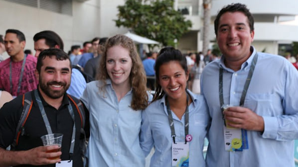
On Tuesday night, we will be hosting our Developer Social once again at the Marriott, but this time we will be at the South Pool! Come by to meet some of the other developers who are attending UC, including Esri developers and the rest of the Developer Support and Outreach team. We will be there to welcome you, share some of our stories, collaborate, and network! Come enjoy some appetizers and drinks on us! Be sure to let us know you’re coming by RSVPing!
Lightning Talks
This year we are rockin’ the Lightning Talks again on Monday evening! We will be in Ballroom 20D at the San Diego Convention Center, and we will be kicking it off at 5:00pm, right after the plenary. We have a great selection of topics that are being covered including talks about drones, agricultural datasets, hockey dashboards using ArcGIS for personal use, and crowdsourcing apps. And we have a fun surprise in the middle for those of you who are up-to-date on your GIS trivia! We heard one speaker likes to give away prizes!
Here are the talks we have for you:
Natalie Campos, San Bernardino County, “Monitoring Homelessness Within Flood Control Facilities”
Daniel Cassiday, Blue Raster, LLC, “My Life as a (Version) Control Freak: Versioning ArcGIS Online Items with Python”
Adrian Hughes, Royal Society for the Protection of Birds, “Drones for Conservation”
Kevin Wohlmut, Litigation and Adjudication Program (LAP) of the Hydrographic Survey Bureau (HSB), under the Office of the State Engineer, State of New Mexico, “Hydrographic Survey of Water Rights in Northern New Mexico”
Audrey Martinez, University of Idaho, “Building Sensitive and Censored Agricultural Datasets”
Rachel Layko, The Nature Conservancy, “Fishy Data: Modeling Fishing Pressure Helps Conserve Coral Reefs”
Dan Meaney, Cuyahoga County Planning Commission, “Bivariate Mapping & Climate Vulnerability Assessment”
Jaydeep Mistry, University of Waterloo, “SMART App: Sustainable Management with Augmented Reality Technologies”
Warren Vick, Europa Technologies, “What Do You Know?”
Jason Clemis, Pinellas County Government, “Creating a Hockey Dashboard Application Using ArcGIS for Personal Use”
Shannon Julius, City of Whittier, “GIS for Active Shooter Planning and Response”
Ryan Bank, Geospatial Intelligence Center (GIC), “Geospatial Intelligence: How It’s Transforming the Insurance Industry”
Teresa Crean, University of Rhode Island Coastal Resources Center, “Rhode Island’s Coastal Hazard Application Viewer”
Rhonda Joyner, DeKalb County Government (DeKalb GIS Department), “Tips on Preparing a Parcel Fabric Implementation”
Robin Patton, One Shared Story, “Crowdsourcing Public History”
Susmitha Nambuthiri, Washington State Department of Health, “Using GIS to Demonstrate Program Effects of Improving Affordability of Healthy Food for Low-income Individuals in Washington State”
William Cozzens, HNTB Corporation, “VTABSV Phase II – GIS Enterprise Digital Innovation”
Michelle Oldfield, Arcadis Consulting (UK) Ltd, “Computational Earthworks Design with ArcPy”
Hailey Turner, GHD Limited, “Water Storage and Pumping Station Site Selection: Environmental Avoidance/Suitability”
Be sure to add this event to your agenda as well!

Make it a great UC!
Please take advantage of everything UC has to offer you this year. We have a lot of great resources available to you and are welcoming you, looking forward to hearing your thoughts, and sharing good ideas together.
To read more developer-related content about what’s happening at UC, please check out the following blog posts:

See you soon!

Commenting is not enabled for this article.