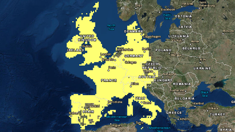
We have updated the World Imagery basemap with more recent imagery from DigitalGlobe and several organizations from the GIS user community. This latest update features DigitalGlobe imagery for large parts of Western Europe, as shown below.
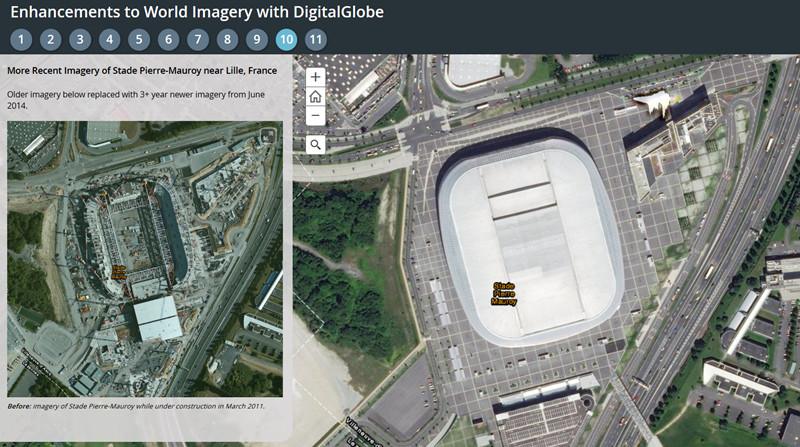
This is the third in a series of planned updates to our World Imagery basemap with imagery provided by DigitalGlobe, expanding on our initial update in September and second update in early October. This latest update includes 50cm resolution imagery for Western Europe where it improves on the image currency or quality of our previous imagery. In many areas, the imagery is 2-4 years more current than the previous imagery, as you can see for a few sample areas (tabs 8, 9, 10, 11) in the story map below.

Over the next few months, Esri will continue to release updates with latest available DigitalGlobe imagery from both Basemap +Vivid and Basemap +Metro products. The next +Vivid updates will include 1m resolution imagery for several more countries. In addition, we will soon release the first set of +Metro updates with sub-meter resolution imagery for hundreds of large metro areas around the world.
To learn more details about our plans for updating World Imagery with DigitalGlobe imagery, please join me and my colleagues for a free webinar on November 3.
Community Maps Imagery
With this update, we have also published new or updated imagery for several different cities and counties in Canada and the United States, including:
- North Vancouver, British Columbia
- Okanagan-Similkameen, British Columbia
- Rossland, British Columbia
- Chestermere, Alberta
- Brandon, Manitoba
- Peterborough, Ontario
- Rancho Cucamonga, California
- Salt Lake County, Utah
- Loudoun County, Virginia
- Hartford, Connecticut
We would like to thank these contributors for sharing their imagery so it can be made available as part of our World Imagery map. If you have imagery that you’d like to share, please visit our Esri Community Maps for Imagery site to get started!


Article Discussion: