If you build it, they will come. Well sort of… You need to entice them first, and then make the process easier for your organization to embrace GIS. With the onslaught of point solutions these days, GIS professionals are having to take a step back from our data and think more as marketing specialists. That’s right, marketing. Like how in the summer, products like marshmallows and chocolate bars are in multiple locations throughout your local grocery store, when these items are more heavily utilized. So how do we make our GIS the technology equivalent of s’mores, ready to be embraced at the checkout line? That’s easy, through its integration with other systems. You could also think of this as bringing your GIS to your users, rather than asking them to seek out your GIS. The first step is to ensure you are utilizing best practices in your environment, whether that is ArcGIS Online or Enterprise. Then, once you are more familiar with Groups and the structure of your organization, it is time to look at how you can lower the barrier of entry for utilization by your users.
Note the s’more.

Some connoisseurs argue that you must roast them until they turn the appropriate shade of brown, and others (like me) prefer to dive right in and momentarily set them on fire. As GIS professionals, we can do the same thing. We can begin by exposing the power of our GIS or we can completely turn people off when we come out of the gate with everything ablaze. So, what’s a good approach? Let’s cross market and expose your organization to your GIS through the productivity tools they frequent. Oftentimes, the non-GIS folks of your organization spend little to no time on your ArcGIS homepage or with your favorite app. Instead, these professionals spend their days in email and other communication platforms like Microsoft Teams. In this scenario, we will focus on utilizing Microsoft Teams and the ArcGIS for Microsoft Teams integration. For a full list of Microsoft 365 integrations, here is a recent blog from earlier this year to get started.
In my opinion, the integration between ArcGIS for Microsoft 365 is an often-underutilized enhancement to your GIS. In this example we will look at a Microsoft Team I configured to highlight some of our content from our fictitious mining organization.

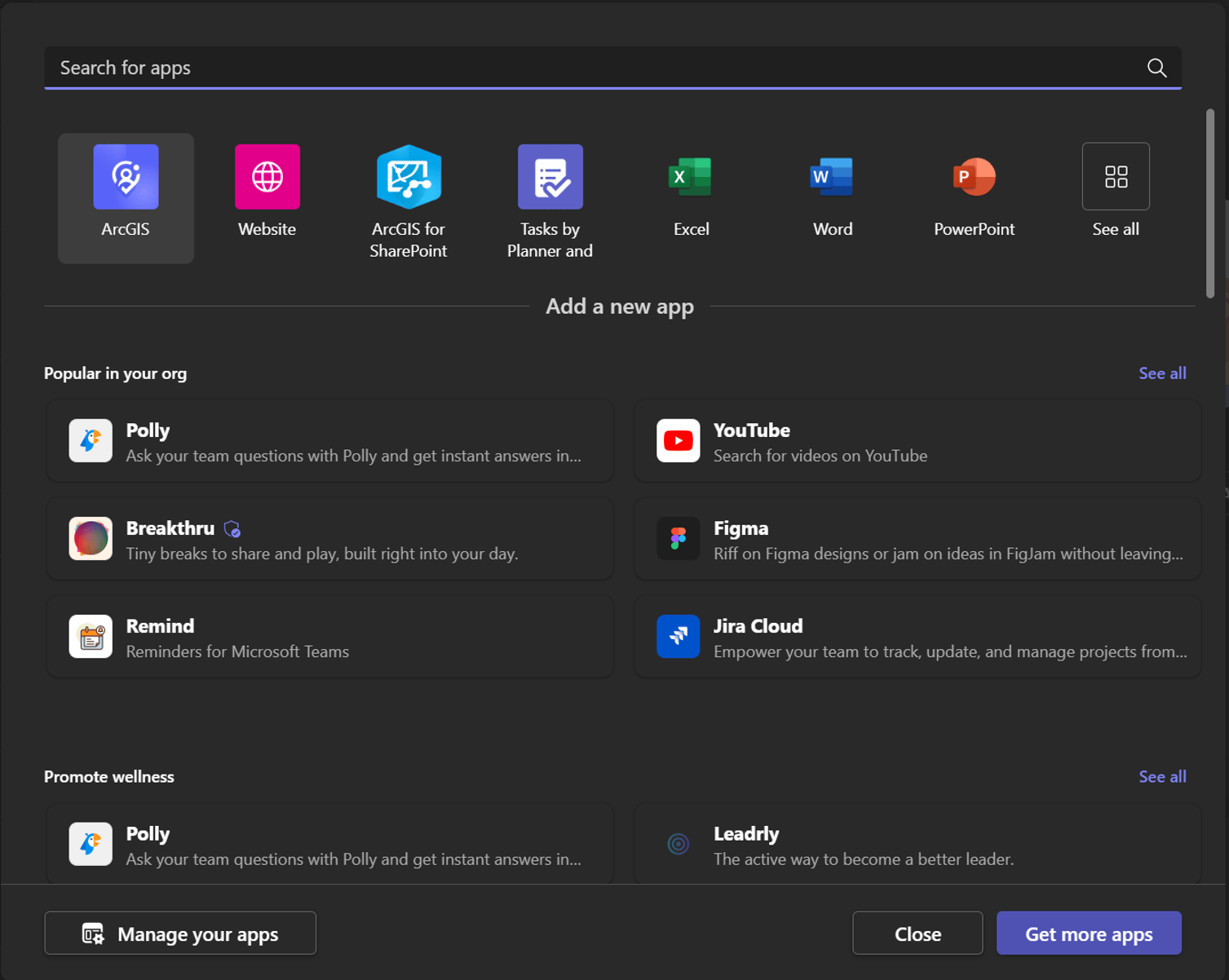
To begin, we go to the plus sign at the top right of the team’s channel for the add a tab section. You may need to search, but if you type in ArcGIS you will see a purple ArcGIS icon and that’s the one we want. Note that ArcGIS now appears, and you can search ArcGIS Online as well as items specific to your organization (this would also work with ArcGIS Enterprise).
Here we are looking for Live Feeds from the Living Atlas that we want our organization to be aware of, which we can then view in a new map or integrate into existing solutions.

Once we’ve signed in, we have the option to search ArcGIS Online, My Content, My Organization, or My Groups . In this case, we are looking for a new Hub Site to bring awareness to it throughout our Health Safety and Environment (HSE) workgroup.
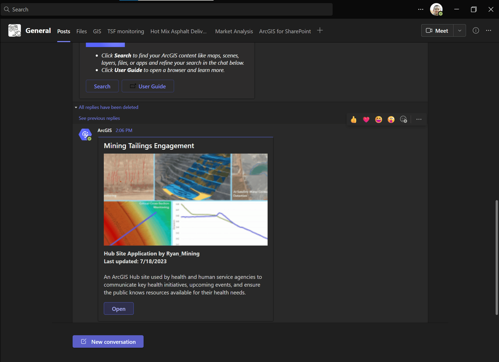
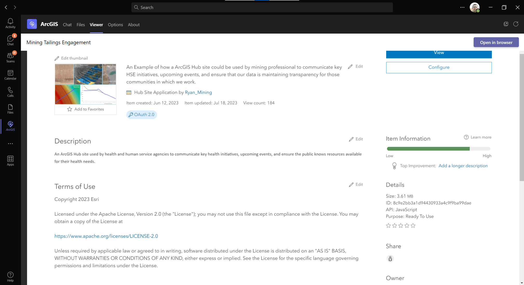
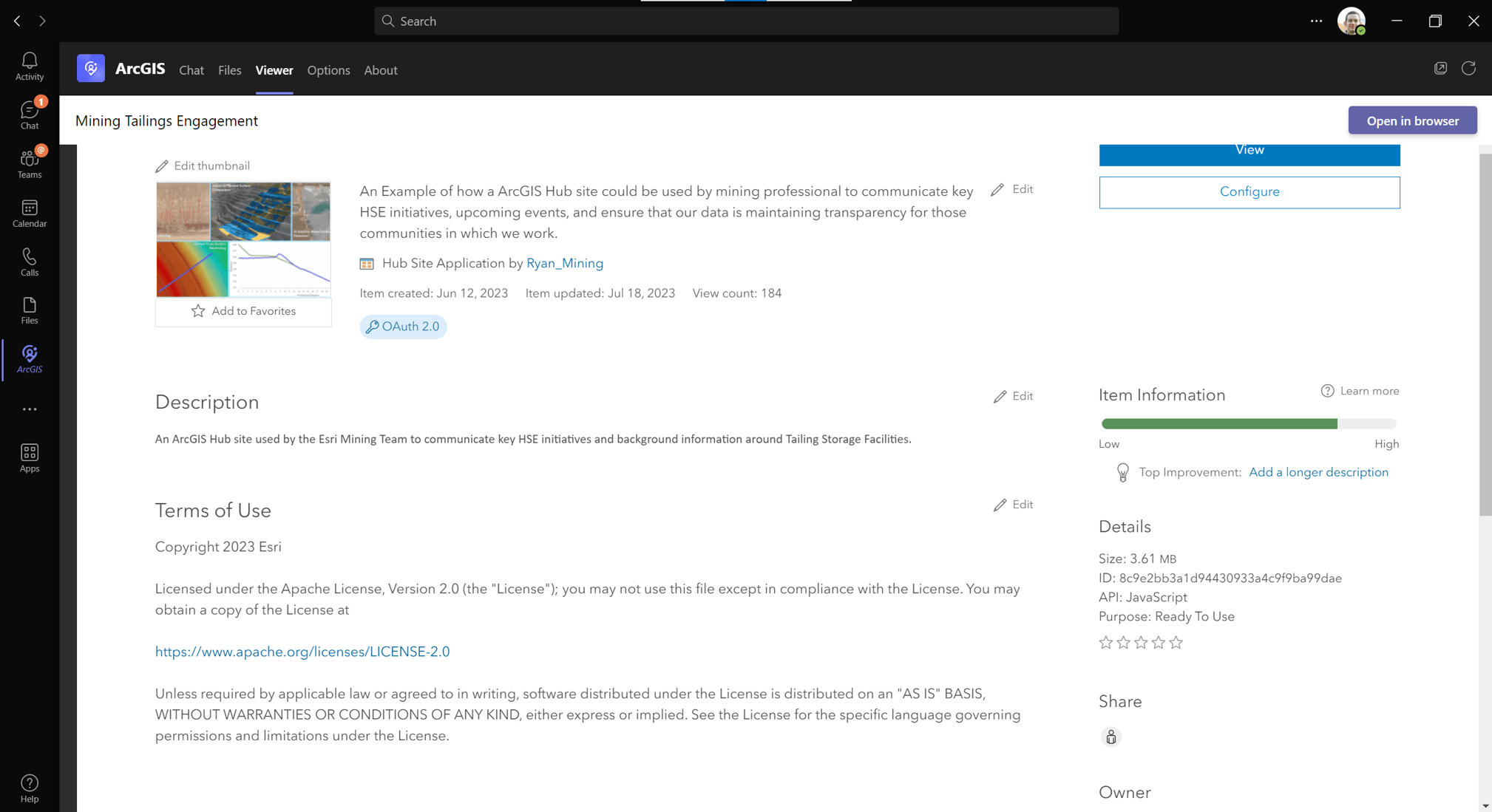
Note that once we have the Hub Site up, we arrive at the item details page, and as seen in the initial Hub Site photo below, we can even update some of the details I neglected to replace when utilizing the initial template for this Hub Site from the team’s window.
Now, taking things a bit further, we want to utilize the website tab and highlight some of the work for our mining Site Managers or maybe an Engineer Of Record (EOR). In the picture below, we are showing an Experience Builder application where we have configured links to individual pages of featured applications for mining business workflows. By utilizing the flexibility of Experience Builder, we can cater pages specific to their areas of expertise, and more importantly, expose the applications we have within our organization to assist them with their analysis and decision making. In the first tab, we see pressure feeds, where we have real time data feeds coming in for the Site EOR.

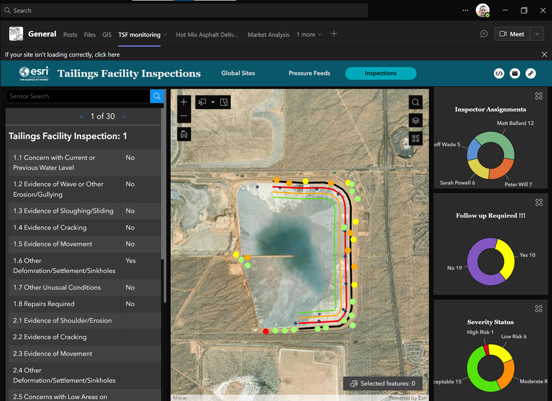
As we move to the next tab in the image below, we utilize the connectivity of ArcGIS to display the results from our mobile workforce’s field inspections, tying our efforts together for a more holistic operating picture. As you are starting to see, the Microsoft 365 integration is an easy way to feature powerful GIS applications and maps for your organization. Our overall goal is to provide users with a sampling of content and analysis to make their workflows easier, and to hope that this sampling is enough to entice them to see what else they may be missing within your organization’s GIS.
As GIS professionals we are often working on powerful solutions and utilizing the connectivity of ArcGIS to bring authoritative data to our teams and workforce. However, at times we can forget the importance of growing the exposure of our GIS to other professional teams within our organization. When catering content, I encourage you to think about role-based groups e.g., Analyst, Technical Professional, Decision Makers (C-suite), and how you might bring your GIS to the platforms where they spend their workdays. From here, I hope this quick example of integrating ArcGIS with other platforms will get you thinking about how you can more efficiently expose your hard work to your management and professional teams, and maybe, bring more professionals from your organization into the fold for s’more GIS.


Article Discussion: