We recently released two new Wilderness layers: The USA Wilderness feature layer and USA Wilderness imagery layer provide access to a map of 765 designated Wilderness Areas that protect over 109 million acres in 44 states and Puerto Rico.
USA Wilderness Feature Layer
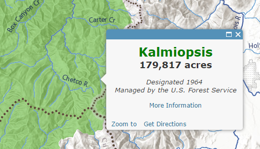
The USA Wilderness feature layer includes basic attributes about each wilderness area that are used to populate the pre-configured pop-up. You can also use the attributes to create your own custom pop-up, filter the data, or symbolize the data. You can set a custom configuration and save a view or export the data.
USA Wilderness Imagery Layer
The USA Wilderness imagery layer provides a high performance layer that can be used as a geoprocessing input in ArcMap and ArcGIS Pro. The layer draws well at all scales and is particularly useful when used to display wilderness areas at regional to continental scales.
Web Map
Both layers work well with base maps including the Topographic and National Geographic base maps. This web map built from the wilderness feature layer uses the Hydro Reference Overlay, World Terrain base and the Light Gray Canvas provides a good start to creating your own maps and apps with the Wilderness layers.
Deprecation
The new layers replace older versions of our wilderness map image layer and imagery layer. These layers have been put into mature support.


Article Discussion: