
ArcGIS Pro Intelligence is intelligence analysis software built for intelligence analysts working in the military and in civilian intelligence agencies, law enforcement, and the private sector. Use link analysis, 2D and 3D maps, timelines, imagery exploitation, and graphs to uncover patterns, trends, and relationships in data to inform decision-making. ArcGIS Pro Intelligence scales to meet your mission whether you need to conduct movement analysis, understand patterns of life, or perform investigative analysis. ArcGIS Pro Intelligence is interoperable and extensible, supporting your data integration strategy across multiple domains in connected, disconnected, and air gapped networks.
The Problem
Countering human trafficking operations are carried out by federal, state, and local law enforcement regularly to disrupt the actions of those who would prey on the vulnerable. Using ArcGIS Pro Intelligence analysts can assist in identifying areas law enforcement should focus their efforts on. To proverbially find the needle in the haystack, law enforcement and other stakeholders often work overtime to identify areas where human trafficking victims and their abusers may be. ArcGIS Pro Intelligence can assist in cutting the haystack in half.
The Workflow
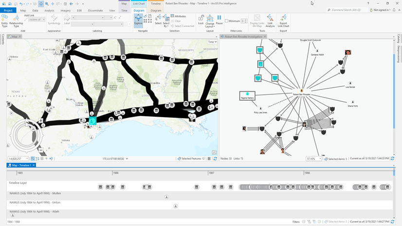
The first step in combatting human trafficking is understanding where possible victims and their traffickers are, not only in space, but also in time. The timeline tool is able to parse out individuals into separate timelines so they can be compared across space and time. Using a quick selection inside of the timeline we can highlight the overlap of two individuals of interest. The timeline selects the record in the timeline but also selects the record in space on the map view.

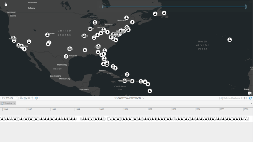
Now that we have highlighted an area these two individuals both traveled to on September 19, 2020, we can begin to use anonymized track data to highlight possible meeting locations using the Find Meeting Locations tool.

Adding the track data shows a few different tracks for a few different individuals of potential interest. Using the Find Meeting Locations geoprocessing tool, we can pass specific parameters to identify if any of these individuals have met for at least 30 minutes within 100 meters of each other. This will return a polygon feature class and point feature class highlighting any area these individuals have met in for the specified amount of time and within the specified distance.

After running the tool, the results clearly show two individuals met in this motel for at least 30 minutes and were within 100 meters of each other. There is still required work by law enforcement to launch operations to investigate the possibility of human trafficking, but we have narrowed their focus to this specific area so they can concentrate their resources effectively.

ArcGIS Pro Intelligence assists law enforcement in deploying their resources effectively and with focus. In addition to the enforcement side, ArcGIS Pro Intelligence can also be used to assist prosecutors in building a case against specific individuals who are suspected of participating in human trafficking. Using historical track data and the tools available in ArcGIS Pro Intelligence any arm of Law & Order can use geospatial data to assist and rescue victims from human trafficking situations.
To learn more about ArcGIS Pro Intelligence, or to contact sales, visit go.esri.com/arcgis-pro-intelligence. To view other articles like this, videos, and training, visit go.esri.com/arcigis-pro-intelligence/resources.


Article Discussion: