by Steve Kopp, Esri
Have you ever wanted to draw a viewshed or elevation profile for a location but didn’t have the data? Or needed to know the slope of a road, predominant aspect of a forest plot, or where water flowed to, or came from? In ArcGIS for Desktop 10.2.1 all these capabilities are easily accessible as Ready-To-Use Services.
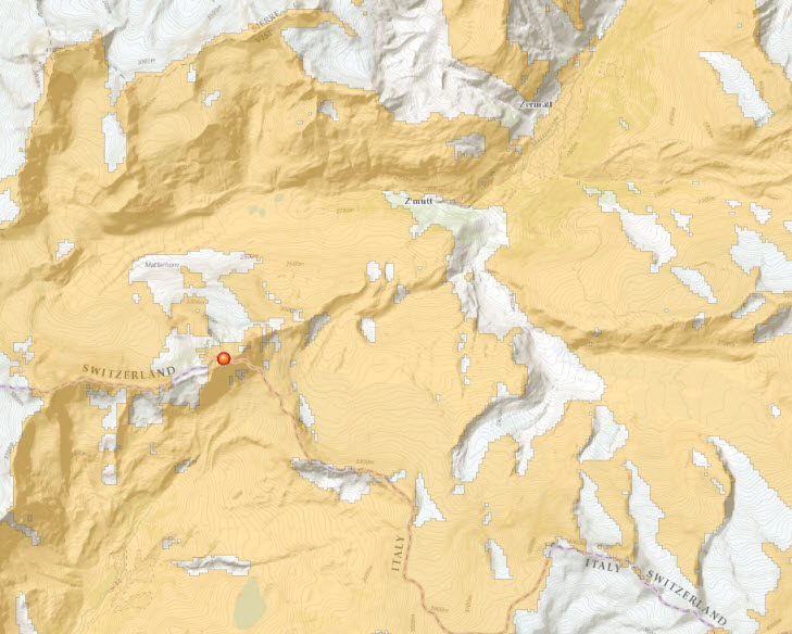
Ready-To-Use Services are ArcGIS Online geoprocessing services which use ArcGIS Online’s data and analysis capabilities. Simply provide a few input features, and all the other data needed for the analysis, as well as the computation, are hosted in ArcGIS Online. Most analysis need relatively small amounts of data to be passed to and from the services so they are fast, for example you can calculate a viewshed for anywhere in the world in under 5 seconds.
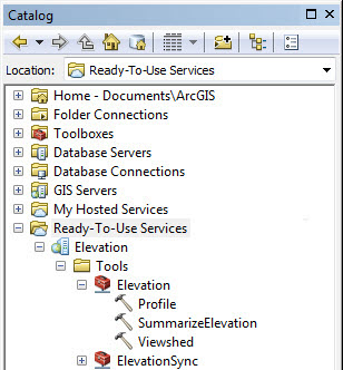
How can you use them? Simply open ArcGIS for Desktop 10.2.1 and log in to your ArcGIS Online organizational account, then at the bottom of the Catalog window you will see Ready-To-Use Services. Click on the Elevation connection, then the tools folder, then the Elevation toolbox to see the tools. Double click a tool such as Viewshed to open it, and run it just like any other geoprocessing tool. You can also use them directly in your ModelBuilder models just like any other tool.
If you are unable to see the Ready-to-Use services after logging in, you may need to install a patch. For instructions on installing the path, please read this blog.
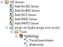
 What if you want to use the Hydrology services, or you’re not using 10.2.1 yet? Simply open ArcGIS for Desktop 10.1 SP1 or later and in the Catalog tree expand the GIS Servers node. Double-click Add ArcGIS Server, then choose Use GIS services and click Next. For the Hydrology services (Watershed and Trace Downstream) add the ArcGIS Server http://hydro.arcgis.com/arcgis/services. If you want to access the other elevation tools such as Viewshed, Profile and Summarize Elevation, add the ArcGIS server http://elevation.arcgis.com/arcgis/services. Then enter your ArcGIS Online organizational account credentials and click Finish.
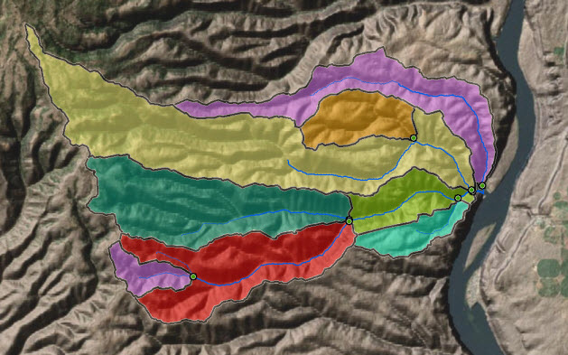
The hydrology services in the US are based upon the NHDPlus Version 2.1 database which has been optimized for fast web service performance. The services are also available for most of the world south of 60 degrees north, plus much of Alaska and Canada, based upon the HydroSHEDS project.
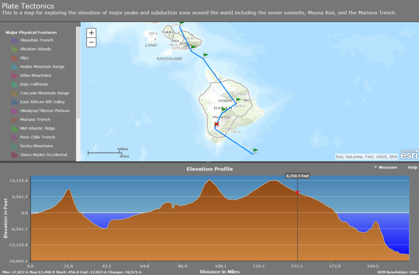
The elevation services work against global data at approximately 1 kilometer and 90 meter, 30 meter resolution data in the continental US and Mexico, plus 10 meter data in the continental US.
Additional information about these analysis services and some of the related image and map services for elevation can be found here.
The elevation and hydrology content for ArcGIS Online grows through the Community Maps program. As new areas and resolutions are covered they will be included in these analytic services. For more information on becoming a Community Maps contributor, click here.
Developers can also use these services in their application via REST. Additional information for developers and samples can be found here. There is also a configurable web application template available using the profile service.
Keep an eye out for more blogs in the near future about additional elevation profiles services and samples, as well as the network analysis Ready-To-Use services.


Article Discussion: