Join Esri’s utilities and telecom team for the second in a new 3-part webinar series. This webinar will demonstrate how Esri’s field solutions support new workflow challenges during this difficult time. Join us to learn how to quickly set up solutions. The webcast is to be held Tuesday, April 21st at 9:00am Pacific. To register, click here.
Rethinking Field Workflows
Coronavirus disease (COVID-19) is challenging utilities and telecoms in nearly every way. These unprecedented times means rethinking all operating modes that require remote workers to gather new data. Any process that is not digital creates a break in information flow. It creates a bottleneck for daily operations. Organizations need to know what work is required and what work is completed. They need to know who can work and where they are working to make business continuity decisions. And, this information needs to be in real time.
COVID-19 came upon us quickly. Utilities and telecoms need solutions to meet their rapidly shifting field work forces. They can’t afford to spend months or even weeks to develop and implement applications. Utilities need solutions that can be deployed out of the box with just minimal configuration. Esri’s suite of field-based solutions can be implemented in hours, and on devices like tablets and phones that field workers use every day.
In response to COVID-19, field workers are not reporting to service centers. Many will be working remote and alone. No longer will they be dropping off marked up paper field notes. They will need to communicate in ways verbal and text messaging cannot. Staff need to collaborate in real time to dispatchers, contractors and co-workers. They need to coordinate work with public safety officials and most importantly they need to continue to do their work safely.
Field managers and supervisors are also working alone. They need critical information about the location of workers, of hazards and especially of network failures. With customers working from home, it is essential that telecom, electric, gas and water services remain uninterrupted.
Mobility applications to help you maintain business continuity
Tracker for ArcGIS
Managing a remote workforce can be difficult without knowing where employees are. Tracker for ArcGIS provides real-time collection of the location of workers. For example, knowing where your staff is located when issuing work can save time. Should an electric worker enter an identified hazardous area, Tracker can trigger an alert.
Workforce for ArcGIS
Being able to schedule and dispatch crews effectively to manage work is critical. Workforce for ArcGIS sets up a system for assigning and managing work in the field. It adds that work to the already scheduled work. This allows field workers to see nearby work assignments and complete the needed maintenance right away.
Survey 123 for ArcGIS
The power of Survey123 for ArcGIS is that is can quickly be configured to replace paper-based forms. It enables organizations to transition to a digital platform in a matter of minutes. At a time when there is no option to retain legacy paper process, this is proving to be transformational for many organizations. This also assists in combating the emergence of disparate excel spreadsheets to manage information.
Esri has provided several new, out of the box, Survey123 templates in response to COVID-19:
- Personal Check-in Survey: This survey collects information on work status, work location, and wellness information directly from field personnel. The survey allows individuals to self-report on a daily-basis, or when their work conditions change throughout the day.
- Team Check-in Survey: This survey reports total counts for crews on a regular schedule. It works well when not all staff have access to devices required to submit the Personal Check-in.
- Facility Status Survey and Reporter: This solution can be implemented with very little configuration. It provides detailed information about the current status of each facility, including impacted operations, access restrictions, scheduled closures, and government restrictions.
Finally, despite the slowdown in customer requests, there will be occasions when field crews need to meet with customers and developers. Survey 123 can provide a simple and easy way to collect customer requirements for new electric, gas, water and telecom services.
ArcGIS Dashboards
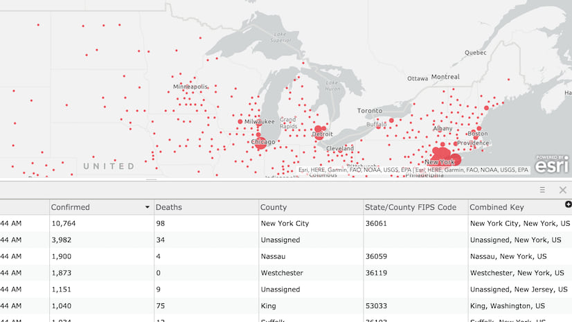
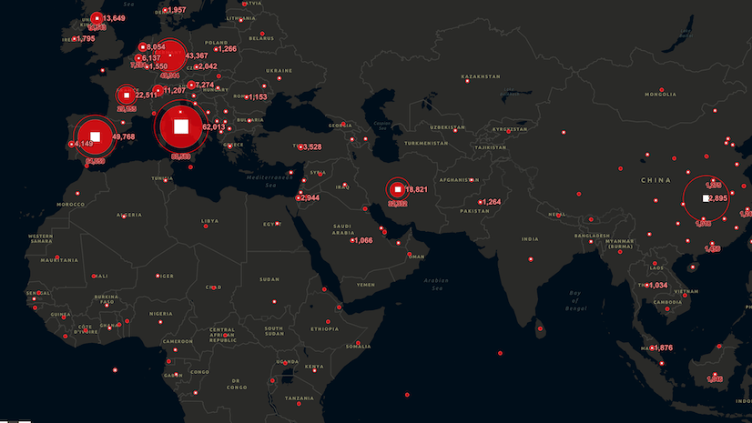
ArcGIS Dashboards are the ultimate communication vehicle for all things field related. Federal, state and local governments have deployed dashboards to track at risk populations, COVID-19 cases and spread. Dashboards can be used by supervisors, managers and executives to see the progress of work in relation to clusters of COVID-19. ArcGIS Dashboards provide the most comprehensive way to see, in one place, full situational awareness. Esri developed a new COVID-19 solution based on ArcGIS Dashboards called Facilities Status Dashboard. It monitors facility status, uses filters to see specific information and review historical trends. It helps field operations personnel understand the impact to their organization.
Please join us for a short webinar on how Esri’s field applications can be deployed to help utilities in this dramatic transformation of field work.
Digitizing and Mobilizing Field Operations
Tuesday, April 21, 2020
9:00 am Pacific


Article Discussion: