The Site Scan team has been working closely with Esri Partners Freefly Systems and Auterion to support Freefly’s latest drone, the Astro, within Site Scan’s complete end-to-end process. Built in the USA and designed specifically to meet your mapping needs, you can now fly the Astro using ArcGIS Flight then process the data in Site Scan for ArcGIS and create stunning outputs to share within or outside of your organization.
Meet the Astro
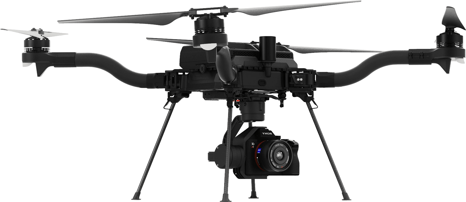
Freefly has been the industry leader for producing high-performance and efficient drones for over a decade, building a reputation in the TV and film industry for building the toughest drones. Made in the USA, the Astro is the latest commercial mapping drone in their fleet created for accurate and high-resolution data capture. Equipped with multi-band RTK system the Astro gives centimeter level precision rock solid position hold.
It’s a powerful drone platform, built for our Enterprise and Industrial partners. Freefly designed the Astro from the ground up to achieve the perfect blend of efficiency, agility, and reliability while keeping the pilot workflow simple and fast. Combining a purpose-built mapping drone with the most advanced drone mapping and geospatial analysis software creates a complete solution for your organization’s drone program.
Astro’s software integration is powered by the Auterion ecosystem, built for enterprise that makes large-scale drone operations simple, safe and fully integrated.
A Powerful Partnership
Flying the Astro with ArcGIS Flight allows you to have a complete picture of your projects with high resolution and accurate imagery, using repeatable flight plans that ensure high-quality data capture.
When planning your flight choose from a variety of flight modes tailored to the type of site being scanned, and the app will automatically define the optimal flight path and allow you to preview it in 2D or 3D. Experienced pilots can use Terrain Follow with their Astro, which enhances imagery quality by adjusting the drone’s height to follow the terrain.
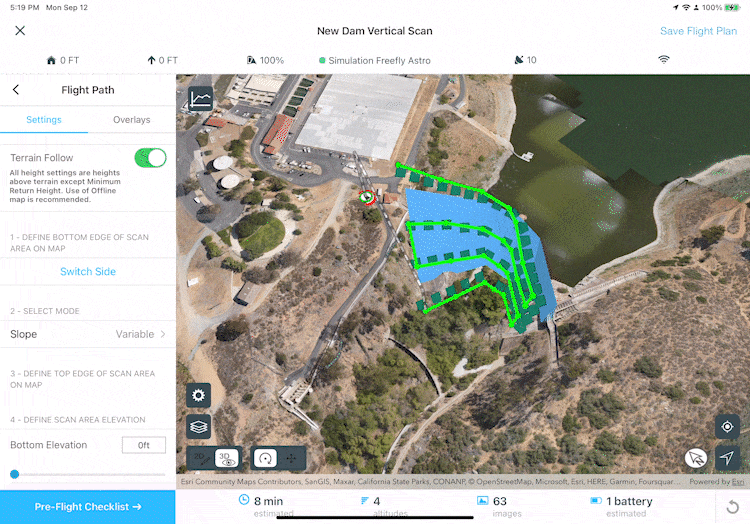
After completing your preflight checklist, the app automatically conducts aircraft checks and executes the flight. Long flights are automatically split, allowing you to change your drone’s battery and resume where you left off.
ArcGIS Flight is connected to the Site Scan for ArcGIS and ArcGIS Online, allowing you to import base maps, saved flight plans, overlays, and previously captured orthomosaics for precise flight planning. Use your ArcGIS Online credentials to log in to Site Scan for additional security benefits, such as leveraging your organization-specific login method.
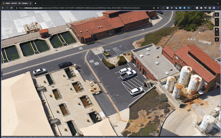
After completing the flight, wirelessly transfer the images to your iPad and upload them to Site Scan for ArcGIS to securely process your data in a scalable cloud environment. The accurate and high accuracy data captured with the Astro combined with the Site Scan processing engine, creates 2D and photorealistic 3D imagery products that can be quickly shared throughout your organization, on any device. Creating these products with Site Scan can help you update your imagery basemaps, generate detailed 3D meshes to serve as the foundation for a digital twin, and share reports to your stakeholders in formats you need. With the press of a button, your data is available throughout the ArcGIS system, on-premises or in the cloud, to perform and automate advanced analytics such as object detection with ArcGIS Image Analyst. Easily integrate your drone imagery with building information modeling (BIM), lidar data, real-time Internet of Things (IoT) data, and more.
In an upcoming release, the Astro will be fully supported in Site Scan’s Fleet Management to keep track of battery health, and flight history.
Read this article for more information on how to connect your Astro to ArcGIS Flight.
To learn more about Freefly Systems, check out their Esri Partner listing.
Please share your ideas for future enhancements and questions in the Site Scan for ArcGIS community page, and to stay up-to-date on all things Site Scan make sure you’re subscribed to our newsletter.

Article Discussion: