July 15, 2021 | Multiple Authors | Analytics Shade equity – Determine tree planting locations with suitability analysis
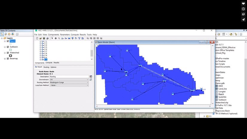
March 23, 2021 | Caitlin Scopel | Water HMS-PrePro: An Automated GIS Toolbox for Extracting Cloud-based Data, Delineating Watersheds, and Calculating Hydrological Parameters
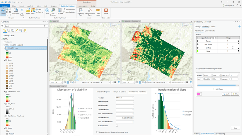
August 12, 2020 | Kevin Johnston | Analytics The new Suitability Modeler: Changing the way suitability models are created
July 29, 2020 | Michael Dangermond | Natural Resources Is Georgia still the Peach State? Getting crop statistics for the USA using ArcGIS Living Atlas.
July 2, 2020 | Multiple Authors | Announcements Spatial Analysis and Data Science at the 2020 Esri User Conference
May 28, 2020 | Dawn Wright | Announcements Esri Joins Microsoft-GEO BON Biodiversity Grant Initiative
April 30, 2020 | Adam Martin | Sharing and Collaboration Save Time on Advanced Analytics – ArcGIS Open Platform Series: Part 4
April 10, 2020 | Carsten Bjornsson | Health and Human Services Authoritative COVID-19 information and not violating patient rights—Can we do both?
February 11, 2020 | Drew Faherty | Imagery & Remote Sensing Unmixing Dirt: Mapping Ancient Lakes in the Desert
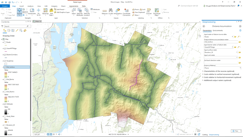
February 6, 2020 | Juan Laguna | Analytics What’s New for Spatial Analyst and Raster Analysis in ArcGIS Pro 2.5
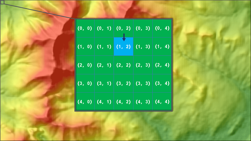
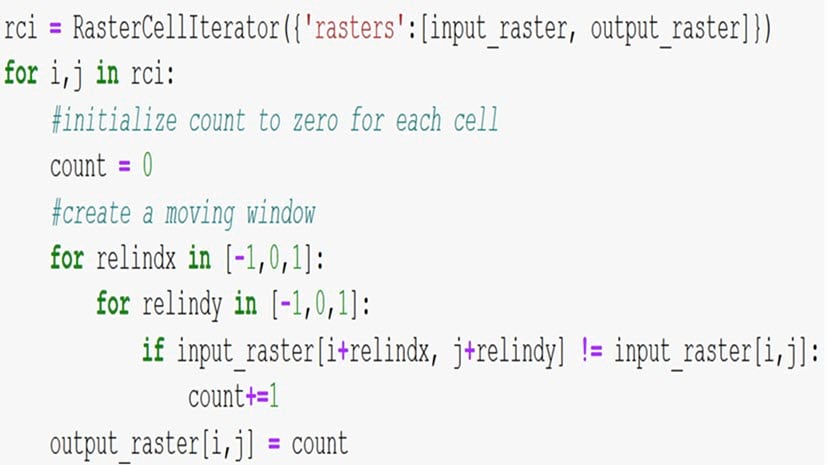
February 6, 2020 | Multiple Authors | Analytics Unleash the power of RasterCellIterator to perform custom raster analysis
July 8, 2019 | Juan Laguna | Analytics What’s New for Spatial Analyst and Raster Analysis in ArcGIS Pro 2.3/2.4 and ArcMap 10.7
May 6, 2019 | Multiple Authors | Analytics Introducing the new resolution preserving cell size projection method
July 20, 2018 | Juan Laguna | Analytics What’s New for Spatial Analyst and Raster Analysis in ArcGIS Pro 2.2 and Desktop 10.6.1.