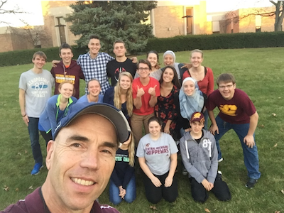
About the author: Mark Francek is a Professor of Geography at Central Michigan University and teaches courses in physical geography, soil science, and environmental studies. In 2016, Mark was awarded the College Teacher of the Year from the Michigan Science Teachers Association. Mark is a passionate believer that the best science instruction grows out of building classroom community, holding students accountable for their learning, and showing students the relevance of science to their everyday lives.
_______________
After seeing the wonderful potential of Survey 123 for ArcGIS and Esri Story Maps at the 2018 Esri Education Summit, I wanted to give both a try in my Physical and Environmental Geography classes here at Central Michigan University. Students responded well, grateful to “do science,” collecting environmental data in the field through Survey 123 and expressing their creativity through the interactive maps, video, imagery, and web pages of Story Maps.
That said, there were a handful of lessons learned along the way that, had I known then what I know now, would have made bringing these technologies into the classroom even easier. Here are my 10 tips—some specific, some general, some easier to implement than others—to make your run with Survey123 and Story Maps as smooth as possible.

Quick and easy things to get right
1. Create meaningful, unique file names
Naming creations like “Map 1”…”Map 2” are easily forgotten, can be confusing, and aren’t that descriptive—requiring files to be opened to discover the content within.
2. Turn off Wi-Fi when collecting with Survey123
Once leaving the confines of the classroom, Wi-Fi won’t allow students to collect data at actual collection points. Instead, points will cluster only where the Wi-Fi signal can reach. Rely on students’ provider signal instead.
Fine-tuning your instructions
3. Provide step-by-step directions with icons
How much detail do you provide when writing exercise directions? When I surveyed my students with this question, they clearly preferred step-by-step directions with screenshot icons. Use Esri’s Teach with GIS lessons as a guide for how to structure a lesson.
4. Scaffold instruction
I jumped into Story Maps and Survey 123 without giving students the chance to fully explore basic ribbon icons, the relationship between scale and map detail, filtering; and, more generally, how to explore, create, and share maps. Consequently, at the end of the semester I was answering basic questions on map creation instead of helping students synthesize spatial
A better approach is to first provide guidance for navigating and zooming, adding basemaps and layers, and then move on to modifying symbology. Once students have a grasp of these skills, proceed to querying attribute tables and creating web apps.
5. Zoom to proper scale
So you are not constantly having to pan and zoom to the students’ theme coverage, provide guidance on how the map’s scale will look to readers. In my exercises students were usually applying Story Maps and Survey 123 at the county level; yet, when I went to evaluate their work, some maps opened at the state or even continental scale of resolution forcing me to pan and zoom to the students’ study area. In Story Maps, this involves saving a custom configuration on the main stage menu instead of the map default. In Survey 123 this simply involves saving the map layer at the scale of resolution.

6. Train in map search techniques
Esri’s ArcGIS Living Atlas of the World alone contains more than 8,000 quality, curated maps. With so much to choose from, though, students often struggle to find the best map. Point out that search results can be filtered by maps or layers, recency, location, popularity, and more.
7. Challenge students to read directions
Some students would rather you solve their problem than having to read the directions. Most of us would like to think of ourselves as helpful and empathic instructors but we should also harden ourselves in pointing students to specific sections of the exercise where “the answer” can be found. Therefore, directions need to be easy to follow (see the next tip) and reviewed before distribution. Knowing where to find specific instructions in an exercise can be tough if you wrote it months ago!
8. Allow students to critique your exercise directions
Ouch! Students can be brutally honest in pointing out directions left out, placed in the wrong location, or repeated unnecessarily. This remains, however, the best way to improve your exercises’ clarity. Offer extra credit for this assessment. Better yet, make this a required question on all exercises.
Go beyond the classroom
9. Use GIS from day one
Sure, Survey123 and Story Maps tap higher order learning skills like evaluation, analysis, synthesis, and creation—but they’re also great icebreakers for the first day of class. Have students slide the location pin in Survey123 to their neighborhood or hometown and analyze the resulting pattern. Gauge students’ preference for restaurant type, use of social media, pets, and other questions to illustrate the uniqueness and commonalities the class shares.
10. Show the relevance of GIS to students’ lives
Always tie GIS techniques back to students’ majors, employment potential, and how GIS can provide useful information about one’s hometown of neighborhood. Require students to write on how they could incorporate Survey123 and Story Maps into their future major or work. What better an opportunity to showcase how useful GIS is to our everyday lives!
_______________
Any of the tips outlined above will ease your transition into using Survey123 and Story Maps. There are some—like tips 4, 6, and 8—which require more planning, but these are also more likely to yield a greater course impact. Of all the tips, showing the relevance of GIS to students’ everyday lives will yield a more focused, motivated class. But regardless of where you start, don’t be overwhelmed. Pick one tip, then another, and soon, you’ll be on your way to unleashing the analytical power of Survey123 and Story Maps!


Article Discussion: