Find a partner
Esri’s global partners help you leverage ArcGIS technology. They support customers through their knowledge and expertise, solutions, implementation services, and dynamic content across every industry.

Unlock the full potential of GIS
Discover a global ecosystem of partners delivering GIS and location intelligence

Choose from Esri's top-tier partners who are highly engaged and aligned with ArcGIS technology
Esri partners have earned specializations in various industries, such as state and local government and nonprofit organizations. They have also earned specializations based on their proficiency in different capabilities, such as indoor GIS and parcel management.
Partners with specialties demonstrate an ongoing dedication to enhancing location-based insights for their clients, and many customers actively search for Esri partners with these recognized skills.


Discover the value of the Esri and Microsoft partnership with ArcGIS spatial analytics capabilities natively integrated in Microsoft Fabric. Be empowered to analyze critical events, identify optimal locations, and more—all within a single, unified platform.
Learn how Esri partners help customers with innovative GIS-based solutions for a gas utility and two counties, enhancing workflows to streamline operations and fix data inaccuracies.
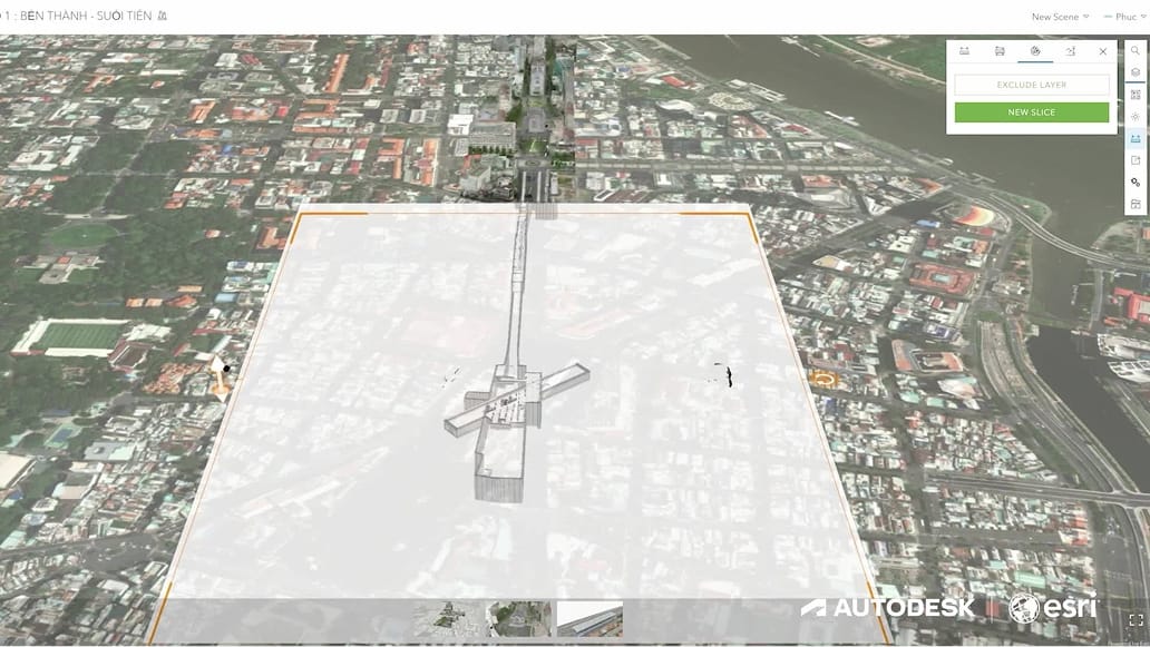
Discover how Portcoast shares the crucial role of ArcGIS and Autodesk Construction Cloud in the planning, maintenance, and design of the metro line in Ho Chi Minh, Vietnam, and Portcoast's future work to extend the metro line to 183 kilometers by 2035.

Learn how Esri partners help utilities and cities implement GIS for a range of needs, from streamlining operations and asset management to monitoring and being proactive about network management to make the most of their GIS implementations.
Connect with us to find out how you can reach your business goals with Esri, the global market leader of GIS mapping software and location technology