
ArcGIS Solutions for broadband outreach
Use these ready-to-deploy enterprise solutions to identify and analyze demographics, understand neighborhood broadband coverage, and optimize plans for broadband infrastructure.
Apply GIS to broadband expansion efforts using federal funding
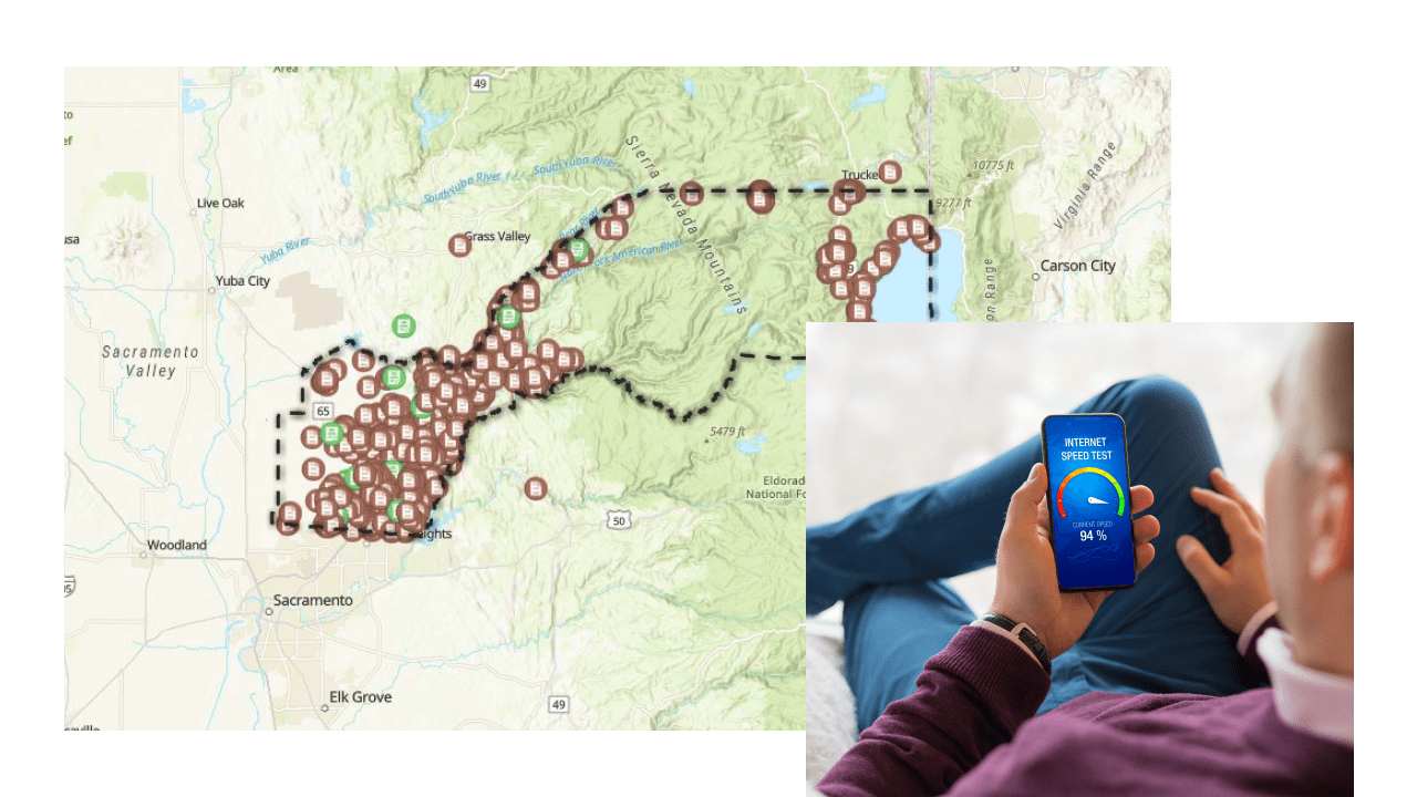
To truly address broadband needs, you must first establish a baseline for current service levels; understand specific business, resident, and student needs; and identify where there is lack of service, unreliability, or unaffordability. Use GIS tools to identify service levels through accurate data collection from residents. Then validate reported internet coverage and speeds for a better understanding of current service across the community.
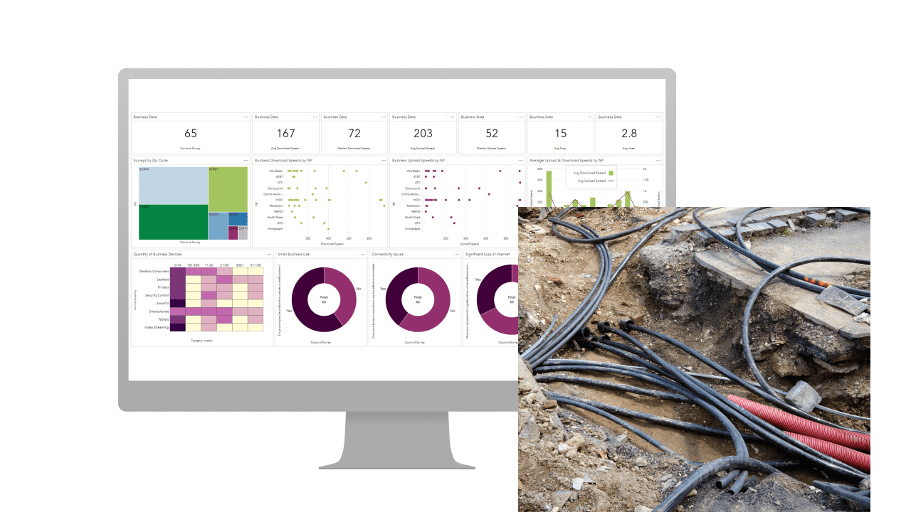
With advanced GIS analytics, you can identify statistically relevant areas to allocate resources, whether it's a business corridor, a neighborhood of K–12 students, or another critical region. After identifying priority areas, quickly present service providers with projects that increase customers, coverage, and profits while also addressing community concerns about speed, access, cost, and equity. A strategic plan and public-private partnership can help support and strengthen applications for broadband funding.
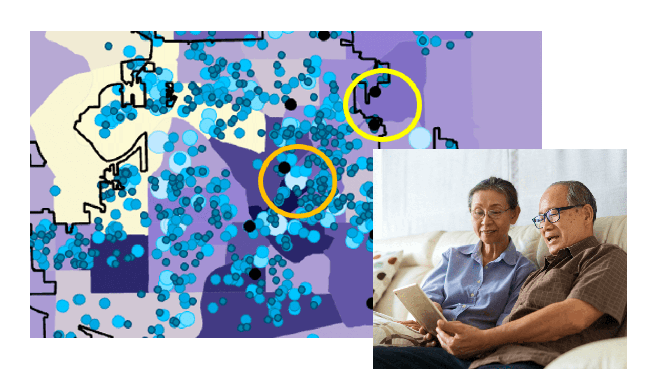
As communities work to expand broadband coverage and promote economic mobility, each investment decision needs to incorporate equity considerations. GIS analytics and social equity tools can help identify priority populations and where gaps in broadband coverage occur so that investment can be prioritized in underserved and unserved communities.
Governments may not be the service provider, but feedback and concerns from residents often come directly to you. Better communicate your plans and activities to improve service levels with information hubs. Showcase performance dashboards of service-level improvements across the community as you build relationships with new providers and expand service. Use mobile survey tools to solicit feedback and validate coverage and speed from residents and businesses directly.
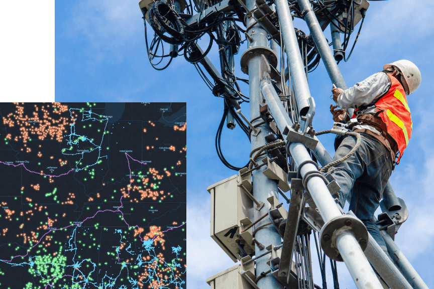
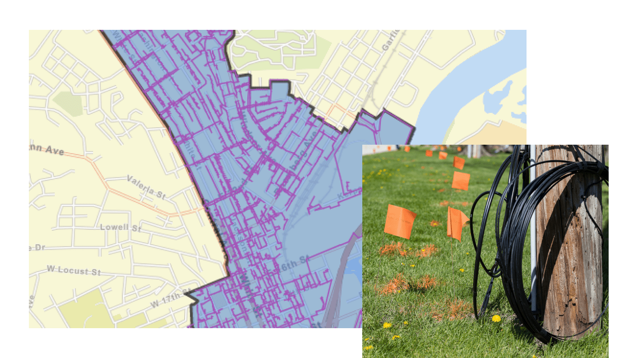
With an influx of broadband funding and infrastructure investment in communities across the nation, a geographic approach is essential to right-of-way management. To effectively plan broadband expansion projects, facilitate acquisition of property or analysis of existing rights-of-way, and improve coordination with stakeholders, organizations must have rights-of-way mapped and managed in GIS.
Esri technology supports broadband expansion efforts.
Use these ready-to-deploy enterprise solutions to identify and analyze demographics, understand neighborhood broadband coverage, and optimize plans for broadband infrastructure.
Understand community characteristics, analyze community conditions and actions, and generate an equity analysis index that can be used to educate internal and external stakeholders.

Work with internal and external stakeholders, acquire and analyze input, track the progress of initiatives, and improve community outcomes with accountability and transparency using this focused, initiative-driven community engagement software as a service.

Present data and analytics on an intuitive and interactive screen to visualize trends, monitor status in real time, and inform stakeholders.
Recent federal funding includes the largest investment in broadband deployment and expansion, with billions of dollars available across multiple new or hyperfunded programs.
This grant provides funding for the construction, improvement, or acquisition of middle mile infrastructure to reduce the cost of connecting underserved areas to the internet. Applications close September 30, 2022.
Apply nowThe National Telecommunications and Information Administration (NTIA) will fund more than $47 billion across four main programs that focus on equity, access, and middle mile.
More on NTIA fundingThis US Department of Agriculture (USDA) grant program provides funds for the construction, improvement, or acquisition of facilities and equipment needed to provide broadband service in rural areas.
More on this program
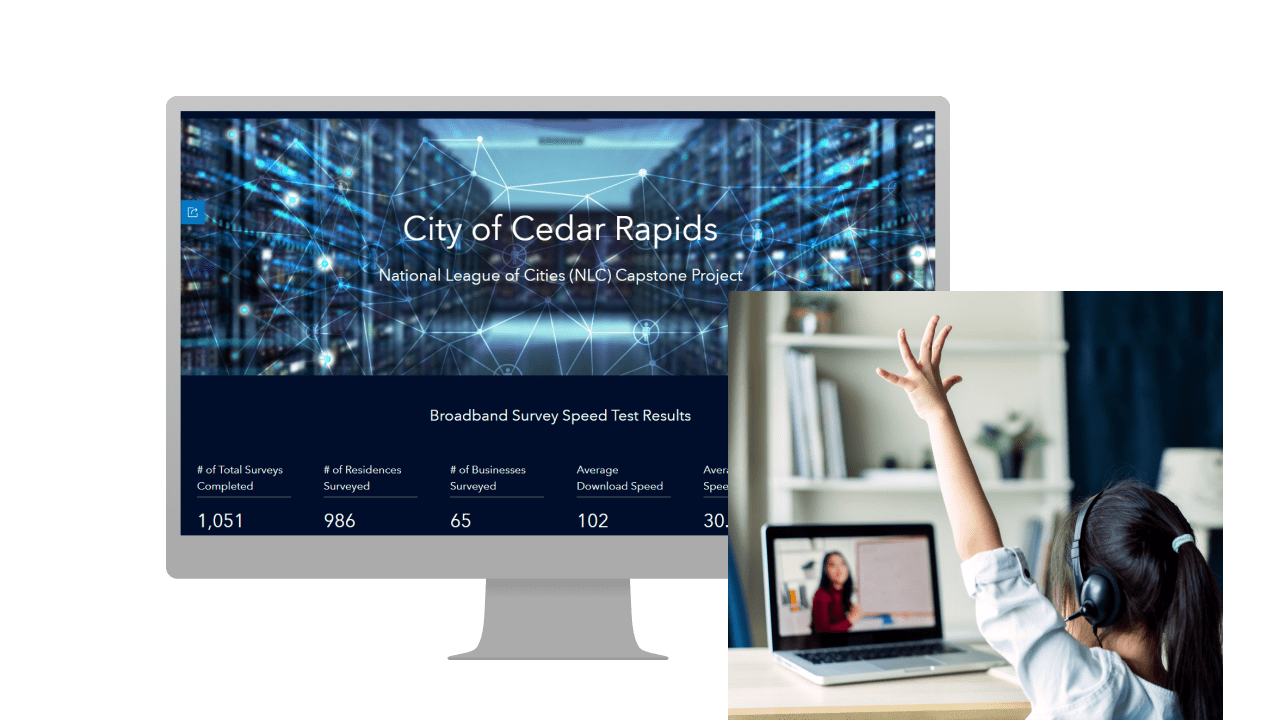
Local leaders surveyed residents and used advanced analytics to identify a project area, partner with providers, secure funding, and fast-track local broadband investment.

In a National League of Cities project, Esri worked with three cities to validate data and implement solutions that helped them better understand community needs and plan broadband expansion.
To better understand the community's needs and identify gaps in service, the county used crowdsourcing tools to collect data and engage residents.

Spatial analysis helps two of the country's largest school districts examine the digital divide and provide resources to low-income students when they were forced to study from home.

The Public Service Commission of Wisconsin is breaking down barriers to broadband access. Staff are using GIS to compile authoritative and useful data to see where allocation of resources would have the most impact and empower all residents to reach their full potential in work, business, education, and more.

State leaders in Ohio are taking steps to bridge and close the digital divide, starting with an accurate picture of broadband access. With GIS technology, Ohio has increased insight into community needs and developed a comprehensive broadband strategy—especially for underserved and disadvantaged communities.
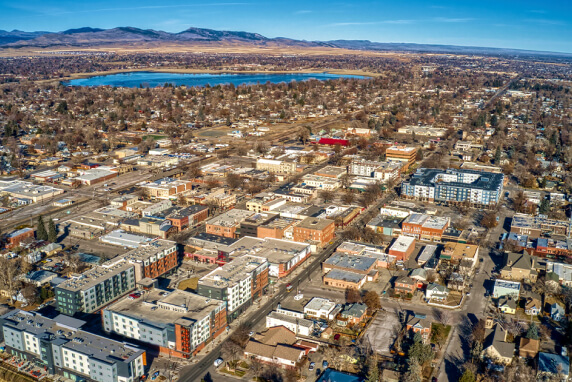
In one year and with ArcGIS as a foundation, Loveland, Colorado, partnered with Schneider Electric to build a new fiber provider's infrastructure from scratch.
Explore how Esri technology aligns with other funding objectives.