Last week’s Infrastructure Management and GIS Conference (IMGIS) featured demonstrations of new Esri ArcGIS products, ArcGIS user presentations, and live round table and special interest group discussions. A re-occurring topic in many of the sessions held was centered around NextGen network management and the build-out of communications infrastructure. It started with the conference plenary led by Esri’s Jack Dangermond who outlined a vision of GIS being at the heart of the digital twin. GIS is uniquely positioned to not only manage the location of assets, but interconnect and model physical networks in a digital world, while providing real-time asset updates.
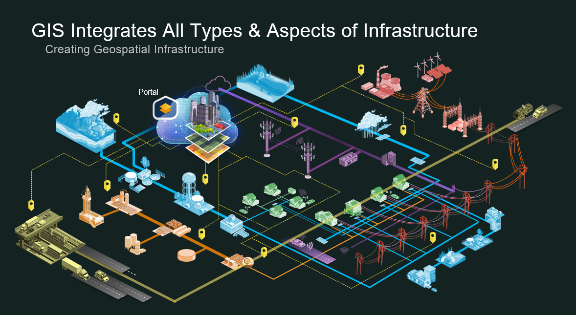
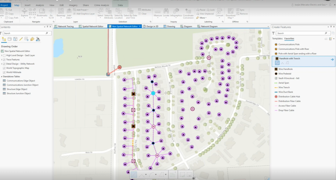
The theme of multi-domain infrastructure management and building a GIS digital twin continued throughout the week. The telecommunications industry keynote highlighted the business value that a complete GIS platform for PNI can offer when that platform supports fiber, copper, coax, and wireless assets all in one network management platform. During the keynote, new Esri technology was showcased for managing communications networks using a lightweight, quickly to deploy, hosted cloud solution, as well as a complete, enterprise managed, network management solution that leverages the new ArcGIS Utility Network Management product. These two Communications Data Management solutions will be officially released next Tuesday, November 10th.
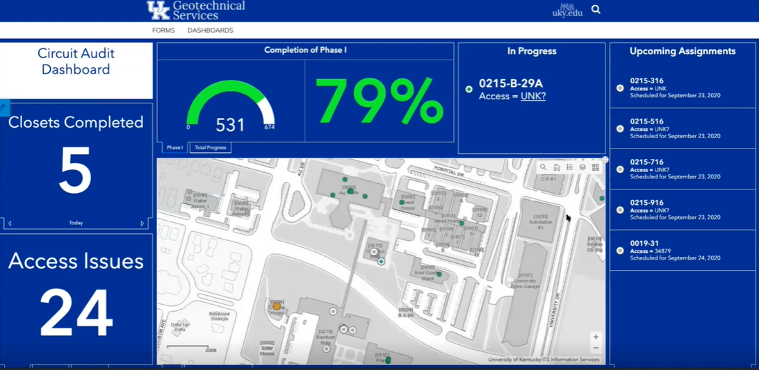
The University of Kentucky also shared their experience of using Esri’s ArcGIS to manage their communications campus infrastructure, and showed how they are using ArcGIS as a system of engagement to easily share network build-out information to campus staff.
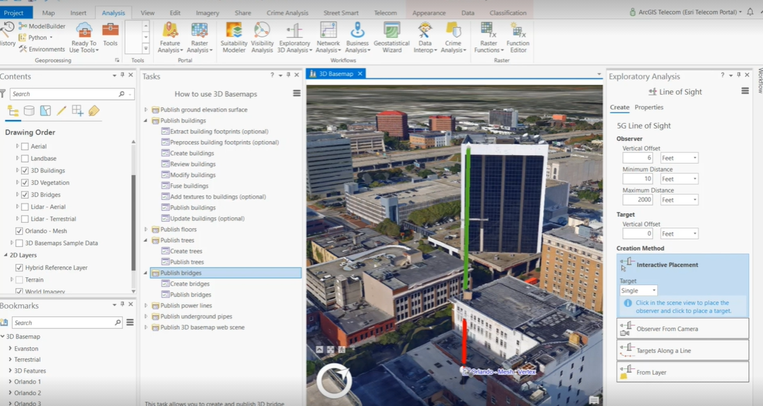
Finally, the keynote highlighted the ease to create and manage 3D GIS data being used to plan 5G networks. The technology demonstration also showcased new line of sight 3D analysis tools within ArcGIS.
After the keynote, many technical sessions, user presentations, and panel sessions were held. NextGen network management solutions, tools, and ideas were on display in the Configuring Apps for Telecom Workflows session, the Getting to Know the Utility Network for Communications session, and the Spatial Analysis for Telecom session. ArcGIS users and GIS professionals from Comcast, TDS, ADP Resources, ATMC, City of Loveland, Midco, American Tower and HTC all shared the different ways they were using ArcGIS to solve business challenges, ranging from; COVID-19 and disaster response, to network management, to field operations, to planning and engineering, and market analysis.
And finally, one my favorite highlights of the week was an Executive Leadership Forum which featured Jennifer Petit, Senior Director at WOW!. Jennifer discussed how WOW! implemented a geospatial strategy and used ArcGIS in a service qualification tool which netted a 300% ROI in the first year of implementation.

Overall, while not a traditional in-person conference, it was another great Esri conference for the GIS community in telecommunications. Sessions are available to be re-watched for those who have previously registered for the event and be sure to check the new NextGen network management solutions being released next week.
Have questions, comments, or feedback about the event? Please get in touch with us at telecominfo@esri.com.