A state health department uses federal funds to develop a statewide recreation database
A question I’m often asked is “Is there federal funding for my GIS?” The short answer is yes!
The more complicated answer is that you won’t be able to search “GIS” to find it. However, you will be able to find grants that support your organization’s mission. Additionally, the language of the grant requirements can be key to aligning your GIS use with the purpose of the grant. For example, many grants have language around “data-driven decision making”, “stakeholder collaboration”, “equity and transparency”, “public engagement”, “innovative research” and more. These are all supported by GIS. Consider too that the goals that these grant programs seek to achieve require inter-agency and inter-departmental cooperation, paving the way for greater understanding and adoption of an enterprise-wide GIS system.
When I worked for the State of Tennessee in their Department of Environment and Conservation (TDEC), we were just getting a park-wide GIS off the ground. One of the datasets that was in the highest demand was a trails dataset for the entire state. Every five years, the State Comprehensive Outdoor Recreation Plan was reviewed and revised. In order to reach communities and gather information about their recreational assets, a spreadsheet was sent out. These spreadsheets didn’t provide a trail or greenway track, and the information that it did provide was often incomplete and inconsistent. This meant that someone was stuck with translating and synthesizing this information into a single source before any analysis or planning could ever be done, without any way to identify community gaps.
Out of the blue one day in 2017, John Vick with the Tennessee Department of Health gave me a phone call asking about a state-wide trails dataset. They had an idea to be able to provide a website where doctors could query a database of trails for their patients and “prescribe” them exercise based on their needs, accessibility, and physical abilities.
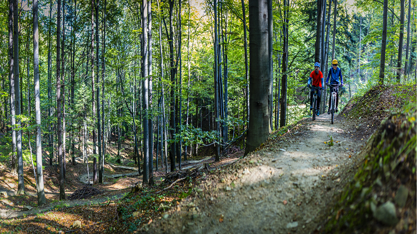
According to County Health Rankings, 36% of adults in Tennessee are overweight or obese, and 24% of adults don’t participate in recreational physical activity. For high-schoolers, the rate is even higher at 38% who are overweight or obese. While Tennessee boasts incredible outdoor recreation opportunities, it can be difficult to know where to go or what you might be getting into when you get there. It is also difficult to know what’s closest to you, immediately. While there is at least one state park within an hour’s drive of every Tennessean, what about within a short walk? The greenways or city and county trails? And are there disparities between who has access to outdoor recreation and who doesn’t? While I was in love with the idea, I had a well-practiced script about the limitations of the existing dataset, but I agreed to participate in the first roundtable discussion. In addition to lengthy discussions on what “defines” a trail or greenway, we also discussed logistical challenges to collect the data. These included a lack of person power to collect the spatial information, and communities that lacked the resources for GIS tools. I proposed using an ArcGIS Hub that would allow us to provide these tools to volunteers and to have a built-in schema so the data would come to us clean. Yet, we still didn’t have funding – the biggest logistical issue of all.
On that day in 2017, we had no way of knowing that a global pandemic was around the corner and that John’s question and interest was about to be more relevant than ever. Through the years, the group worked on the concept for the trails database, but again, funding always remained elusive. When the pandemic hit, one of the earliest things we understood was related to risk factors for hospitalizations and deaths related to COVID-19 – which included obesity. Suddenly, Vick had an “ah ha” moment.
“We wanted to look way upstream and identify these risk factors [for COVID-19] and find solutions to mitigate them,” said Vick. “Addressing obesity, heart disease, and other chronic conditions are important for preventing severe cases of COVID. We also know that parks and other outdoor spaces were a lifeline for people during the pandemic, giving them a way to stay active, support mental health, and safely be around their family and friends.” His original vision for the database was suddenly rooted in an immediate, global emergency.

Vick turned to the CDC’s COVID Disparities grant, funded through the 2021 Coronavirus Response and Relief Supplemental Appropriations Act. The grants provide funds to states to specifically reduce health disparities related to COVID-19, and provides support to directly address these issues in communities that need it most. The goals were to discover where outdoor spaces for physical activity were lacking so they could help mobilize resources to increase access, provide a resource for communities to find places for outdoor recreation in their communities, and to promote their health benefits.

The TNDOH was collaborating with Tennessee Strategic Technology Solutions (STS) for technical implementation. The grant funding not only supplied STS with the funds to merge multiple data sources and develop a standardized geodatabase of parks, greenways, and trails for the state, but also supported the purchase of Esri’s Professional Services to help strategize, advise and prototype the initiative via ArcGIS Hub Premium. Now, in 2023, nearly 7 years after we first began discussing it, the Tennessee’s Trails Recreation Environment Community (TREC) website is about to be released this fall.
It would be a mistake to think that this is the final culmination of this journey, however. The TREC will be a living database, supported by a community of users throughout Tennessee. It not only supplies information on Tennessee’s recreational opportunities, but provides the tools that communities need to fill in gaps in the data. While the grant helped facilitate the purchase of the ArcGIS Hub Premium platform for this particular initiative, the fact that it can be used to deploy an unlimited amount of initiatives means that any Department throughout the State of Tennessee can benefit from the platform.

For trails, the data can be leveraged by any stakeholder, including TDEC, who are tasked with updating the State’s Comprehensive Outdoor Recreation Plan (SCORP) every five years. No longer scraping together excel spreadsheets that provide only a limited view across the state, TDEC now will have a dynamic, authoritative resource to pull from when assessing Tennessee’s SCORP. Not only will other state agencies benefit from this resource, but all Tennesseans seeking a more sustainable, healthier future.

There may not be a dedicated federal fund for GIS, but there are numerous opportunities to align your GIS to program missions. Right now, through ARPA, the Bipartisan Infrastructure Bill, the Inflation Reduction Act and more, there are unprecedented funds that can be used to support outdoor recreation, conservation and environmental initiatives. The relationship between our environment, our economics and our social systems is more recognized than ever before, and GIS is uniquely positioned to see all three at once across a landscape. As GIS practitioners, we have a great opportunity to align our GIS needs with our program missions to take full advantage of these funds and to help create a more sustainable world.
Explore how GIS can support federal stimulus program efforts.