Every security professional understands that when critical risk events occur, time is a precious commodity. In the early phase of an emerging disruption, every moment matters to ensuring workforce safety and security, as well as the continuity of critical business operations. Security operations centers (SOCs) quickly mobilize to analyze the situation and help their stakeholders make an informed decision on how to respond, leaving no room for delay. I’ve experienced this firsthand many times, but one memory stands out. In 2024, having a few extra hours helped get my team and me out of a devastating hurricane’s pathway.
In September 2024, I was supporting a security conference in Orlando, Florida. Trust me, the irony of having a gathering of risk professionals in Florida during hurricane season is not lost on me. When I arrived in Orlando on Friday evening, everything was going smoothly. My team was in transit without disruption, our EXPO booth was being built without issue, and the weather forecast looked great. By Sunday afternoon, all of that had changed.
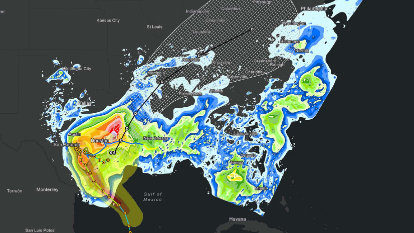
Early Sunday morning, I was meeting with a teammate of mine who has a background in meteorology. We were pulling up our demos for the show, reviewing the pre-conference briefings for our colleagues, and talking about the football game we were inevitably going to watch later that day (my Seattle Seahawks were facing off against his Miami Dolphins). Just before we left our booth, he pulled up a radar feed and got quiet. He called me over and pointed to what looked like just an amorphous blob to me, but it was in fact a hurricane forming in the Gulf.
Being in the risk space, we both knew that there was a lot that could happen over the course of the following days; everything from absolutely nothing to complete catastrophe. It’s in those early moments that risk professionals have time, but not direction. We kept an eye on the storm (pun intended) and watched our game. Thankfully, the Seahawks won to my colleague’s chagrin, but unfortunately, by the end of the game the storm was only gaining strength and shape.
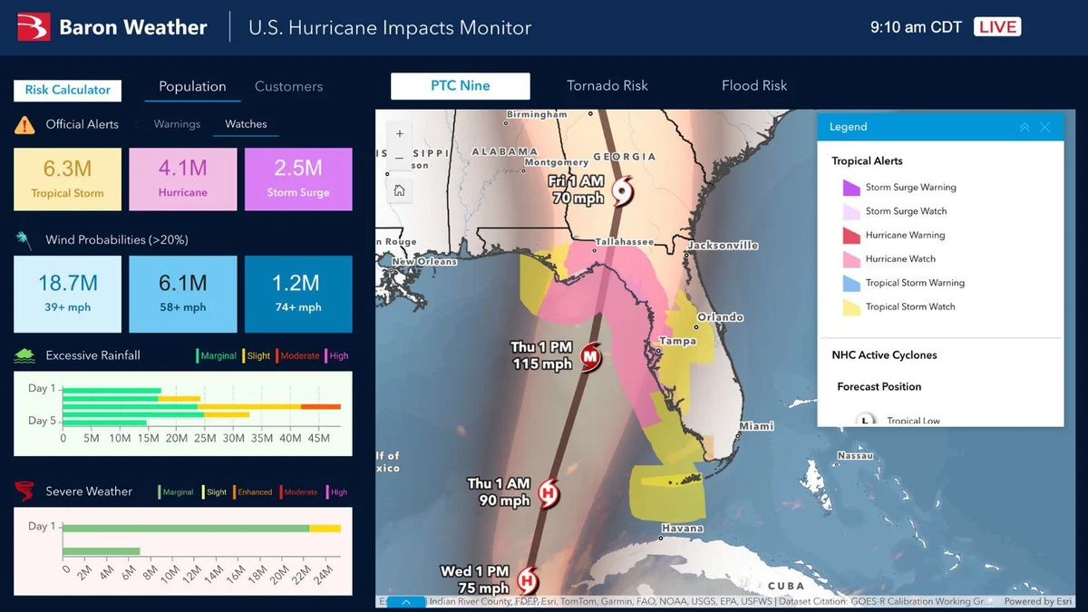
The next morning, news coverage began covering the forming hurricane, which was named Helene. Even with the name, the ultimate path was uncertain, except to one group. My colleague had been working with a new Esri business partner, Baron Weather, which has specialized in severe weather modeling and forecasting for the past 40 years. To our surprise, Baron Weather was forecasting that Helene would head northeast, with Orlando falling in the cone of uncertainty.
Although Orlando is nearly 200 miles from the coast, I knew there would be safety considerations for my team. Flooding was still a very real possibility, and regardless of the final storm path, it would likely impact flights and potentially leave us stranded. Knowing my colleague’s confidence in the team at Baron Weather, I made a quick decision to rebook travel for my team to leave that Wednesday, a day earlier than intended.
Over the course of the week the storm took shape, and the storm proceeded to follow the Baron Weather predictions, with a slight western trend to our luck. Throughout the conference, the Baron Weather feed was on every Esri monitor, and attendees would step away to make calls to their airlines for new flights after looking at the forecast. By Wednesday morning, Helene was being covered by every major news outlet and communities around Orlando were hunkering down.
Although the airport in Orlando remained open, several airlines had announced delays and cancellations due to Helene as expected, including my original flight scheduled for Thursday morning. As I boarded my contingency flight Wednesday night, the captain announced we would be flying through the front of Helene, barely avoiding the most severe parts of the storm. After 60 minutes of exceptionally bad turbulence the plane was past Louisiana, the fasten seatbelt sign was off, and I breathed a sigh of relief knowing my team and I would be getting home that night.
Although I had acted quickly to assess the risk and execute contingency plans, I know firsthand that a decision is only as good as the intelligence that is supporting it. Baron Weather specializes in advanced modeling and forecasting for severe weather events and was designed to support operational decision making. Unlike freely available weather feeds that provide a general overview of weather, the team at Baron looks to provide hyperlocal weather intelligence that shows the precise impact of a peril. This enhanced situational awareness proved to be invaluable as I made the decision to get my team out of Helene’s path.
Today, Esri has expanded the use of Baron Weather’s feeds, utilizing them in our SOC to better monitor, assess, and analyze emerging events that may impact our operations. From assessing facility readiness to understanding where our travelers are in relation to emerging threats, weather intelligence has proven to be a vital element of our own situation awareness.