Retailers are facing a significant increase in criminal activity in and around their stores. Organized Retail Crime (ORC) activity, unprecedented levels of shoplifting, and an escalation of violence in the commission of crimes. Customers and team members report feeling unsafe in stores, and retailers are limiting hours or closing stores to mitigate their losses and protect their employees. In 2022 alone, the National Retail Federation reported that the Retail Industry has lost $112 Billion due to criminal activity.
I recently had an opportunity to attend an event focused on retail crime and loss prevention at the University of Florida, the home of the Loss Prevention Research Council (LPRC). What made this event unique was the singular purpose of the attendees- to discuss new and innovative solutions for retailers to proactively react to criminal activity and mitigate its impact on their businesses. The attendees were from across the spectrum of retailers, law enforcement, and solutions providers.
While theft and shortage are huge issues, the concern for their team members and customers’ health and safety is paramount. ORC attacks tend to be more violent than typical shoplifting, and every executive I talked to is deeply concerned about safety. According to the National Retail Federation, 67% of retail employees said they were witnessing more violence and aggression from bad actors in their stores and did not feel safe at work.
Retailers are responding. In some cases, they have closed stores where personal safety or losses due to theft have impacted their business to the point they can no longer operate profitably. For many neighborhoods, losing a pharmacy or grocery store is more than just inconvenient; it leaves residents without access to the goods and services they need. In other places, retailers have cut store opening hours or put products behind security barriers, requiring store employees to unlock the fixture to access the product. This significantly increases the cost of handling these products while, at the same time, depressing sales. Studies have shown that these barriers result in a 30% decrease in sales.
The current situation is not sustainable.
Shrinkage, or “Shrink,” is the term retailers use to describe the gap between their expected inventory, or that inventory in their stores and supply chain, and what gets sold at retail. While there are several causes of shrinkage, theft is a key one, and that is what I am referring to here.
The LPRC and the Bowtie
The LPRC, as an academic institution, is at the forefront of research on retail crime. Dr. Read Hayes and his team in Gainesville have spent years working with retailers and law enforcement to understand patterns in criminal behavior and retail. Their study of the types and locations of incidents in and around their stores has enabled them to identify ways to mitigate the impact of crime, create safer stores, and not negatively impact the shopping experience for the customers. With each event documented, the scientists at the LPRC capture as much data as they can: where it occurred in the store, what time of day, how busy the store was, what kind of activity happened, was it a theft, assault, vandalism, and finally what as the outcome. Were the bad actors apprehended, or did they get away? Do they think they are repeat offenders, or was this a one-off attack?Their model analyzes the data to find patterns in these bad actors’ behavior.
The research has led to the development of the “Bowtie Model.”
At the center of every bowtie is a knot. The “wings” of the bowtie extend to the left and the right. In this model, the knot is the actual event, the theft or assault. This is the “bang,” to use the industry jargon. Left of Bang are those activities that the retailer does to anticipate and mitigate the event, things they can do to deter a criminal from attacking that location. The Right of Bang are the activities the retailer does after the event. These involve activities that support recovery, prosecution, and future prevention.

Using Location Analytics to support the Bowtie
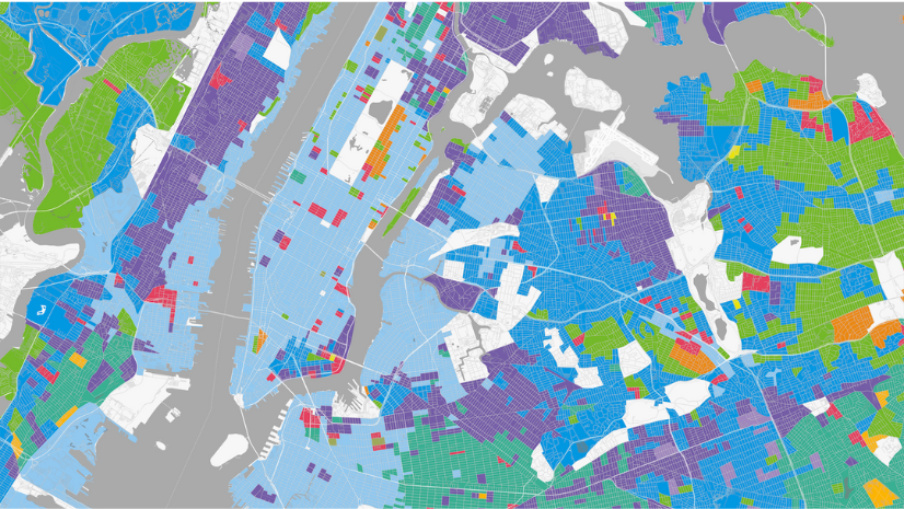
Retail is a location-centric business. While this applies to product placement, distribution, and marketing, it also applies to crime. While it’s true that specific locations are more prone to crime, it is a mistake to assume that this problem is limited only to certain areas or neighborhoods. Criminals, primarily organized criminal gangs, seek opportunities to maximize their “profits” while minimizing risk. In a shocking example from Walnut Creek, California, a highly organized gang of criminals attacked stores in one of the country’s most expensive shopping centers. Retailers have to have an enterprise approach to crime prevention.
Like every location-centric business, ArcGIS has a significant role in helping retailers mitigate the impact of retail crime on their operations before, at, and after “bang.” It allows them to create operations centers and dashboards that will enable them, through a geographic lens, to see their network’s health and current situations.
Pre-Bang: Operational Awareness and Prevention
Understanding patterns in criminal activity allows retailers to implement strategies that can help dissuade bad actors from attacking a location. This has been the case for years. Retailers have a lot of experience changing store designs to make it more difficult for individual shoplifters to steal high-demand items. Using indoor mapping technology and human movement data, they can be even more precise about where to place items in the store and what fixture configuration provides customers with easy-to-shop fixtures while at the same time making it more difficult for a criminal to attack that location. Using location data, they can see how fixture and product placement can influence store traffic, making it more difficult for criminals to go unnoticed when they slip items into a bag or pocket.
Geospatial dashboards are critical for monitoring network health and quickly reacting to criminal activity. They provide operational awareness for organizations by giving users a geographic view of their enterprise in the context of whatever triggers or conditions are important for the retailer. This can be things like known bad actors entering a store or a real-time alert of an event nearby that might have implications for other locations. For example, if a criminal has a pattern of hitting several stores along a highway, triggering an alert based on geographic proximity when they start a spree could allow other locations to take measures to deter a repeat event in their stores.
These alerts and analyses aim to deter people from making bad choices by changing these behaviors’ risk/reward equation.
At Bang: Document and Record- Create an Authoritative System of Record
When an event happens, regardless of its scope and size, it is critical that retailers capture as much data as they can about where, when, and how the attack occurred. Even seemingly innocuous events should be documented and recorded. Simple things like not scanning a few times at a self-checkout kiosk, when considered singularly, may not add up to much. However, looking at these events more broadly, the impact on a retailer’s bottom line is significant. By capturing this data, retailers can find patterns in these activities. These are patterns that can inform strategies and tactics to help mitigate the impact of theft on their bottom line and, at the same time, improve overall customer service. This might mean more intuitive self-checkouts or additional staff to assist customers in high-risk areas of the store.
Having an authoritative system of record of these events helps investigations and recovery and helps law enforcement better understand how criminals operate in each jurisdiction. When you include incidents like in-store accidents or events in the parking lot, analysis after the Bang can expose location-specific safety issues or even fraud cases.
ArcGIS allows users to capture details about an event in the context of where and when it occurred. Using tools like Survey 1-2-3, store teams can complete a quick assessment on their mobile device when they notice something. They can capture the specific variables asset protection teams are interested in, specific to a location anywhere on the property. This data is essential to understanding why things happen where they do.
After Bang: Support Recovery and Refine Tactics
After Bang, location technology and spatial analytics support investigations, provide insights about recovery and prosecution, and add more details about a specific event to an asset protection team’s data. These details are used to home in on patterns in criminal behaviors. ArcGIS can easily combine data from multiple, disparate sources using a location as an unstructured join. This enables retailers to find discrete correlations and patterns in that data. This is especially useful to help anticipate where and when the next attack might occur.
With each event, as more data is added to the record, more intelligence can be brought to bear against the bad actors. As this data is aggregated, more patterns will emerge, more intelligent models and more accurate triggers will be developed, and retailers will get smarter about predicting and mitigating attacks. Very soon, the application of artificial intelligence will help retailers and law enforcement find even more discrete patterns in crime data.
Building Smarter Tools to Increase the Risks for Bad Actors.
The LPRC aims to help retailers use data to react to the rising wave of crime in their stores. Their research enables retailers to build better tools to anticipate and mitigate crime, helping to keep their customers and team members safe and reducing the massive losses they are experiencing today due to criminal activity.
One of the key ideas is giving retailers a tool that can aggregate activities, even from different companies. Retailers who never engage with a competitor can find common ground when determining criminal activity. Criminals are not brand loyal. The bad actors who are attacking Macy’s are also attacking Nordstrom. Target and Walmart see the same ORC gangs in their stores, and their stolen merchandise is fenced on the same online marketplaces. The LPRC has done a fantastic job of normalizing retail crime data. They’ve built a categorization system that assigns a number of attributes to every Bang. This data allows them to quickly assess the data to find those patterns in behaviors and expose places in the bow tie where they can intervene and prevent.
GIS is uniquely suited to interrogating data from multiple sources. As the LPRC continues to refine their research and more retailers participate by allowing access to data, Law Enforcement and retailers will have a much more robust approach to fighting crime at the store, neighborhood, and city levels.