Mapping Accountability: A Geospatial Approach to Combating Fraud, Waste, and Abuse
Fraud, waste, and abuse aren’t just financial problems—they’re operational threats that undermine public trust and divert critical resources from communities that need them most. Whether it’s a fraudulent disaster aid claim, a phantom health-care facility, or an inflated invoice for services never rendered, bad actors are getting smarter.
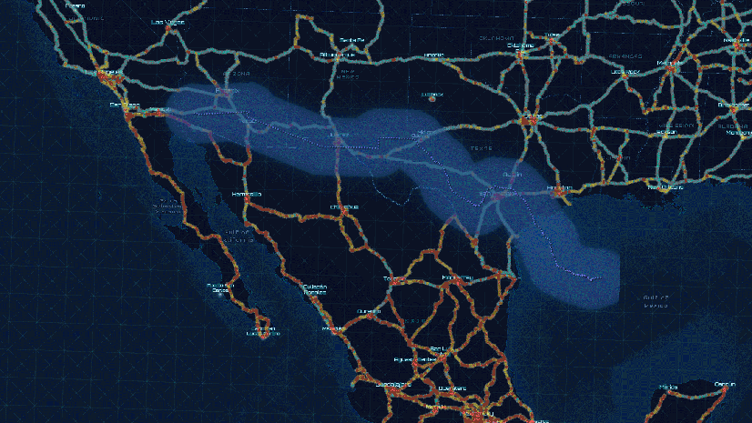
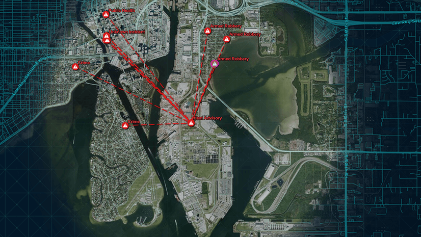
Every fraudulent claim, misused payment, or misrepresented facility happens somewhere. That “where” is the missing link traditional tools often overlook. GIS fills that gap—visualizing patterns, uncovering relationships, and validating claims with objective, geospatial evidence.
This technical paper introduces a practical, location-driven approach to identifying and reducing fraud across various mission areas, including health care, public works, emergency management, and social services.
Inside the Paper:
– Detecting clusters of suspicious activity using spatial analytics and AI – Mapping provider, patient, or vendor patterns that defy logic – Integrating drone and satellite imagery to verify claims – Revealing hidden relationships through network and link analysis – Streamlining investigations with shared dashboards and secure collaboration
By embedding location intelligence into your oversight workflows, you not only gain visibility—you gain momentum.
A Platform Built for Accountability
GIS isn’t just a mapping tool—it’s a platform for insight, integration, and action. Most agencies already use Esri technology for planning, infrastructure, or emergency response. This paper demonstrates how these same tools can be configured to support investigators, auditors, and compliance teams—without requiring the need to reinvent the system.
From collecting whistleblower tips to analyzing impossible billing patterns, GIS helps agencies do more with less—and do it smarter.
If your mission is to protect public dollars, promote transparency, or modernize oversight, this guide is for you.
Carl Walter is the Global Director of Homeland Security Solutions at Esri. He joined Esri in 2010, bringing over 20 years of experience in law enforcement and intelligence operations. Before joining Esri, Mr. Walter served as the Director of the Boston Regional Intelligence Center (BRIC), a DHS-designated intelligence fusion center, and as the Director of the Bureau of Intelligence and Analysis for the Boston Police Department. Following 9/11, he established a coordinated regional intelligence capability in the Boston metropolitan area, integrating local, state, and federal law enforcement alongside private sector resources. His efforts focused on critical event management, including preventing and responding to terrorist threats, man-made hazards, and violent criminal activity. In his current role at Esri, Mr. Walter develops global strategies that integrate technology, operations, and analytical tradecraft to support the security needs of national security agencies and Fortune 500 organizations worldwide. He holds an M.S. in Criminal Justice Management from the University of North Carolina at Charlotte and a B.S. in Criminal Justice from East Carolina University in Greenville, North Carolina.
Brian Lantz
Brian Lantz is the Director of Public Safety and Law Enforcement at Esri, where he leverages his extensive background in geospatial technology, data analysis, and operational security. With experience spanning the U.S. Secret Service and leading GIS companies, he operates at the intersection of advanced technology and high-level security operations. During his tenure with the U.S. Secret Service, Brian developed expertise in applying technology to complex national security challenges, using advanced geospatial solutions to enhance operational efficiency and protect critical assets. His time at Esri has further solidified his expertise in GIS, with a focus on spatial solutions that support law enforcement, emergency response, and defense applications. Brian has led efforts to integrate GIS technology into numerous security and government operations, ensuring its practical application in decision-making and crisis response. His ability to transform complex geospatial data into actionable intelligence has influenced policies and strategies across both the public and private sectors.
Rodney Washburn
Rodney Washburn is an Account Executive with Esri's Federal Public Safety Team, leveraging over 30 years of experience in law enforcement, intelligence, and security operations to deliver advanced geospatial solutions that enhance public safety. Before joining Esri in 2021, he served 25 years in the U.S. Border Patrol, where he held leadership roles utilizing ArcGIS technologies for intelligence and data-driven operations. Earlier, he was a Marine Security Guard, with assignments at the American Embassy in Brussels, NATO Headquarters, and Uruguay. Mr. Washburn holds a master’s degree in National Security Strategy from the Eisenhower School, National Defense University.