The National Audubon Society is a nonprofit organization dedicated to the conservation of birds and bird habitats. Since 1905, Audubon’s important work has focused on reaching millions of people to educate, motivate, and connect diverse communities across the United States.
To assist in Audubon’s essential conservation work, Esri and the National Audubon Society began the Dangermond Fellowship program in 2016. The fellowship enables fellows to receive extensive and immersive access to the entire ArcGIS system through online training and experience working alongside Esri team members.
During the length of the fellowship, the fellows support Audubon’s new and ongoing projects; improve their technical and storytelling skills; and are provided a suite of resources through training, mentors, and leadership from both Esri and Audubon.
Dangermond Fellows and Audubon Team Visit Esri
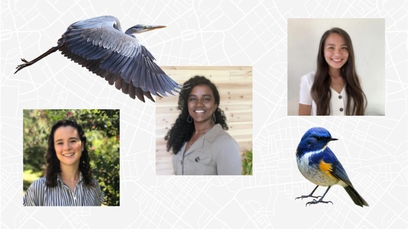
Esri hosted the Audubon team and the Dangermond fellows—Sarah Mandanas, Summers Cleary, and Ariana “Ari” Kim—at Esri’s headquarters in Redlands, California.

Staff from the Geo Experience Center provided demonstrations of Esri software, such as ArcGIS Drone2Map, on various topics such as predictive rising temperatures and landslide analysis due to climate change.

Following these engaging demonstrations, the fellows were led on a tour across the Esri campus. One stop during the tour included a casual geospatial careers conversation with Dr. Lauren Bennett, Esri’s group product engineering lead in spatial analysis.
During the discussion, she shared how she began her geographic information system (GIS) journey, what she is doing to make her team more inclusive, and provided advice and key takeaways. She and the fellows also engaged in discussion about their various interests, concerns regarding inclusion in the GIS field, and how we can improve together.

Following this discussion, Esri hosted a lunch—the first since the Esri campus closed after the COVID-19 pandemic began—for the fellows and the Audubon team at the Esri Café. Jack Dangermond, founder and president of Esri, stopped by to introduce himself to each of the fellows.
Dangermond then provided a thorough campus tour for the fellows and the Audubon team. He took time with each of the fellows to discuss the future of GIS professions and provided insight into what to look forward to in the future.

Get to Know the Dangermond Fellows
During their visit, the fellows sat down for an exclusive Q&A.
Hear from them as they discuss the work they have done over the course of their fellowship and what value they have found through this experience.
Q: What are your Audubon projects with Esri?
Mandanas: My current project is the Spoonbill Tracking Dashboard. This project pulls data directly from bird-of-field [bird monitoring] technology and is uploaded through monitors placed on birds. Monitoring birds and where the nests are is super important. There is so much more room for growth, as there is a lot of data available.
Cleary: My project is Climate Watch and Survival by Degrees Integration. This project is the prediction of species’ range shifts where we can see indicators of species’ survival by degree scenario caused by climate change. There is no longer stable colonization by species. This project is really about datasets, pulling them apart and using analytics/statistics, areas of pixels, and more. This really combines analytical skills with community engagement. The total biodiversity loss is scary.
Kim: I have a handful of projects I have been working on. The EagleWatch project is by far my favorite. This is a community-led conservation project where locals record-eagle sightings on their phones, and this pulls data together for us to map eagles. We are going to be adding eagle banding as well. I am also working on Safety Manual Hub, which is a standardized manual that is human-focused. This is really a fun change of pace. It is searchable—for example, what policies on boating are—and [includes] resources. This project is about curating a safe space for people to share theirs near misses, successes, and more. I may implement an incident reporting into a hub, but [I’m] working on figuring out the best workflow. I really enjoy consulting on [hub sites] and helping to create templates, troubleshooting, and more.
Q: During your fellowship, you worked with a suite of Esri products. What was your favorite?
Mandanas: Honestly, all Esri’s technology, all the web apps, everything. ArcGIS Pro, ArcGIS Enterprise, and Python programming are my main interests, especially Python. Using ArcGIS Notebooks on ArcGIS Online is also a favorite of mine.
Cleary: If I had to choose, I would say ArcGIS Pro in ArcGIS Online and the suite of web apps.
Kim: I love ArcGIS Hub! It is immensely powerful [and] allows for community engagement. You can take ownership and feel as though you are contributing to something bigger. [Hub sites] have a community aspect and allow you to organize into teams.

Q: How would you describe the Dangermond Fellowship experience? Is there any advice you would give to others?
Mandanas: This has been an incredible experience. At first, it was intimidating. But it has been amazing. I have learned so much. Before, I had only worked with ArcGIS Pro and one app, and now I know the whole spectrum of Esri products. Great exposure on the technical and professional levels.
The advice I would give is if you are interested in something, find a way to explore it! Find people who do it and ask about their experience. Put yourself out there. Find people with interesting stories [who understand] what you want to do to provide you with insight to get started.
Cleary: I had specific ideas pertaining to the fellowship, and it totally surpassed expectations. One amazing thing about the fellowship is it is a collaborative partnership between Audubon and Esri, which are two vast networks. You get to work on projects from start to finish, each of which requires different skill sets. This experience will absolutely make us better GIS practitioners in the future. Also, it is a ton of fun!
The advice I would give is to not give up, and continue to pursue your goals. The Dangermond Fellowship may not be offered your first time applying, but keep trying! This fellowship encourages you to ask questions, gets [you] in the room with SMEs [subject matter experts], and more. One of the most valuable opportunities for this fellowship is networking.
Kim: I feel a sense of immense, overwhelming gratitude. The Audubon team is wonderful. They empower the fellows to take risks, and my confidence has significantly increased from before the fellowship. As a fellow, you have the opportunity for real-world work that can be used by many!
The advice I would give is to stay curious and ask a lot of questions—do not be afraid to dive in! There are boundless free resources you can access, and you can take advantage of all of it. Go out in the world and live in communities that are different [from yours] to see a unique perspective [that isn’t] what you are used to. Get outside of your bubble.

The Future of the Dangermond Fellows
A few weeks following our in-person meeting, the fellows made their final presentations to Esri team members virtually. The fellows individually walked through their experience with the National Audubon Society, the Dangermond Fellowship, and their projects. Find out more about each fellow’s project:
Mandanas has accepted a GIS analyst position, specializing in Python, with Esri partner Blue Raster.
Cleary has accepted a position as a member of the ArcGIS Living Atlas of the World team within Esri.
Kim has accepted an Account Executive position as a member of Esri’s Nonprofit team.

Esri is sincerely grateful for the partnership with the National Audubon Society and the continuation of the Dangermond Fellowship. Like this year’s fellows, many others were provided with invaluable experience using ArcGIS technology and have gone on to pursue GIS careers.
To learn about last year’s fellows, check out our blog.
To learn more about Esri conservation, view our industry webpages.