A leading utility company embarked on a 400‑mile power transmission project stretching from the Canadian border to New York City, encompassing both terrestrial and submarine segments.
Challenge
With more than 30 active construction sites and complex right‑of‑way conditions across roads, railways, and waterways, the project demanded precise coordination and timely decision‑making. However, reliance on manual reporting methods resulted in data silos, inaccuracies, and delays in communication between field teams and management. The absence of real‑time visibility into progress further hindered efficiency.
To address these challenges, the client needed a streamlined, digital workflow capable of automating field data collection, standardizing pay item tracking, integrating securely with SharePoint, and delivering a real‑time dashboard to monitor performance across the entire infrastructure network.
Solution
To address these challenges, WSP, a global engineering and professional services firm, leveraged Esri’s ArcGIS Enterprise platform to develop an integrated ecosystem of applications designed to streamline every stage of construction management.
The project team recognized that the traditional approach to construction reporting created data silos, inconsistencies, and long delays in communication between field and management teams. The client wanted to modernize their workflows by automating field data collection and standardizing pay item tracking. They knew these improvements would streamline the review and approval process. They also required secure integration with their SharePoint system and a real-time dashboard to monitor progress and performance across hundreds of miles of infrastructure.
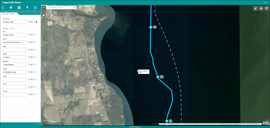
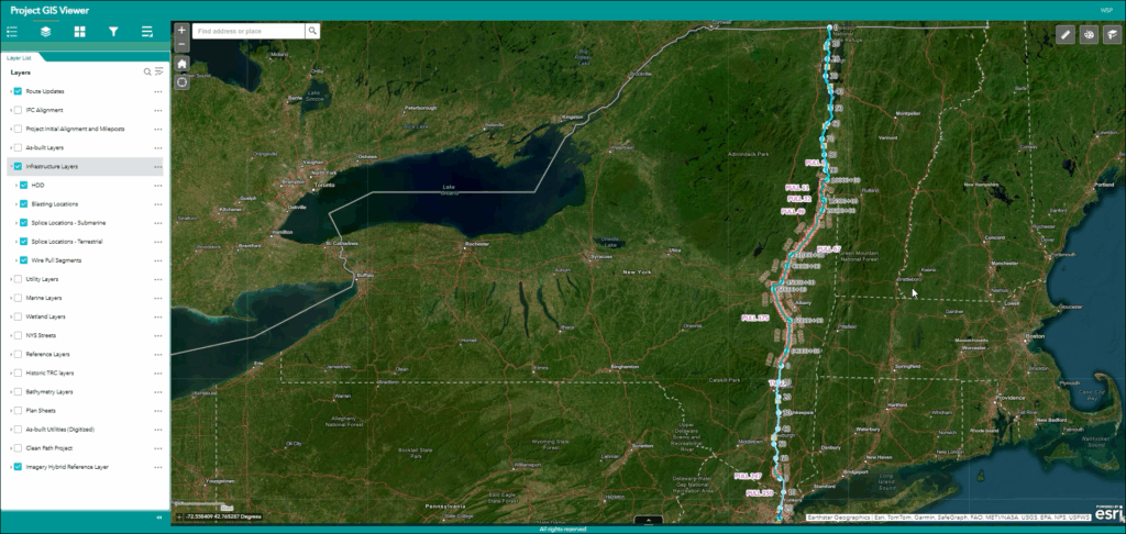
A centralized project hub, built using ArcGIS Hub, served as the single entry point for all geospatial data, dashboards, and applications. The team deployed ArcGIS Experience Builder to create a project mapping interface that organized layers by discipline, allowing users to visualize terrestrial and submarine environments with ease.
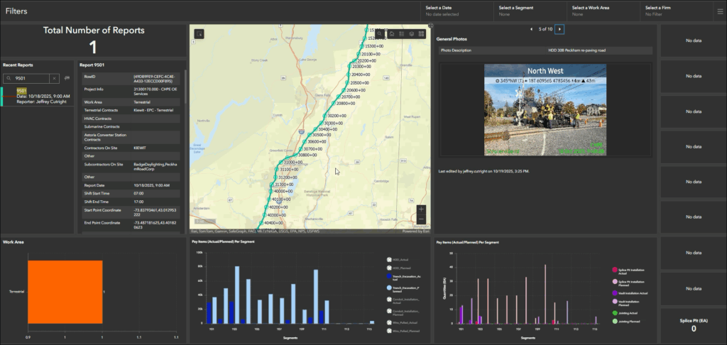
At the heart of the solution was a sophisticated ArcGIS Survey123 reporting tool, which allowed field inspectors to make a digital record of site activities, environmental conditions, safety issues, and pay item quantities directly from their mobile devices. The tool allowed inspectors to enter an unlimited number of pay items, eliminating inconsistencies caused by manual data entry. The application was also refined over several iterations, reflecting direct feedback from field teams to ensure accuracy, usability, and scalability.
To improve oversight and accountability, WSP developed an automated review and approval workflow using the ArcGIS API for Python. Reports were automatically routed to construction managers and senior managers, triggering email notifications at each step. Approved reports were securely stored in SharePoint, and their status was updated automatically within the ArcGIS system. This integration ensured that approved data immediately appeared in the project dashboard, eliminating manual handling and reducing turnaround times.
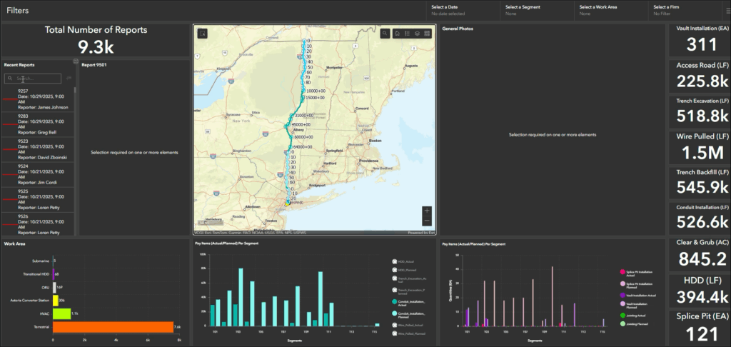
A project-wide dashboard created with ArcGIS Dashboards gave decision-makers a real-time view of progress, showing planned versus actual quantities, staffing levels, equipment utilization, and pay item performance. Users could filter data by location, time-period, or segment, and even compare key performance indicators across different areas of the project.
A robust, role-based access management system ensured that each of the 200-plus users, including inspectors, managers, and reviewers, had access to precisely the information they needed.
Results
Since its launch in September 2023, the platform has automated more than 9,000 construction reports, processed over 19,000 pay items, and securely stored more than 85,000 field photos. Reporting consistency and accuracy have dramatically improved, and approval times have dropped from days to hours. Real-time dashboards now give managers visibility into field operations, improving responsiveness and overall project control.
The platform continues to evolve as a living system, allowing WSP to develop and retire specialized applications as project needs change. This flexibility made possible through ArcGIS Enterprise has positioned the solution as a model for modern digital construction management. Beyond this single transmission project, WSP’s approach demonstrates how GIS-driven automation and data integration can deliver measurable efficiency, transparency, and collaboration across the infrastructure sector.
Learn more about location intelligence for AEC:
GIS for Architecture, Engineering, and Construction.
Stay Connected with Esri’s AEC Team:
Subscribe to the AEC industry newsletter “Esri News for AEC”.