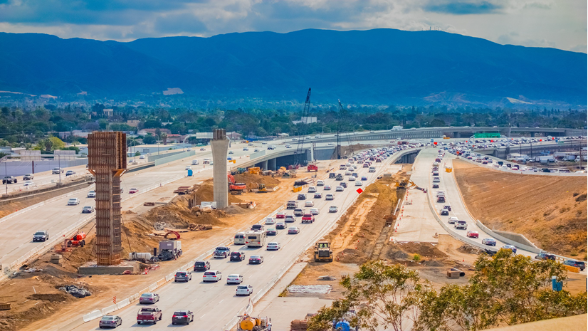
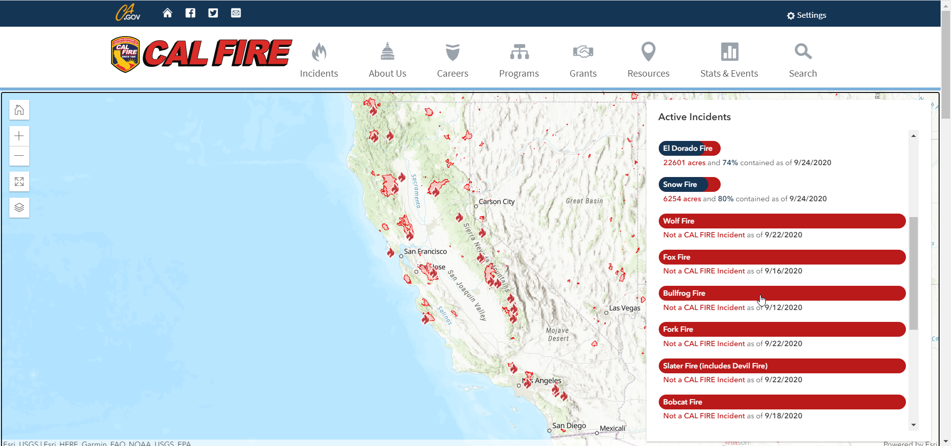
Instead of spending Labor Day outside by the pool or having a BBQ, my family and I were cooped up inside our home in Southern California. We couldn’t go outside for the first few weeks of September without breathing in smoke due to the wildfires along the west coast of the United States. The sky was no longer blue and there was a layer of ash on our yard. We could see the flames from the El Dorado fire in Yucaipa from our house. Although it wasn’t a threat to our home, it was for many others. It destroyed several homes and structures, injured many firefighters, and even led to one fatality. And this is not the only fire still burning nearby; we also have the Snow Fire in Palm Springs (about 60 miles east) and the Bobcat Fire (about 60 miles west towards Los Angeles). Thankfully at this point, a few weeks later, all three of these fires are well on their way to being 100% contained. Growing up in California, this is unfortunately a common occurrence that plagues the summer months; however, this is the first year that I can remember not being able to see the blue sky for weeks. It has made me stop and think about the innovative ways GIS can help prevent wildfires.
As the firefighters continue battling the blazes on the frontlines to reach complete containment, natural resources and land administration agencies are at work figuring out how they can help prevent or at least prepare for future forest fires. Since the implementation of the 2008 Farm Bill, all states and territories are required to assess the condition of their forests and develop solutions to collectively identify and resolve issues, such as areas at high risk for wildfires, in a forest action plan. Although all states now have a plan, Montana has taken their plan to the next level. Montana Department of Natural Resources and Conservation (MDNRC) leveraged GIS to create an interactive and collaborative information website where other agencies, as well as the public, can access their analysis and strategies. They did this just in time, considering our current pandemic situation, with many organizations working remote while still needing to access this critical information.
Montana’s previous forest action plans were antiquated hard-copy or digital documents that could not easily be updated or distributed. There wasn’t any easy way for stakeholders and the public to access the plans or provide feedback. That is where MDNRC saw a new role for GIS—one that would help them improve collaboration and sharing. MDNRC’s GIS team already had experience using ArcGIS to create critical mapping applications. However, they had to get executive sponsorship for GIS to play a role beyond modeling and analysis. They needed to get buy-in on using GIS as a communication and engagement solution, and they knew just how to do it. They demonstrated the value of web apps, Story Maps, and most critically, ArcGIS Hub, the cloud-based engagement platform that could bring together all the data, collaboration, and sharing in one easy-to-access place. Management saw the vision and recognized that ArcGIS Hub was the solution to achieve the engagement and collaboration they so critically needed with the Montana Forest Action Plan.
Using ArcGIS Hub, MDNRC was able to transform their static plan into a living document that is easy to access, explore, and update. This new format makes it easier to identify priority areas to focus on throughout the year as the natural landscape and their research continues to evolve. The current pandemic has clearly shown how critical it is to have this plan in a fluid digital format, as stakeholders still need to be able to access the data from wherever they may be working. This ever-evolving forest action plan now provides a common operating picture of the most accurate and timely information for all stakeholders, including all levels of government, various interest groups and the public. Displaying the data spatially allows users to more easily understand this vital data.
Having all the forest action plan data in one place, in an easy-to-digest format makes it clear just how much the plan has helped Montana’s forests and wildlife. While forest action plans are critical for wildfire preparedness, they also focus on addressing other threats to forest health, such as invasive pests and disease. Whether your daily work is focused on forests or you simply enjoy the outdoors, we all want the same thing – healthy, resilient forests. Montana is clearly a leading example that is paving the way for other states and territories to create interactive, collaborative forest action plans.
But don’t just take my word for it, you can hear first-hand from Brian Collins and Wyatt Frampton from Montana DNRC on the Montana Forest Action Plan.
Thankfully, all three of the fires burning in Southern California are well on their way to being completely contained. Our sky is blue again and the folks that were evacuated are beginning to return to their homes. However, the forecast already shows more fire danger temperatures headed our way. Although I know we can’t prevent all forest fires, making the critical data and analysis on our forests more readily available, like Montana has done, is definitely another step in the right direction.