The dynamic of the community planner’s role has been expanding within city, county, and regional planning over the last decade beyond the traditional responsibility of dealing with site plans and comprehensive plan updates. When I was last working in a planning department, that’s almost all we did. In a quickly-growing suburb of Raleigh, we were inundated almost exclusively with subdivision reviews, site plans and the occasional zoning change. It’s so inspiring to me to see the position and value of community planners expand. Nationally, we’re seeing planning professionals being more intricately involved in economic development activities, blight remediation, resilience planning and citizen engagement at the local government level. Consequently, planners are participating in policymaking beyond just typical changes in zoning and land use. One of the policies of emphasis we’re seeing take center stage is managing homelessness.
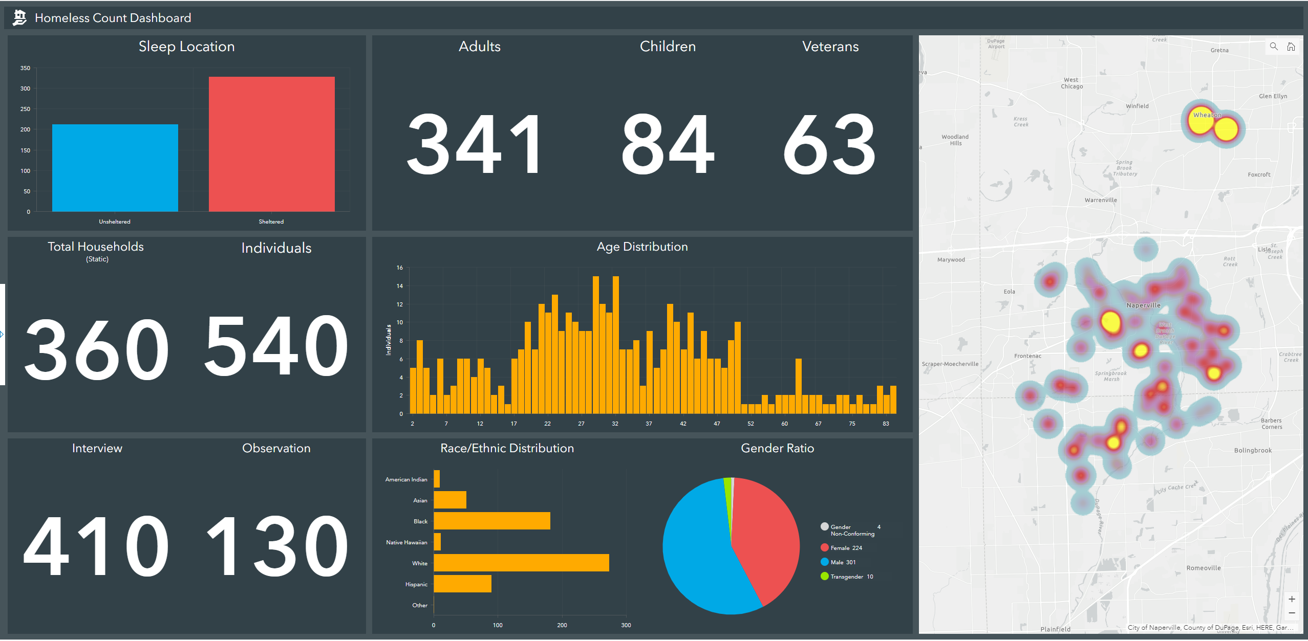
Planners design communities and facilities while keeping seniors, young adults, and children in mind. They make sure these groups have access to schools, parks, community centers, and jobs. Planners also need to plan for the homeless population. But what does that role look like, and where does a planner start? First, you must define and understand what you, as a planner, can do from the standpoint of policymaking. Where are the homeless that have existing job skills (or even current employment) and simply need assistance getting access to affordable housing? Where are the homeless that would need access to education, job training, health and social services, and so forth? If we know that information, it makes it easier to quantify and qualify where these developments can take place. The key is starting with a data-driven approach. Anecdotal evidence does not provide a firm foundation for policymaking, especially something as sensitive as homelessness. When tackling this issue, we must realize there are multiple facets to solving the problem.
There is no way to address sustainable solutions for homelessness without also addressing affordable housing. The two policies are attached at the hip. Otherwise, all we’re focusing on is where to put homeless people, which is just a temporary solution. As we’ve seen with developments like the early days of the East Lake Housing Project in Atlanta, providing affordable housing by segregating lower income citizens does not provide a long-term solution. This is because our goal is not just to remove the poor from the streets. It’s to deliver a path to prosperity that’s defined by the individual. This means we’re also tying a third issue to homelessness: economic mobility. Affordable housing is only viable, and more likely to be accepted by the rest of the community, if it’s combined with policies that provide sustainable economic opportunity for those in said housing. The goal shouldn’t be to just provide housing. It must be combined with providing economic mobility.
So, how do planners leverage GIS to make this data-driven approach?
- Use field collection tools, like Survey123 for ArcGIS, to identify locations and information about the homeless population.
- Analyze the walkable service areas of educational and key health and social services in the community. If public transit is an option, that can be factored into the service areas, as well. At a minimum, we can’t assume those in affordable housing will have access to a car. Next, correlate that with existing business and housing opportunities within the service areas. This can all be accomplished in ArcGIS Community Analyst.

- Generate multiple transit-oriented design (TOD) development scenarios in ArcGIS Urban that quantify new housing and jobs that can be presented to administrators for review.

- Coordinate with local economic development organizations (EDOs), elected officials, and neighborhood leaders through a series of maps and appsdeployed as an initiative in ArcGIS Hub to identify ways to address gaps in these areas. What types of businesses do we need to recruit or provide incentives to expand? Where do we need to provide additional educational, health, or social services? Do we need to re-examine our zoning to accommodate the type of housing and/or mixed use development we need to reach our goal?

With this approach, community planners become a vital part to a successful policy that provides real, sustainable housing, access to services, and economic opportunity to the homeless population, while simultaneously meeting the needs of the rest of the community.

