Why Esri, Why GIS, and Why Does That Matter?
Where you are is directly related to the hazards and threats that occur, the degree of social inequities experienced, accessibility to health care, availability of nutritional food and clean water, the quality of public education, and the list goes on. The question of where is the first one emergency managers ask: Where is the incident happening? Then it is followed by: What is it like there?
In addition to where, geospatial science can lead emergency managers toward answering the why and so what of nearly any incident that occurs—questions that political or C-suite leadership asks all the time, so getting to those answers is what matters most. But to get to the why and so what, first, emergency managers need to address a common misperception of geographic information system (GIS) technology. Only then can you begin to see the application of the science in all phases, all mission areas, and all components of our practice.
The Misperception of a Tradecraft
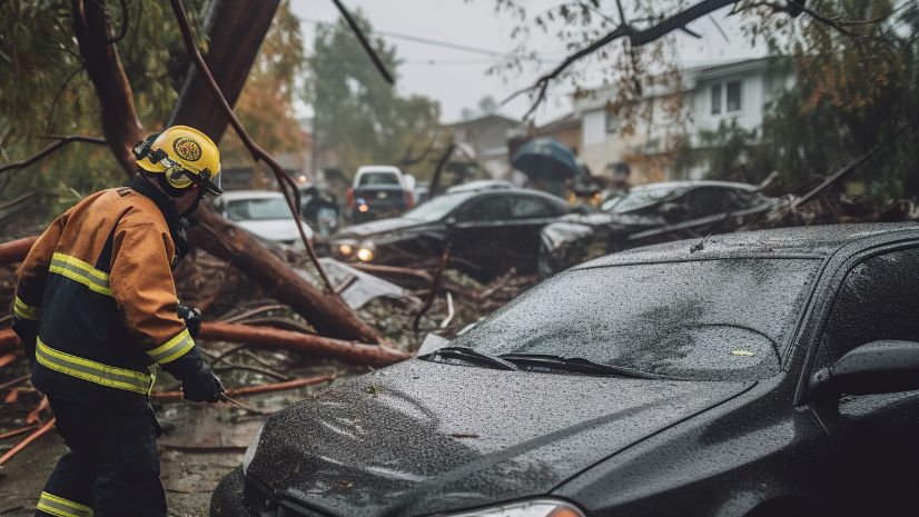
Let’s face it: The majority of emergency managers use their GIS capability reactively. In nearly every organization, GIS is ramped up in the days/hours leading up to a known event (e.g., special event, hurricane) or immediately after an incident occurs to gain better geographic situational awareness. During an activation, the GIS analysts report to the situation unit of the planning section in the Emergency Operations Center’s (EOC) incident command structure—where, according to the Federal Emergency Management Agency’s (FEMA) National Incident Management System (NIMS), “they produce maps.”

In other mission areas, many agencies use GIS to develop the risk assessment for their hazard mitigation plan. Some have even expanded the use to include daily situational awareness dashboards and field-based data collection through Esri’s ArcGIS Survey123 solution. However, few agencies have fully integrated ArcGIS beyond situational awareness and response operations. Emergency managers often use a GIS analyst and the technology to create maps and dashboards as a quick and easy solution during time-sensitive missions. This can mean analysts and the technology may be underutilized resources that we must tap into more earnestly.
Redefining GIS for Emergency Management
GIS practitioners can be your frontline intelligence analyst. Their ability to conduct intelligence analysis applies to preparedness, mitigation, recovery, and resilience—not just response operations and situational awareness. They often have access to your organization’s entire geospatial data library—which inherently makes them pretty powerful data hubs. And much like traditional intelligence analysts, GIS analysts are constantly searching for data feeds, identifying trends, analyzing what it all means, and assessing the impacts of what they’re monitoring—spatially and relationally—to make a visual story of their analysis to share it with you. Their knowledge, skills, and abilities expand far beyond cartography and “producing maps,” and the results of their work inform some of our most critical decisions.
But redefining GIS in emergency management doesn’t end there.
What if your GIS analysts are also part of your alert, watch, and warn function as well as your future planning capability? The technology they use has made tremendous advancements over the last several years—it’s gone mobile—and the systems they use can automatically notify the analyst when triggers and thresholds are met that you’ve identified as a priority.
Let’s play this redefined role out in a scenario.

For example, a director of emergency management has tasked their GIS analyst with creating a dashboard that monitors data points specific to heat waves. On that board, they have displays of the three-day weather forecast, the geographic locations of historically recurring heat islands, current data on the health-care system’s capacity, cooling center locations and building status, utility/power infrastructure status, and population statistics—highlighting the geographic location of their most vulnerable residents.
Once the weather forecast predicts an impending heat wave, the thresholds set in the dashboard are triggered, and the GIS analyst is alerted via email or text to monitor the board for changes. The analyst follows the organization’s alert, watch, and warn standard operating procedure and shares this new information with leadership and operations teams for decision-making purposes.
Using ArcGIS, the analyst then conducts an assessment of the event’s cascading impacts through data analysis and modeling, which helps the entire team understand what will be impacted, who will be impacted, where resources should go, and how bad it will get ( like an intelligence analyst). These anticipated impacts inform their activation level, public notification strategy, the staging of resources, their readiness posture for days and weeks to come (i.e., future planning), and the essential government services they need to ramp up or down for delivery to their residents.
As the event continues, the GIS analyst deploys Esri’s ArcGIS Survey123 to all response personnel via a mobile link to collect real-time data from the field. This data not only reflects the current situation but also serves as the mechanism to inform the command staff’s decision-making processes. The data loop within the ArcGIS system continually updates its situational awareness dashboard in the EOC, incident maps, and incident management system, which, in turn, informs their response posture, logistics needs, public information strategy, etc.
This short scenario demonstrates that the use case for GIS is more than just producing maps in the situation unit. It shows that GIS is a mission-critical capability.
The array of GIS solutions available to ArcGIS users includes data analytics, trend analysis, and predictive analytics—which give emergency managers the so what they are solving for. Other scenarios could just as easily describe GIS’s strategic application to grants management, hazard mitigation project scoping, community resilience planning, social equity analysis, and climate change preparedness.

Here’s the best part about redefining GIS for the industry: the GIS analyst likely already has the knowledge, skills, and ability to do everything described in the scenario above. But it is only with leadership’s support that their role can be elevated from “just producing maps” to using GIS technology to inform long-term strategic decisions.
Competing Priorities
Some emergency management organizations may be inadequately resourced to fulfill their unique mission. Emergency personnel are being tasked to manage not only traditional emergencies but also atypical emerging trends and threats (e.g., the opioid epidemic, homelessness, and gun violence) that have not historically been led by the industry, regardless of sector or level of government. Their resources are spread thin, and the to-do list keeps getting longer.
It is often because of these competing priorities that most organizations only partially staff/fund their GIS unit, and in many cases, borrow analysts from other organizations during activations because they don’t have their own. These circumstances make it difficult to get the most out of technology investments, and it makes the long-term strategic use of GIS a significant programmatic challenge.
But what if the cycle of underfunding and under-resourcing GIS units keeps occurring because the power of the analyst or the pieces of intelligence they manage isn’t fully understood? What if this cycle continues simply because we have not seen the application of GIS for the so what, using data analytics, trend analysis, and predictive analytics? And what if we weren’t aware that the science can be applied to every single threat and hazard that we experience? Without being exposed to all that the technology can do for your program, it becomes a leadership challenge to invest even more into your organization’s GIS capability—and the cycle of underfunding and under-resourcing continues.
Invite Them to the Table
By redefining GIS as an intelligence, watch and warn, and future planning capability within emergency management, it is easier to see GIS’s unique contribution to decision-making processes beyond the situation unit. And it also serves to highlight just how underutilized GIS is in many organizations.
Inviting your GIS analyst to the leadership table will help you—and practically force you—to solve problems through a different lens. Their analytic skills and geospatial mindset will inherently motivate and inspire you to think differently and to ask different questions. They will help you break down process barriers in information sharing and data management so that you and your elected officials can make decisions faster and more effectively.
So, what can you do? Emergency managers must empower their GIS analysts by inviting them to the table. Encourage them to speak up when they see data and trends of concern and support their progressive and proactive use of the technology in all phases of emergency management—tactically, operationally, and strategically. If you are concerned that the conversation will turn to the technology’s hardware and software components, or specific GIS technical workflows—ask them to elevate their briefing skills for a nonuser audience. They are more than capable of adjusting their approach.
In addition to inviting them to the table, perhaps the most important thing you can do is to ask your GIS analyst for frequent demonstrations of new ArcGIS solutions. The suite of ArcGIS tools and solutions continues to evolve, so ask for demonstrations often. And ask for their specific ideas on how to integrate those solutions into your program, across all mission areas.
Learn more about Esri solutions for emergency management.