Last week, Esri hosted the second Planning Directors Summit in West Palm Beach, FL. Planning leaders from across the country met with their peers and learn how GIS is being integrated into key initiatives. Attendees learned successful workflows used in planning departments to implement comprehensive plans, transportation planning, housing, and more.
Words from the American Planning Association
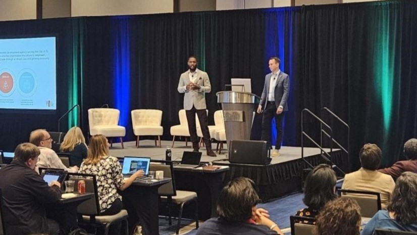
We kicked off the summit on Monday with the President of APA, Sue Schwartz, delivering the keynote. Her story is reflective of so many planners today who found a drive and a passion for improving communities of all sizes. Sue’s reminder that “it takes a planner” is something every planner and administrator should remind themselves of from time to time. So much of the work a planning department does is behind the scenes for the public and elected officials. The late hours, weekends, planning commission meetings, and town hall meetings are often underappreciated by leadership and the public but are essential in designing and driving home the initiatives that make a community thrive.
Jason Jordan, APA’s Principal for Policy and Public Affairs, discussed the impact of federal policy and legislation pertaining to local planning departments. He highlighted which initiatives APA advocates for and ways for planners to be more closely involved. Many planners are absorbed by the day-to-day activities and challenges in their own municipalities. Jason provides a big picture view for every planner to understand how what is happening in Washington affects them locally.
GIS Success Stories
Monday’s morning illustrated how communities of all sizes use GIS for comprehensive planning. Presenters included Charlotte, North Carolina, Dublin, Ohio, Fort Wayne, Indiana, and Clarksville-Montgomery County, Tennessee. It was inspiring to see four very different communities find common ways to leverage GIS for one of the most important planning initiatives. John Houseal, co-founder of Esri partner Houseal Lavigne, moderated an insightful panel discussion. This discussion gave the audience a deeper understanding of the challenges and strategies of each community.

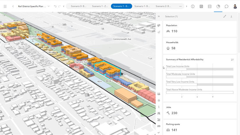
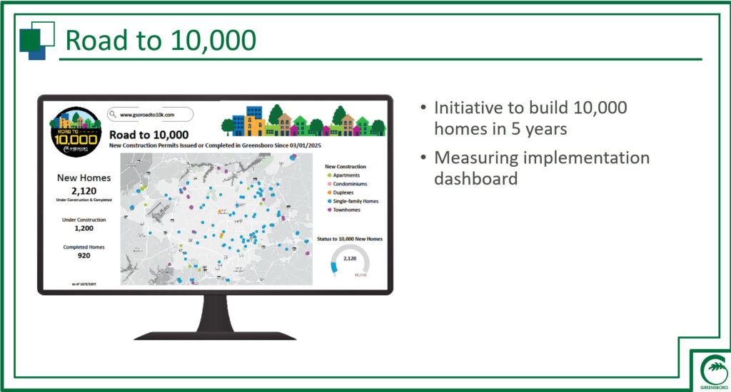
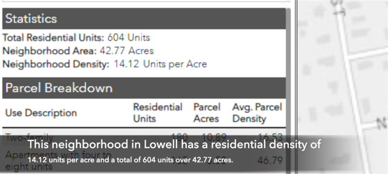
Then Cedar Rapids, Iowa, showed how ArcGIS as a Planning System increased public engagement. The Commonwealth of Massachusetts followed by demonstrating their residential density tool. The second day focused on a combination of regional and transportation planning from Fort Worth and Chattanooga-Hamilton Regional Planning Agency. The user presentations closed with the innovative use of digital twins in Wake Forest, North Carolina and Pinellas County, Florida.
ArcGIS as a Planning System
Esri staff also gave insight into ArcGIS as a Planning System. Their sessions provided important updates on the paths of ArcGIS Solutions, ArcGIS Urban and ArcGIS CityEngine, and Esri Professional Services. The summit’s sponsor, Houseal Lavigne, showed their modern approach to integrating technology and planning, from 3D renderings in gaming engines to effectively leveraging AI.
For the second year, the Esri Planning Directors Summit delivered an informative and inspiring message to planning leaders. Communities thrive when planners understand community needs and create policies to fulfill them. GIS technology is the most effective tool for planning professionals to apply their craft and expertise. As our presenters demonstrated, integrating real-time data, advanced analytics, and collaborative environments in GIS builds confidence in the decisions planners make.