We’re less than a month away from the second annual Esri Planning Directors Summit in West Palm Beach, Florida. Just like last year, we are getting together to give planning and community development directors in cities, counties, and regions of all sizes the opportunity to learn from each other. It is an opportunity to see how GIS has become a mission-critical component in the modern approach to comprehensive planning, housing policy and zoning reform, public engagement, resilience planning, and economic mobility initiatives, without having to be a GIS expert.
This summit will provide an opportunity for planning directors to get together and discuss their challenges, their wins, their setbacks, and their vision. One of the prevailing strengths of Esri users has been the enduring aspect of community…the occasions to share stories and learn from each other, and the Esri Planning Directors Summit provides that occasion for leaders in planning and housing. Though I’m admittedly biased, here are four reasons why you need to attend the summit:
1. Keynote
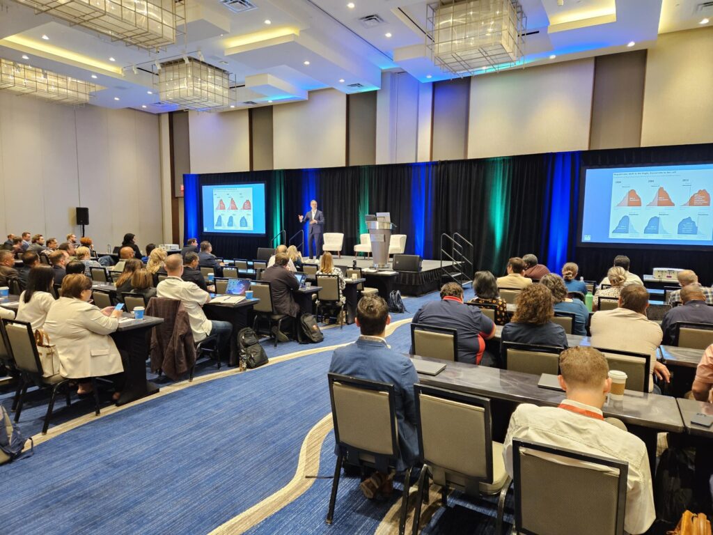
The summit will kickoff Monday morning with new APA President Sue Schwartz delivering the keynote to the attendees. I have been fortunate enough to be on a panel with Sue and have heard her present other times, as well. Her story is an inspiring one, and just like APA CEO Joel Albizo did last year in this role, she’ll do an excellent job connecting with the audience.
2. Learning Sessions
Over the two-day summit, we will have over a dozen sessions presented by other planning professionals covering a range of topics most planning departments are dealing with daily, including:
- Updating comprehensive plans
- Modernizing housing policy and zoning reform
- Leveraging innovative public engagement
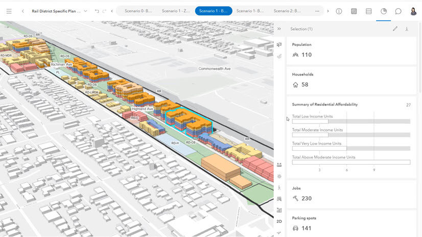
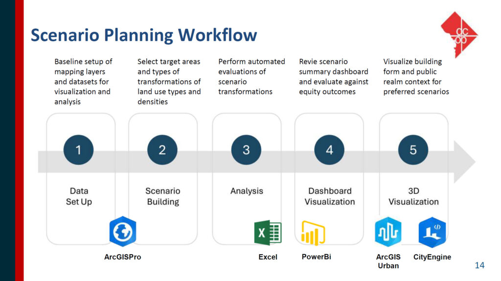
- Implementing digital twins
- Designing sustainable transportation and mobility strategies
And in all of these, our presenters will show how GIS is an integral part of each project. The goal is not to make the attendees fluent in the use of GIS. No one is going home an expert in ArcGIS Pro. Rather the goal is to see the big picture about where GIS plugs in as a prolific system in planning and housing projects.
The agenda is a single track with brief (25-minute) presentations. In addition, we will also have plenty of opportunities with several networking breaks to bounce ideas off one another, as well as a few panel discussions where attendees can ask questions and take a deeper dive into the projects.
3. Informative Updates
Mixed into the agenda will be several sessions with informative updates for planning directors. Jason Jordan, Principal of Policy and Public Affairs at APA will deliver an essential legislative update, outline APA’s strategic approach to engage lawmakers, and what this means for planners of all jurisdictions.
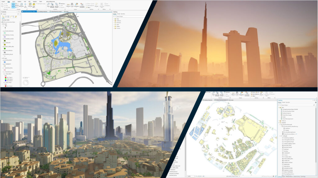
From Esri, Silvia Casas, Product Manager for ArcGIS Urban and CityEngine, will wrap up our summit with a high-level overview of ArcGIS as a Planning System that will enable you to amaze your GIS staff when you return. Michelle Flemming will provide some real-world examples of how Esri Professional Services is helping planning departments with GIS implementations and in-house projects across the country. And Mike Brown from the Solutions Team will give you an update on the new apps that are coming down the pipeline for planners to help with permitting, review, and other current planning workflows. These are apps that are already part of the ArcGIS platform and have no additional cost.
Finally, and certainly not least, the team from our conference sponsor and Esri Gold Partner, Houseal-Lavigne, will show you what the cutting edge of planning and technology look like in some amazing projects with which they’re engaged. This was a real highlight of last year’s summit, and the new material they’ll show will not disappoint. To say it will be inspirational is an understatement.
4. Networking and Sharing
The Esri Planning Directors Summit was put together to give leadership in planning and housing an opportunity to learn from each other, and a big part of that is networking and sharing stories (good and bad). From what our attendees told us last year, we’re extremely confident you will leave with a broader vision about how GIS is an integral part of what you want to accomplish in your planning department.
If you’re interested in requesting to attend, just click here.
We hope to see you next month in West Palm Beach!