
We are about to experience an unprecedented tidal wave of capital that will be flooding the construction industry, fueled by such things as federal funding packages, the transition to renewable energy, a growing demand for housing, and decades of underinvestment in infrastructure. This massive capital pipeline coupled with declining productivity in the U.S. construction industry and historic talent shortages in the Architecture, Engineering, and Construction (AEC) sectors means that organizations must figure out how to plan, design, and deliver projects more efficiently and collaboratively. The good news is that integration of GIS and the Building Information Modeling (BIM) process are already helping AECs to significantly meet many of these challenges.
Scheduling is an important aspect of the BIM process. Construction projects of all scales rely on scheduling to estimate the project duration, develop a logical sequence of activities, and measure progress. Common scheduling workflows craft, update, and report on schedules using tools such as Oracle Primavera Cloud, P6 Professional, P6 EPPM, and Microsoft Project. While all construction projects are inherently spatial, schedules have been mostly developed separately from the spatial components as they relate to the schedule activities.

Bringing scheduling into the BIM and GIS integration workflows by incorporating location into the construction scheduling workflow brings into focus conflicts that may otherwise have gone unnoticed, and opportunities for streamlining work based on constraints not previously discernable from the schedules tied to engineering drawings alone.
Additionally, instead of presenting project schedules only in Gantt chart form, linking schedule data to spatial features on a map can help planners, designers, project managers and other stakeholders interact with the detailed construction schedule in a more intuitive, visual way, providing better understanding, and faster insights and decision cycles.
The Great Schedule and GIS Divide
Project schedules are essentially a timeline and a sequence of steps required to construct an asset. However, schedule data often lacks an actionable spatial component or representation and often there is no easy way to visualize the spatial implications of schedule activities. As a result, project stakeholders frequently flip between numerous systems and files to understand the spatial context of a schedule activity and can sometimes even completely exclude these critical spatial aspects, which can introduce potential conflict, delay, need for re-work, and other risks.
On the other hand, while many AECs have incorporated BIM data into their GIS, the integration can leave out the time component including essential real-time project status information. Without time-enabled GIS data, we cannot test for clash detection. Without the status data, we cannot easily visualize what is complete or what is behind schedule without manually populating a status attribute.
Some construction teams have taken the time to collaborate and produce reports combining the schedule and GIS data, however, these workflows have often been labor intensive, slow, and data becomes quickly outdated if not frequently maintained.
Automating the integration of temporal data from scheduling software with spatial data in GIS benefits all project stakeholders, enabling cross-discipline teams to better identify and mitigate risks before construction begins, drive operational efficiencies, and improve collaboration during the construction phase.
Spatial Schedule Synergy

To achieve an intuitive, spatial view of schedules typical in the AEC world, we created a standard workflow that quickly and easily synchronizes schedule data that is tied to GIS data. We have released the open-source Schedule Sync ArcGIS Pro Toolbox which enables this synchronization workflow. Included in the toolbox are tools for the syncing of schedules in a wide variety of formats. The Sync ArcGIS Pro Toolbox is compatible with the outputs from the most common scheduling platforms including Oracle Primavera Cloud, P6 Professional, P6 EPPM, Microsoft Project, Asta Powerproject, InEight, and any scheduling platform that can export CSV, Excel, or P6 XML files.


The schedule sync tool enriches schedule data using a feature class containing vector spatial data – points, polylines, or polygons . The enriched schedule is then published to ArcGIS Enterprise or ArcGIS Online organization as a hosted feature service. If already published, the tool will detect and update the existing hosted feature service. The hosted feature service can be shared with an individual, a select group, the organization, or publicly.

Bringing together schedule and GIS data brings synergy. Time-enabling the spatial layer with the schedule data, allows for spatial-temporal clash detection analysis. We can compare actual progress against expected as-planned or baseline schedules.

Decision Making in Context
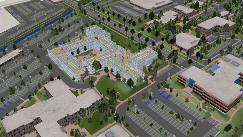
Bringing schedules into a spatial context allows stakeholders to see time-driven activities in relation to the project’s surrounding built and natural environment, which allows for better decision making. Seeing tasks against high-resolution aerial or drone-captured imagery, can help decision-makers anticipate and resolve issues before they arise. Parcel data against schedule data can help project stakeholders identify owners, land uses, and other pertinent land information in neighboring properties before tasks are performed.

In fact, any spatial data layer can now become a valuable resource in understanding potential project risks or opportunities. Hydrological layers can show when in the schedule and which activities may have a risk of flooding. FAA drone restrictions similarly can be overlaid with the project schedule activities to ensure drone flight regulations are properly met.

Critical habitat maps from the ArcGIS Living Atlas can be used to verify when project activities may impact sensitive species. Using the timeline widget with live weather layers shows how weather events overlap with our planned work in real time. Understanding the rich geographic and temporal context of a project allows stakeholders to optimize their work, avoid conflicts, and maximize results.

Having schedules synced to ArcGIS Enterprise or ArcGIS Online organization empowers teams to innovate bringing the synchronized schedule data into Web maps, ArcGIS Dashboards, ArcGIS Experience Builder Applications, and more.

Getting Started
We recommend starting out with one of our simple sample workflows, which will provide for some practice before planning and implementing your own deployment. You can download the open-source Schedule Sync Toolbox from GitHub here. In the downloaded files, you can find the example-workflows directory in the root folder of the repository, which contains the subfolders for each workflow type. Each folder contains all the data and instructions needed to run the full workflow.

Using ArcGIS Pro, load the toolbox in a Catalog View or Catalog Pane. We have included several tools in the toolbox to accommodate the various scheduling platforms: Sync CSV Schedule Tool, Sync Excel Schedule Tool, and Sync P6 XML Schedule Tool.

Using the tools, provide the path to the schedule data file and the feature class used to add spatial enrichment to the schedule. Additionally, enter the link fields and the type of link used to connect the schedule and spatial data. The link field is a unique identifier in both the schedule data and the feature class data that acts as a join key and enables either a join or relationship class.
Next, input the title and location for the published content. Depending on the tool you use there may be additional features available such grouping or custom datetime formatting. Follow the README.md instructions to populate the Sync CSV Schedule tool inputs and run the tool.

Viewing and Interacting with the Published Schedule Data
Once the tool has finished running, sign into your ArcGIS Enterprise or ArcGIS Online organization via your browser and navigate to the folder specified in the tool. You will see two new items. First, there is a file geodatabase created to push the content to the organization. Second, you find a Feature layer (hosted), which is the live spatially enriched schedule data.
Using the feature service, you can build and customize a web map. From the feature service’s item page, click “Open in Map Viewer” to create a new web map with the schedule feature service. You can set your preferred base map and symbology and contextual information can be added to the map from your organization’s internal data, public datasets, and ArcGIS Living Atlas. Save the web map and optionally, share it as necessary. You can now create and share ArcGIS Dashboards and ArcGIS Experience Builder applications built around the new schedule maps.
To update the schedule, simply re-run the tool in ArcGIS Pro to push new or edited schedule data to your feature layer, web map, and all other products built on the web map.

Next Steps
Together we have learned where to find the new Schedule Sync tools and how to deploy your schedule synchronization workflow. Please reach out at AEC_Consulting@esri.com if you have any questions about how to deploy or customize these workflows for your organization. We are happy to be making synchronizing your schedules fast and easy. However, we are most excited to see what incredible digital resources and projects your organization will build!
Projects Portfolio Dashboard Powered by Schedule Sync