Esri Young Professionals Network’s (YPN’s) new series, Faces of YPN, provides insight and advice for young professionals entering geospatial technology careers through interviewing YPN members in geospatial careers from various industries.
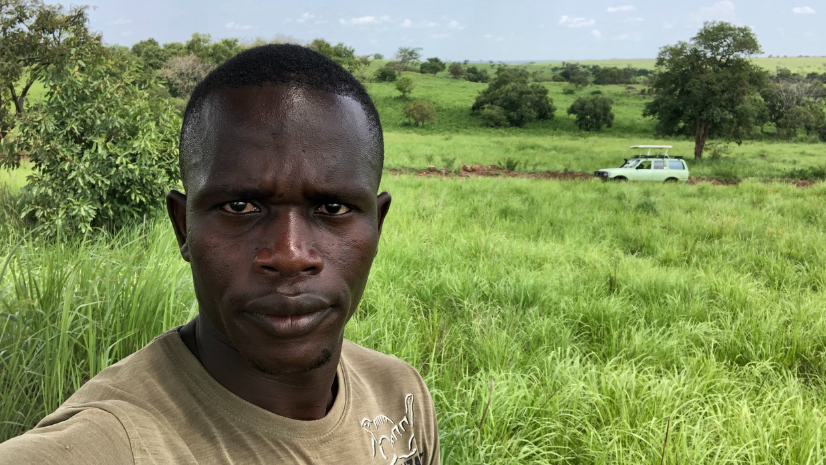
In our next interview, we highlight Drileyo Gilbert, a wildlife biologist with the Uganda Wildlife Research & Training Institute, where he discusses the importance of GIS in wildlife conservation efforts.
I love GIS [geographic information systems]… It has opened my mind and chances to explore many (innovative) technologies, include wildlife telemetry technology, among other technologies used in the wildlife conservation domain.
Below is our Q&A interview with Drileyo Gilbert.
Q: What does your typical day look like?
A: I sleep every night dreaming about geospatial tasks. A typical day is busy for me: [I am] conducting lectures for students; researching more about new technologies in GIS and RS [remote sensing]; and at times, going into the field treating/rescuing sick and injured wild animals—also, performing regular field data collection for further analysis for management decision-making purposes. I also spend about 20% of everyday learning about various data analysis packages such as R/RStudio, Stata, MATLAB, Python, React, etc. for research problem-solving purposes.
Q: How did you learn about GIS technology?
A: My current knowledge and skill status in GIS technology did not just come out of the blue! It was full of passion, determination, and hard work. Unfortunately, I did not have much exposure to training opportunities and lacked the finances to learn more about the technology. I didn’t have any training opportunities in GIS in the early phases of my career apart from the 10-minute training I received from a friend who had returned from a spatial crime analysis training in Germany.
While at the Uganda Wildlife Research & Training Institute pursuing my Diploma course in wildlife & natural resource management from 2014-2016, GIS was one of the course modules taught though with limited exposure to practical sessions. While working at Queen Elizabeth National Park as a conservation volunteer attached to the Ecological research & monitoring unit, I got a lot of hands-on exposure to various GIS tasks for conservation area management purposes.
I was exposed to SMART conservation software as well as the EarthRanger Application during my volunteering period. While at Makerere University Faculty of Veterinary Medicine pursuing my first degree from 2017-2020, I was very versatile in exploring any GIS-related training within the university where I managed to get several training certificates. I also organized many GIS training courses for my fellow students within the university from various faculties as a way of creating more social networks.
ArcGIS software is what I mostly use for any spatial analysis that I do. I use ArcGIS Desktop for mapping the distribution of species, mapping vegetation changes with remote sensing satellite imagery data, and more. I also use the software for network analysis, occupancy modeling, terrain analysis, nearest neighbor analysis, invasive species distribution mapping, species movement mapping with telemetry data, disaster risk mapping, disease outbreak mapping, and modeling, wildlife mortality mapping, etc.
Q: How do you use GIS technology for your species research?
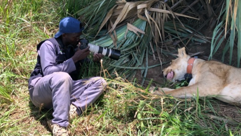
A: I am a wildlife biologist and research scientist with no borders, I mean, a “generalist conservationist.” But recently, after spending a lot of time in the field working with the African lions, I have finally specialized in this species due to the continuous decline in its population worldwide! I use GIS in African lion research in several ways, including habitat suitability mapping and modeling; species distribution mapping; home range estimation; movement pattern monitoring; habitat use mapping; and threat mapping, i.e., wire snare poaching mapping and modeling.
Q: Describe some of the GIS projects you are working on?
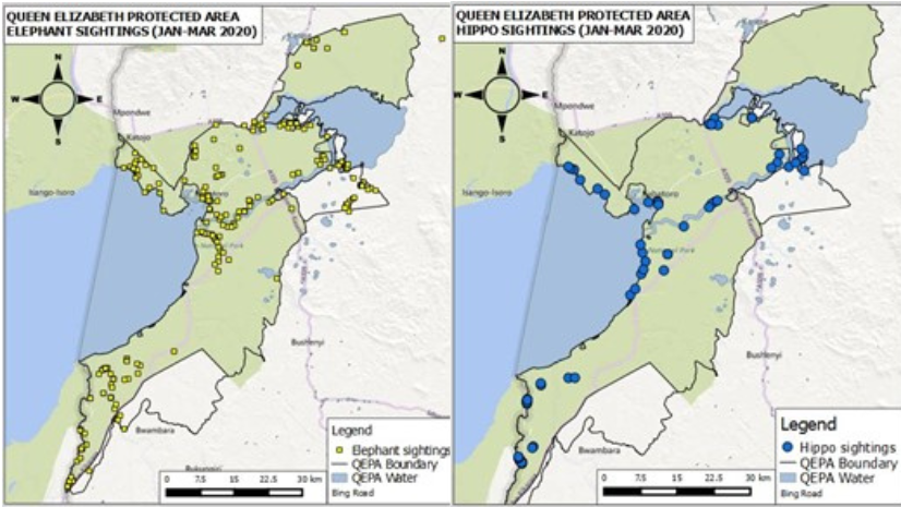
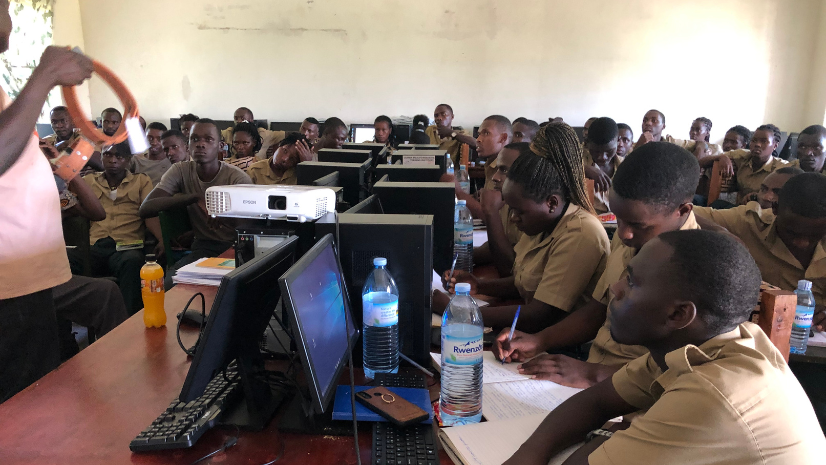
A: My first project was part of my undergraduate research that involved mapping the spatial distribution of wire snares and the associated risk determinants in Queen Elizabeth National Park, Uganda. Apart from this, I have executed several GIS projects including invasive species mapping; key wildlife species mapping with ranger patrol data from Queen Elizabeth National Park, Uganda; and several GIS training sessions for my students from Uganda Wildlife Research & Training Institute, Kasese.
Q: What GIS training or resources would you recommend to other young pros?
A: I would recommend [that] my fellow young pros start with GIS trainings for hands-on skills by experienced mentors in GIS and remote sensing. One can further enroll for courses in applied GIS at various levels in recognized institutions to further expand their knowledge and skills.
I think my journey in this technology was influenced by a few individuals who tirelessly mentored me in this technology; i.e., Dr. Margaret Driciru and Mr. Fredrick Wanyama of Uganda Wildlife Authority and Mr. Bazil Alidria of Wildlife Conservation Society. Additionally, Dr. Alexander Braczkowski, Dr. Tutilo Mudumba and Mr. Mustafa Nsubuga, who have been behind my mentorship in conservation in various aspects including GIS & remote sensing mentorship. The most important factor was the passion I had for the technology!
Q: What value does Esri YPN bring you?
A: This is my first time getting involved in Esri YPN and I am very excited for this opportunity. I am sure this is going to be another stepping-stone for me to connect with the GIS world as far as my conservation career with GIS & Remote Sensing specialization is concerned.
Q: What advice would you like to provide for young pros?
A: My advice for other young pros is that we are currently living in a world where geospatial technology can never be underrated. And this gives us the right opportunity to further explore this technology to enable us to be future change-makers in such a world facing lots of climatic changes among other global challenges like epidemics and political instabilities. It is only when we invest our efforts into this new and ever-emerging field that we shall always be able to bring change to the world with spatial problem-solving and being part of all government decisions.
Catch up on our first Faces of YPN article.
Learn more about Esri conservation on our web page.
Learn more about Esri Young Professionals Network.