The dynamics of healthcare have changed. In our fast-evolving digital landscape, the power of geographic information system (GIS) technology and location intelligence is emerging as a game-changer for health systems focused on delivering personalized care. By providing a nuanced approach to understanding and communicating with various patients and communities, GIS opens doors to modernized outreach, tailored messaging, and data-informed decision-making.
GIS: More Than Just Maps
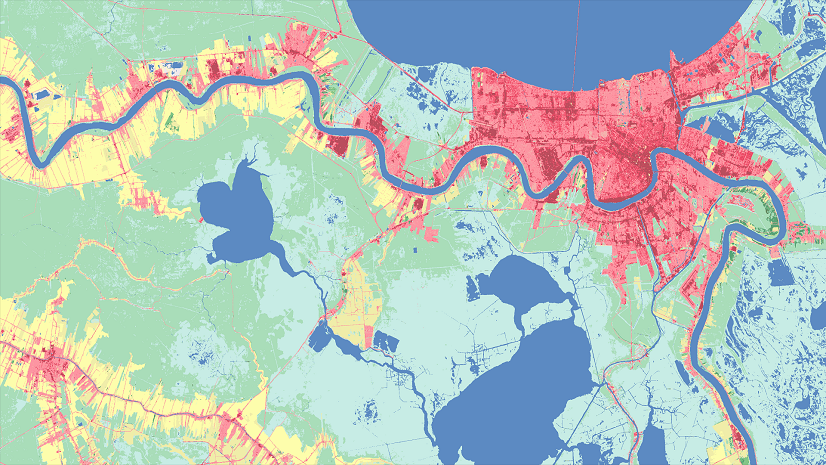
While many associate GIS with maps, its potential in the healthcare sector transcends spatial visualization. GIS enables health systems to capture, analyze, and present data in impactful ways such as calculating access to care for your patients, examining the health impacts of their community context through the social determinants of health model, and implementing service reconfigurations that align with local needs. GIS not only makes your own data more valuable, whether it comes from your electronic health record system, claims and billing systems, or other data warehouses, it also makes it easy to source and use additional reliable platforms such as Esri’s Living Atlas of the World and premium data resources. Here are just a few examples of both health-focused datasets and datasets that are cross-cutting to health:
- US Census Bureau for demographic data at the block group level
- Centers for Disease Control and Prevention Social Vulnerability Index at the census tract level or chronic disease related measures at census tract and ZIP Code Tabulation Areas
- The Robert Wood Johnson Foundation for County Health Rankings at the county level
- US Department of Housing and Urban Development for data on homelessness by Continuum of Care
- National Oceanic and Atmospheric Administration, supporting climate and weather information in real-time
- Federal Emergency Management Agency to assist with disaster response data needs and the national shelter system at the point level
The scope of available data is vast and versatile.
CHNAs and the Changing Landscape of Nonprofit Hospitals
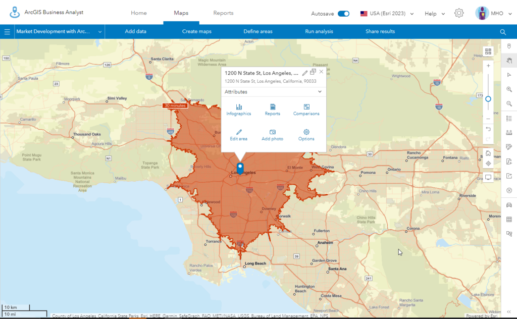
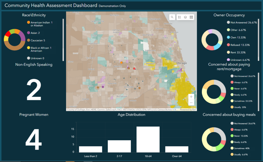
Community Health Needs Assessments (CHNAs), a regulatory requirement for nonprofit hospitals, have also become a pivotal tool for many. These assessments delve deep into the health needs of communities, paving the way for targeted healthcare services and strategic initiatives that relieve immediate suffering and begin to get upstream of pressing health problems for more sustainable resolutions. Ultimately, the intention behind CHNAs is to ensure that nonprofit hospitals actively engage in community betterment. Yet, the regulations surrounding CHNAs, especially concerning their role in nonprofit hospital tax exemptions, have come under scrutiny. Recent discussions have highlighted potential gaps in IRS enforcement, leading to debates about the authenticity of community benefits provided. But here lies the power of GIS: it can be an invaluable asset to nonprofit hospitals, streamlining the CHNA process, showcasing the community initiatives they undertake, and validating their beneficial impact. By leveraging GIS, hospitals can transparently tell their stories and present their contributions, alleviating concerns and emphasizing their ongoing commitment to community health. Further, the CHNA, when digitized and dynamic, transforms into a strategic tool for planning and prioritizing your plans going forward.
For those seeking an in-depth understanding of CHNAs in the context of IRS regulations, this IRS guide can provide more insight.
Gauging Market Potential with Data and Sentiment Analysis
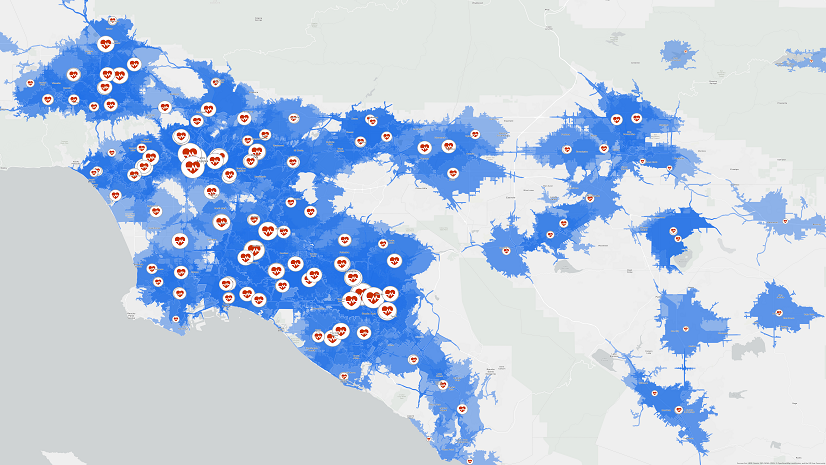
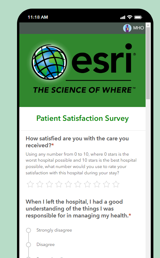
Before executing your plans and diving into new markets or amplifying current endeavors, health systems require refined, granular data to understand target demographics effectively. GIS tools, like ArcGIS Survey123 and ArcGIS Dashboards, offer a seamless experience in collating individual sentiments, thoughts, and feelings on planned programs. The interoperability of ArcGIS tools streamlines the data analysis process, turning feedback into actionable insights swiftly.
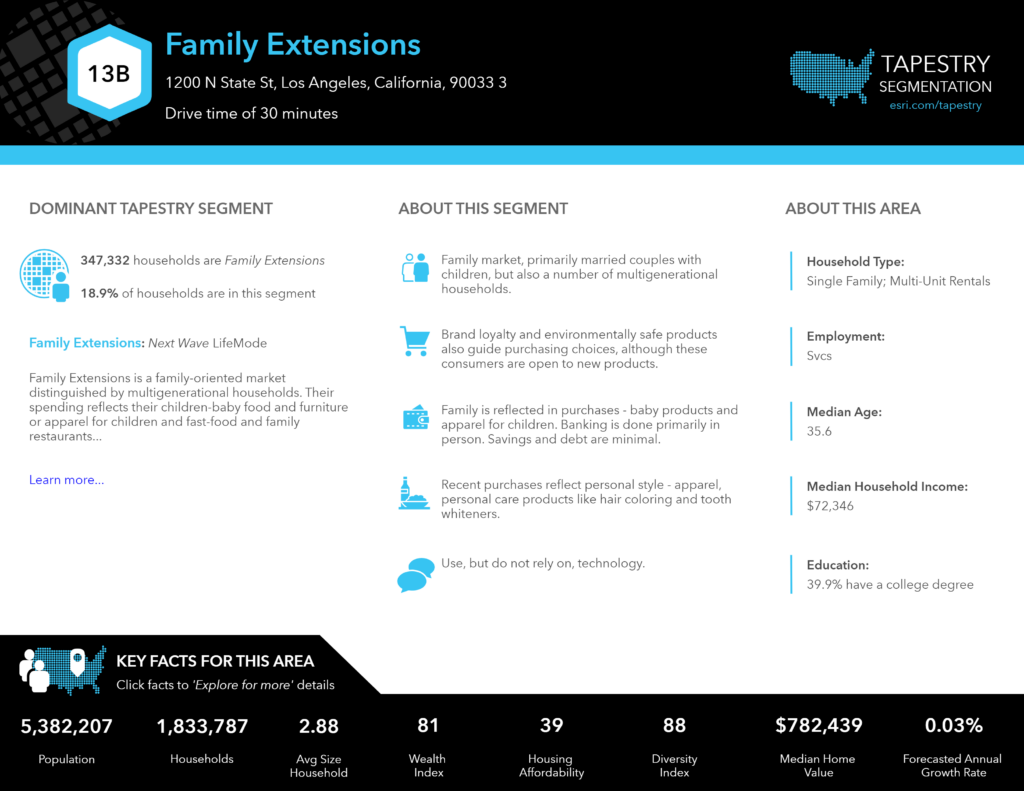
Yet another data input is Esri’s Tapestry Segmentation, which classifies US neighborhoods into 67 market segments based on common demographic, consumer, and media behaviors. Tapestry allows health institutions to tailor their messaging and communication channels effectively. Imagine knowing the spending habits, health insurance statistics, or outreach preferences of a particular neighborhood before devising an outreach campaign. The precision offered by GIS, in this regard, is unparalleled.
With all this amazing geo-enabled data, management teams can assess current markets, improve community awareness of their offerings, and foster growth through a unique competitive edge. Location intelligence is the key to informed decisions for enhanced health outcomes.
Join Us to Explore the Value of GIS for Healthcare Market Development and Engagement
The ever-expanding horizon of GIS in healthcare beckons. To unlock its potential, continuous learning and adaptation are crucial.
Embracing the capabilities of GIS is about more than enhancing outreach and engagement. It’s also about understanding the patients and communities you serve and ensuring that interventions are more relevant, personalized, and effective. For more information visit our website to remain connected.