Customer Spotlight Story
Washington City Power (WCP) is a municipally owned public power utility serving one of the fastest-growing communities in southwest Utah. Operating since 1987, the utility delivers electric distribution service to approximately 12,000 customers.
As Washington City, Utah, continues to expand, WCP plays a critical role in supporting community growth by maintaining a reliable, safe, and cost-competitive electric system tailored to local needs. Guided by a mission centered on operational excellence, transparency, and customer service, the utility has positioned itself as a forward-looking “power department of choice,” focused on continuous system investment, modern infrastructure, and smart planning to ensure dependable service and long-term value for the community it serves.
To support this mission, WCP relies heavily on its Esri-based GIS infrastructure for field operations, outage management, and system planning.
CHALLENGE
Seeking to modernize its capabilities, WCP realized it needed a more robust network management system. WCP’s legacy GIS provided limited visibility into the utility’s circuit configurations, meter connections, and network conditions. The GIS lacked connectivity and topology rules, hampering outage management and making it virtually impossible to keep network data current, especially with limited staff resources. This limited visibility into circuit configurations and meter connections makes outage management inefficient and data maintenance nearly impossible with limited staff.
Field crews had to rely on the “normal configuration” of circuits maintained in GIS, rather than the actual configurations that existed during the outage. In addition, during outages, crews had no reliable way to identify affected meters or estimate restoration times. Configuration changes, such as taking a substation offline, were too labor-intensive to reflect in GIS, forcing crews to translate between outdated maps and real-world conditions mentally. These challenges were compounded by a largely new staff unfamiliar with the legacy GIS system, underscoring the need for accurate, up-to-date network data to support safe and effective operations.
SOLUTION
WCP decided to migrate to ArcGIS Utility Network. The goal was to enhance operational workflows, improve data accuracy, and enable integration with SCADA, outage management, and Advanced Metering Infrastructure (AMI) systems. This strategic upgrade aimed to deliver real-time network visibility and streamline utility processes across departments. Migrating to ArcGIS Utility Network enabled accurate topology and connectivity. This migration addressed the major challenges.

The new system increased productivity and improved decision-making for operational staff.
WCP partnered with SSP Innovations to implement ArcGIS Pro along with ArcGIS Utility Network using SSP Accelerate, a packaged migration solution. Starting with a solution that is 80–90% complete, WCP focused on the aspects of the migration that are truly unique to WCP.
The project was completed in under 90 days, leveraging a pre-built model tailored to electric utility best practices. SSP’s automated tools cleaned and migrated legacy GIS data, followed by rigorous QA/QC to ensure connectivity and phasing accuracy. WCP adopted SSP Productivity for asset creation and editing, streamlining workflows with context-sensitive prompts and background processing. This solution provided a scalable, user-friendly platform that reduced the learning curve and positioned WCP for future integration with AMI, SCADA, and outage management systems.
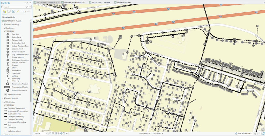
WCP data migrated to ArcGIS Utility Network schema to power the topology.
Rather than implementing the complete ArcGIS Utility Network model with over 600 fields, WCP worked with SSP Innovations to implement a streamlined version built on electric utility best practices. SSP’s automated tools were used to clean up and migrate WCP’s legacy GIS data to its new ArcGIS Utility Network solution. Further QA/QC was performed on the migrated data within ArcGIS Utility Network. WCP used the new network functionality to confirm connectivity and phasing and make necessary corrections.
RESULTS
Since implementing ArcGIS Utility Network, WCP has seen significant operational improvements. Switching procedures that once took days now take minutes, thanks to versioned modeling and validation tools. Outage response times have improved with real-time access to circuit configurations, enabling crews to identify affected meters quickly. Data integrity has increased through tracing and phase propagation, revealing and correcting legacy errors. The implementation also laid the groundwork for integrating AMI and outage management, enhancing long-term planning and system automation. According to WCP leadership, the system’s accuracy and responsiveness have already proven valuable in the field, transforming operations and delivering measurable efficiencies within weeks of deployment.

The new system improved switching, outage response, and data quality.
PARTNER
SSP Innovations specializes in GIS, work, and asset management consulting for utilities. For this project, SSP deployed its Accelerate solution to deliver a streamlined ArcGIS Utility Network implementation tailored to WCP’s needs. SSP provided automated data migration, QA/QC, and productivity tools to simplify editing and improve data accuracy.
BENEFITS
WCP is experiencing dramatic improvements in switching, outage response, and data quality. Just weeks after implementing, WCP was already enjoying rapid switching procedures with enhanced validation. Before implementing ArcGIS Utility Network, WCP’s switching procedure was a manual process that involved drawing the configuration on paper, signing off on the plan, and then manually updating the GIS after implementation. There was no way to test the plan before it was implemented, and there was a lag in updating the GIS with the final configuration.
“The migration process went smoother than I anticipated. We finished earlier than expected and got to do a few more things that weren’t on the original list.” – Rick Hansen, Washington City Power Director.
With ArcGIS Utility Network, crews can model the switching plan in a new version, test the changes for unexpected de-energization, and immediately post the updates once the switching procedure is complete. What previously took several days to update in GIS can now be completed within a few minutes. Other benefits include:
- Enhanced Outage Response: Field crews now have access to up-to-date circuit configuration, enabling faster response times during outages and providing better visibility into which meters are affected.
- Improved Data Integrity: ArcGIS Utility Network’s tracing and propagation capabilities have identified previously unknown data errors, enabling WCP to improve the accuracy of its electric model systematically.
- AMI and outage management integration.
- With automation, context-sensitive prompts, and background processing, the new system provides a streamlined editing experience and reduces the learning curve.
NEXT STEPS
WCP’s GIS editors will initially use ArcGIS Pro editing tools, with plans to use SSP Productivity for asset creation, editing, and management. WCP plans to use ArcGIS Field Maps to enable work crews to access ArcGIS Utility Network in the field.
The implementation has positioned WCP to proceed with planned AMI deployment and SCADA and OMS enhancements.
“When our crews go out on an outage, I think it’s important to have the best information available. Our system has only been up for a few weeks. Still, we’re already seeing the value of the map staying up to date with the current switching configuration.” – Rick Hansen, Washington City Power Director.

