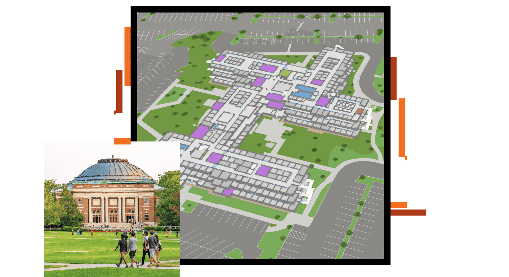
Skip to Content

Administrators

ArcGIS for smart campus operations

A map visualizing indoor data for a large, multistory building overlaid with an image of a walking path surrounded by grass, light posts, and old stone buildings

Esri technology integrates campus and building data so that you can understand the complex needs of your spaces and staff. A well-managed work environment supports employee performance and productivity, improves resource efficiency, and reduces costs. Increase the value of your portfolio with insights delivered by powerful data management, analysis, and visualization capabilities.

Campus facilities and planning

Facility managers achieve success using powerful data management, analysis, and visualization. A digital approach to facility management helps leaders assess security risks, develop plans, optimize space use, protect staff and assets, and improve daily operations. GIS for facilities helps lay the cornerstone for a campus digital twin.

An aerial photo of a university with buildings in blues and reds with a large green tree-filled park in the middle

Campus utilities

ArcGIS contains all the elements staff members need to meet utility challenges. They can use ArcGIS to maintain key information, analyze it, and distribute it to everyone who needs business intelligence through a system of record, a system of engagement, and a system of insights. This process creates a true digital twin of your campus infrastructure.

Two field professionals in hardhats and yellow vests examine a large hole dug in a sidewalk to expose pipes beneath

Campus health and safety

Whether you need to know the real-time location of officers and staff on campus, analyze historical incidents of crime to understand campus risk, or generate Clery Act reports and information requests, ArcGIS brings spatial analysis to the forefront for informed decision-making and enhanced campus security and safety.

A photo of a large, well-lit urban university campus in orange and yellow against a dark blue night sky

GIS capabilities for campus operations

Fully mobile field workforce
Equip all personnel with real-time spatial data.
Operational awareness
See key metrics and spatial context in dashboards.
Data management
Use industry-standard data models and symbology.

Success Story

Michigan State connects people to places

Michigan State University uses mobile tech for campus navigation, enhancing user experience and connectivity.

Read the article

Webinars

Learn how to deploy and use GIS to spatially enable your campus and support operations.

Access the recordings
A person sitting in a cubicle working with mapping and data software on multiple monitors

Ebook

The Smart Workplace

In this 19-page ebook, learn how indoor maps give operations teams comprehensive insight into facility performance and enhance decision-making by visualizing building activities and asset status.

Download the ebook
A hand holding a smartphone displaying an indoor map with the inside of a brightly lit, modern building in the background

Contact sales

Need help determining which option is right for your institution? Schedule a conversation with a member of our team.

Connect with the Esri education team