Skip to Content

GIS-Enabled Parcel Management

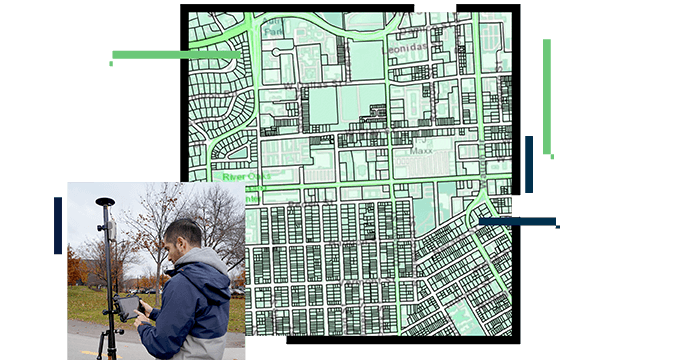
Land parcel management has always been paramount in land administration and tax systems worldwide. ArcGIS Parcel Fabric—GIS parcel mapping—meets the global needs of managing parcel data integrity, maintaining the survey record, and tracking parcel history with configurable business rules and workflow management. This services-based solution provides a comprehensive commercial off-the-shelf (COTS) framework for efficiently managing, editing, and sharing land parcel data and includes capabilities for creating map books, plotting legal descriptions, managing public data publications, and sharing data securely.

Comprehensive solution for parcel management

Efficient workflows

ArcGIS delivers standardized workflows with training resources and can be easily configured for custom workflows and nomenclature. Whether its 2D, 3D, or 4D parcels, it's easy to learn, works out of the box, and supports multiuser parcel editing.

Improve accuracy

Your parcel data may not be as accurate as you would like, but it's too expensive and time-consuming to remap. Esri's ArcGIS Parcel Fabric includes specific tools and workflows to help you improve your data over time with your daily work.

Validate deed descriptions

Quickly enter deed descriptions and validate metes and bounds descriptions to check for closure errors and enter data only one time. This easily deployed solution supports connection lines and can be easily integrated into larger land records workflows for a complete inventory of parcels, lot subdivisions, and related encumbrances.

Create map books

GIS allows you to quickly produce tax map atlas pages and tax map books for the public and other stakeholders. You can use your existing index maps to divide the map into sections or map sheets and automatically generate new maps.

Aggregate parcel data

Land administration agencies of all sizes—including those in national, provincial, state, and county governments, and those that are part of cadastral agencies, emergency operations centers, and other groups—can easily aggregate parcel information from authoritative sources to a central parcel database and deliver focused parcel maps and applications to key stakeholders.

Integrate with business systems

Built on services and standards-based open architecture, parcels in ArcGIS integrate with other land administration systems including registry and valuation. Eliminate duplicate datasets and provide a single source of authoritative data.

Story Map

Parcel fabric pro . . . it's a big deal

Originally in CAD, Buffalo County modernized its land records for increased efficiency and improved quality control.

View the story map

Products and solutions for parcel management

Previous
Next

Contact sales

Contact us

Outside the United States

Connect with the Esri land administration team