ARCGIS BLOG
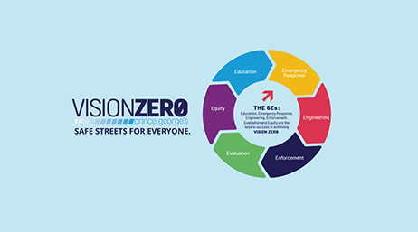
Prince George’s roadmap for Vision Zero
Prince George’s countywide plan is built on ArcGIS Hub to provide resources for community members to engage the Vision Zero strategy.
Explore resources for roads and highways agencies and connect with industry experts
The Massachusetts Department of Transportation (MassDOT) uses its award-winning GIS app to make more strategic budgeting decisions.

Prince George’s roadmap for Vision Zero
Managing right-of-way with GIS

Las Vegas crash mitigation and Vision Zero plans

Building a more resilient transportation system
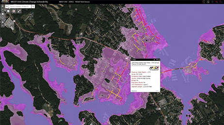
Maryland uses mapping for resilient infrastructure

Colorado DOT and a system of engagement

The future of transportation
Elevating location data
Join the geospatial conversation, ask your questions, or browse the forums.

Esri User Conference | July 13–17, 2026 | San Diego Convention Center | San Diego, California

Esri partners offer specialized solutions built on ArcGIS to solve your real-world challenges.
Sign up to receive the latest news, updates, and helpful tips for transportation professionals.