Skip to Content

Data Center Planning, Site Selection, and Analysis

Location intelligence for data center siting and expansion

A blue and gray map showing lines radiating from a shared point of origin, overlaid with a photo of computer banks in a dimly lit room

Dynamic visualization reveals ideal sites

Quickly assess site suitability, network connections, and labor markets

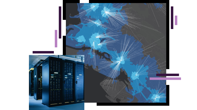
Selecting the right location for a data center requires deep understanding of vast amounts of data including network capabilities, workforce skills, government regulations, and environmental hazards. Visualizing variables from multiple domains on smart maps with advanced spatial analytics reveals connections that are hard to discern in spreadsheets. Use innovative geospatial technology to understand site-related data from global to hyperlocal scales. Ensure that data center expansion investments are in places that will support fast, reliable performance for customers.

Previous
Next

Assess, plan, and optimize end-to-end data center siting and development

Enhance strategic planning and expansion

Data-rich maps reveal markets with high demand for cloud services. Analyze the geography of political, economic, and social factors to support rapid and informed decision-making for data center planning, optimization, and expansion.

A map dashboard with assorted maps, graphs, and lists of data

Speed site selection and network analysis

Use maps to see where fiber exists near available sites and determine which parcels are suitable for development. Overlay labor data to understand which areas have a workforce ready to support data center siting and expansion activities.

A dark gray and blue map with roads and map points in neon orange and green

Aid engineering and construction

Understand all aspects of design and construction projects. Use smart maps to assess environmental hazards, access to utilities, and transportation infrastructure capabilities. Teams can use ArcGIS GeoBIM for an easy-to-use web-based way to collaborate on building information modeling (BIM) projects in real time and throughout a data center expansion project.

A 3D graphic of a system of pipes inside building walls

Fortify operations and security

Protect people and critical infrastructure across the entire built environment with real-time operational awareness. When a crisis occurs, make rapid decisions based on a complete view of an incident to reduce downtime and ensure safety.

More on corporate security
A world map in dark gray and blue with scattered brightly lit multicolored map points

WHERENEXT

The holy grail of IT—A digital twin

A revolutionary IT mapping technique is changing how CIOs view a complex IT puzzle.

Read the article

Products

Previous
Next

Contact sales