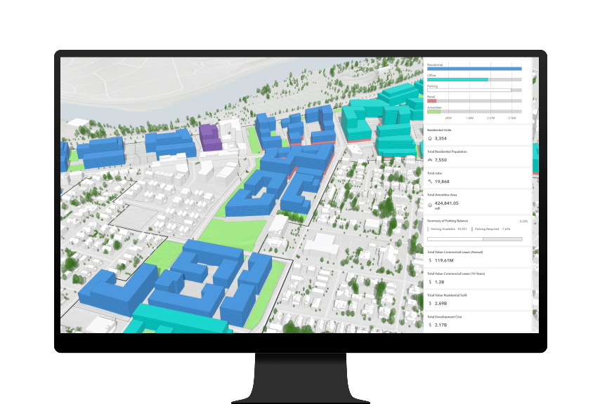
Skip to Content

Enable 3D mesh basemaps, parcel exploration, data integration with BIM and more

In our quest to help you better plan the future of your city, we have added a range of new capabilities in ArcGIS Urban. Register for our webinar to learn about new enhancements, including 3D mesh basemaps, building information modeling (BIM) data integration, parcel exploration, community usernames, and performance enhancements for large-scale planning, which are now available with the October 2020 release of ArcGIS Urban. We are also excited to announce the beta release of the Urban API.

ArcGIS Urban enables planners and design professionals to create consistency and collaboration across teams with a web-based 3D application that drives decision-making with analytics and a scenario-driven planning process.

Watch the recording to see some of the exciting new enhancements in ArcGIS Urban.

Register to view recording