Fall 2004
Fall 2004 |
|||||||
|
|
|||||||
GIS—The Language of Geography Stresses Collaboration
24th Annual Esri User Conference Spotlights ArcGIS 9 |
|
|
"GIS is emerging as a new language. It's becoming intelligent and collaborative," Dangermond said. "That's one of the main missions that we have for the next generation of tools—collaboration, widespread collaboration built on the technology stack. GIS professionals, you, will be the people who apply this language, creating a better future."
In addition to classroom education, Esri has also focused on virtual training as part of Esri Training and Education. Some of the courses have been bundled into packages of both instructor-led and Web-based classes. The first of these packages is GIS Analysis. In addition, Esri Press now offers more than 60 publications with another 20 on the way. Esri live training seminars occur approximately twice a month. They are free, one-hour sessions with Esri staff and cover a variety of GIS tasks. The sessions are available for viewing afterward. Dangermond stressed that technical support has improved, especially in the areas of call tracking and the Online Support Center. The Project Design Center is working on posting application implementation information on the Web for download. This year, Esri added a new institutional partner—the Jet Propulsion Laboratory, which is focusing on using GIS in the planetary science world. In 2004, Esri marked its 35th anniversary. It remains financially stable with zero debt. The Esri workforce now numbers more than 4,400. Esri UC Software NewsDangermond led off the presentations of Esri's latest software offerings. Following his talk, the afternoon plenary was packed with software discussions from many other Esri staff, including Clint Brown and David Maguire. The following is a sampling of the topics. ArcGIS 9 is currently shipping and Service Pack 1 is now available for download. There was much attention devoted to explaining this complete system of component architecture for GIS professionals. The release of ArcGIS 9 brings improvements in geoprocessing, three-dimensional visualization, interoperability, cartography, annotation, and raster imaging. The services-oriented design can distribute the business logic of GIS and supports a distributed enterprise network. The new ArcGIS 9 geoprocessing environment includes ModelBuilder for creating and executing models to support individual work flows and share knowledge. Esri continues to focus on interoperability and providing technologies that help organizations easily share information across applications and industries, regardless of data format, schema, or database management. The new Data Interoperability extension (see "ArcGIS Data Interoperability Now Available") brings interoperability on many key fronts, including direct data access, data transformation, and export capabilities, to more than 70 standard formats. www.esri.com/arcgis, www.esri.com/ modelbuilder, www.esri.com/datainteroperability Significant improvements to annotation for creating, editing, and managing labels have been incorporated into ArcGIS 9. In addition, ArcGIS 9 provides advanced capabilities for high-quality cartographic text placement, labeling, and conflict resolution via Maplex for ArcGIS, a new desktop extension that significantly reduces map production time and enhances cartographic quality. www.esri.com/maplex Two new product introductions are ArcGIS Engine for embedding GIS functionality into desktop and field applications (see "Organizations Embrace ArcGIS Engine to Build Custom Applications") and ArcGIS Server, a centrally managed framework for serving enterprise GIS applications. www.esri.com/arcgisengine and www.esri.com/arcgisserver The ArcGlobe technology introduced in ArcGIS 3D Analyst enables users to view geographic data seamlessly from a three-dimensional earth. Any ArcGIS supported data, including images, textures, and terrain, can be visualized intuitively by layering the information on the three-dimensional globe. www.esri.com/3danalyst The new ArcGIS extensions, including ArcGIS Network Analyst (see "ArcGIS Network Analyst Development Progresses"), are "not just eye candy," said Dangermond. They include tools for advanced surface modeling and analysis, temporal mapping, and data transformation. www.esri.com/networkanalyst New tools for ArcIMS 9 include the ArcIMS Data Delivery extension, which makes distribution and sharing of data easy and open. Users can clip, zip, During the plenary session, Danny Hillis, inventor of the Thinking Machine and a principal at Applied Minds, Inc., demonstrated his impressive Touch Table tabletop with a map projected over its surface, which was developed with ArcGIS Engine. With a simple touch of the menu, Hillis zoomed in and out of various locations around the world. www.appliedminds.com After Dangermond's presentation, Esri's John Calkins gave the audience his list of the 10 key features of ArcGIS 9, and Maguire and Brown led a series of afternoon demonstrations. The final discussion addressed what Esri has planned for the road ahead, which included descriptions of desktop and server products and task and data management enhancements. (See "ArcGIS 9 Product Plans.") The Multidisciplinary LanguageDr. Rita Colwell, a marine microbiologist and internationally renowned epidemiologist, gave the User Conference keynote address. She spoke of her work in Bangladesh during the last 25 years to find solutions to "As we look to the century ahead," Colwell said, "our quality of life will in large measure depend on the vigor of our economy, the health of our planet, and our opportunities for enlightenment." As she ended her talk, she said that engineering, technology, and the pursuit of science "will continue to be the propelling and sustaining forces of our well-being." Colwell also said, "Let us pursue the future with wisdom and compassion." (See "Dr. Rita Colwell Shares Her Science of Cholera With Esri Users.") Awards and PresentationsLifetime Achievement Awards went to Professor David Rhind and Dr. Allan Schmidt. Dr. Rhind is vice chancellor of City University of London and former director general and chief executive of the Ordnance Survey in the United Kingdom. He collaborated with Esri on the development of the book Understanding GIS: The ArcInfo Method, an important tool for learning about GIS. During the early days of the development of GIS, Schmidt was assistant, associate, and executive director of the Harvard Laboratory for Computer Graphics and Spatial Analysis. During the awards presentations, Dangermond also presented the Presidential Award to the Peace Parks Foundation in South Africa. The Making a Difference Award went to Jeremy Harris, mayor of Honolulu, Hawaii, for his scientific approach to managing a city. During his talk, Harris said, "GIS is the central nervous system of 21st century urbanization." The final presentation of the conference opening day was the GIS in Schools Award, which honored Bishop Dunne Catholic High School in Dallas, Texas. Several years ago, the school's enrollment was down, and it was at risk of being closed down. Today, enrollment has turned around due in large part to the acquisition of 300 computers, high-speed Internet access throughout the school, and GIS. Three students, Christi Derdyn, Victoria Doan, and Robyn–Ashley Hall gave demonstrations of their GIS projects. An annual evening event on opening day, the Map Gallery reception gave attendees an opportunity to view thousands of maps. Each year Esri recognizes organizations for their outstanding achievements in GIS. The Seventh Annual Special Achievement in GIS Awards ceremony took place on Thursday afternoon during the conference. Winners were chosen from more than 100,000 user sites worldwide. User Conference ActivitiesSixteen special exhibits dotted the San Diego Convention Hall during the User Conference. The beautiful and unusual "Los Murales de la Luz—Mapas Antiguous," ancient maps of the world hand painted on ceramic tiles to comprise large murals, were located throughout the convention site (see "The Talavera Tiles—Bringing to Light and Preserving Historic Maps"). More than 1,100 paper sessions, as well as moderated discussions and technical workshops, took place during the week of the conference. Users shared their knowledge in project design and management and their plans for the future. Technical workshops offered users expert advice about ArcGIS software and extensions. The Exhibit Pavilion was a three-day technology show with direct access to vendors and solution providers. Preconference GatheringsAs in previous years, San Diego hosted several pre-User Conference gatherings, including the Fourth Annual Esri Education User Conference (EdUC), the Second Annual Survey and GIS Summit, and the Fifth Esri Telecom and Location-Based Services Summit. EdUC recorded the highest number of participants this year. More than 800 international attendees represented all levels of education. Susan Henderson, a science educator from the University Corporation for Atmospheric Research, was the keynote speaker for EdUC. Her address challenged the audience to engage in hands-on, inquiry-based learning. Please plan to attend the 25th Annual Esri International User Conference, July 25–29, 2005, in San Diego, California. |
 With attendance records topping the 13,000 mark, the 24th Annual Esri International User Conference got under way in San Diego, California, August 9, 2004. Jack Dangermond, Esri president, welcomed the crowd during the opening day plenary session and introduced the conference theme, GIS—The Language of Geography.
 Dangermond discussed a range of Esri's endeavors, including software and technical support, professional services for GIS, partnerships, educational activities, conservation GIS, and GIS in society.
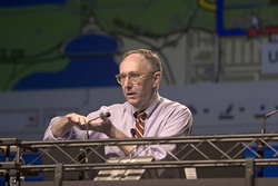 During the next year, Dangermond said that Esri would face many new challenges in developing the 9.1 release, which has as its focus making tasks easier and advancing methods that will facilitate greater collaboration.
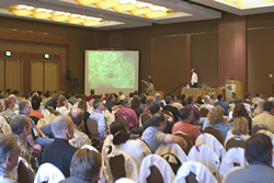 and ship data in multiple formats and projections from a centralized Internet map server. The ArcIMS Portal Toolkit has tools for building one's own metadata server.
  the continuing cholera outbreaks that have plagued the people who live there. Colwell used spatial analysis and geography, which she called "the ultimate, original multidisciplinary language," to study the relationships between weather, sea temperature, and microscopic organisms to understand cholera and devise a simple solution to the problem.
 Professor Willem van Riet, Peace Parks executive director, accepted the award.
 The Association of Zoo Horticulture, National Geographic Society, Southern California Wildfire Emergency Response, and Trust for Public Land also had special displays noting their use of GIS. The Harvard Computer Graphics Lab exhibit provided a historical look at GIS and some of the people who made it happen.