Skip to Content

Farm Planning and Decision-Making

Turn data into actionable information

An aerial image of dark green farmland layered with a heat map, overlaid with a photo of a person flying a drone over a field of crops

Optimize input costs to maximize yields

In response to reduced margins and unpredictable futures, organizations must make planning and decision-making more efficient to remain competitive. Use spatial technology in an integrated system for rapid awareness, faster decision-making, and streamlined operations as market and weather conditions change. Tune workflows, improve schedules, and model workforce activities in real time, optimizing business performance and sustainability.

Visualize and analyze data

Mapping and location enablement

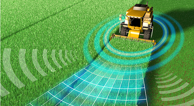
Incorporate location data in analytics and enterprise systems to achieve new spatial insights and improve critical decision-making. Use data on the locations of crops, workers, vehicles, and processes to establish more efficient workflows and achieve a better balance between profitability and long-term sustainability.

A composite photo of green sunny farmland with blue mountains in the distance, with an overlaid heat map grid being projected by a drone overhead

Imagery and remote sensing

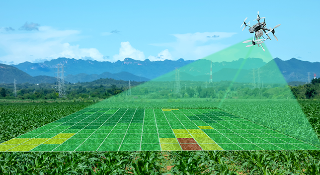
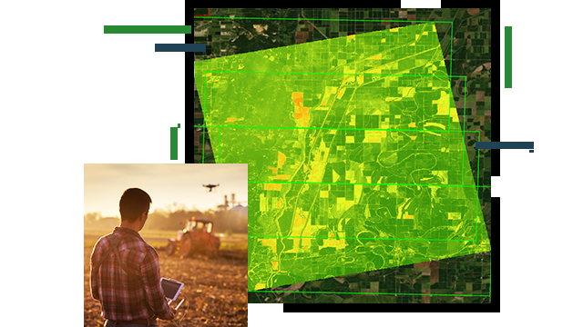
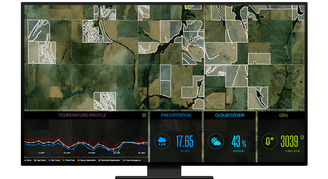
Imagery is essential to precision agriculture. Detect change through multispectral analysis and understand critical crop status over time.

A composite aerial photo of green farmland with an overlaid heat map in brighter green, orange, and red

Spatial analysis and data science

Leverage spatial technologies in an integrated system to create greater opportunities for rapid awareness, accelerate decision-making, and improve the efficiency of operations.

A composite photo of a tractor in a green field projecting a grid and radial lines indicating sweeping sensors

Real-time visualization and analytics

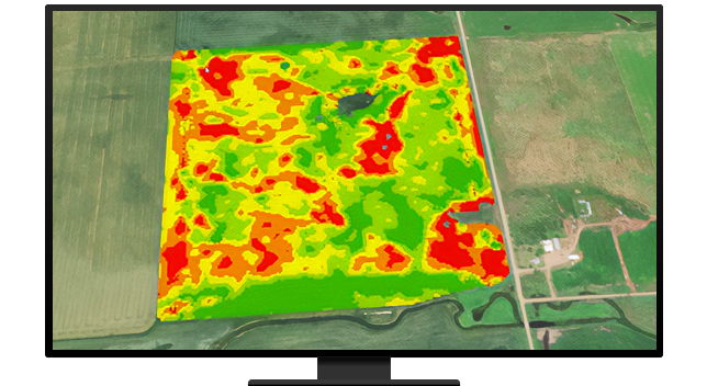
Performance dashboards collect and analyze information in near real time so you can model complex workflows, improve response times, eliminate waste, and reduce costs.

A graphic of a computer monitor displaying a map dashboard which includes a map of green farmland, a line graph, and several statistics

Improved decision-making

Refine planning processes and improve risk management decisions to gain efficiencies and a competitive edge. Evolve farm management plans from reactive to proactive modeling.

A photo of two casually dressed people discussing a tablet held by one of them, standing in a field of golden wheat

CASE STUDY

Putting agronomic analysis in the hands of farmers

With the right tools, farmers can easily analyze their land to determine conservation practices while optimizing production.

Go to the case study

Products for planning and decision-making

These collections of products and solutions will help kick-start your projects with improved data organization, analysis, and sharing.

Previous
Next

Contact sales

Contact us

Outside the United States

Connect with the Esri agriculture team